(about 3.6 miles round-trip).
![](https://blogger.googleusercontent.com/img/b/R29vZ2xl/AVvXsEhGTCOl9AxNbKcANv_W7lZf7mnzjiuMEyvcXu6gNdR8ds_cP9WJyNBGG6Btt-negKfqoPx5ALwQUEy83KqIyekt6CkRG8OKu_FgYfjUmdGO7AFsD4ZUpCe459psbjC4EViDsrif8gwNRK8/s640/Map3.jpg)
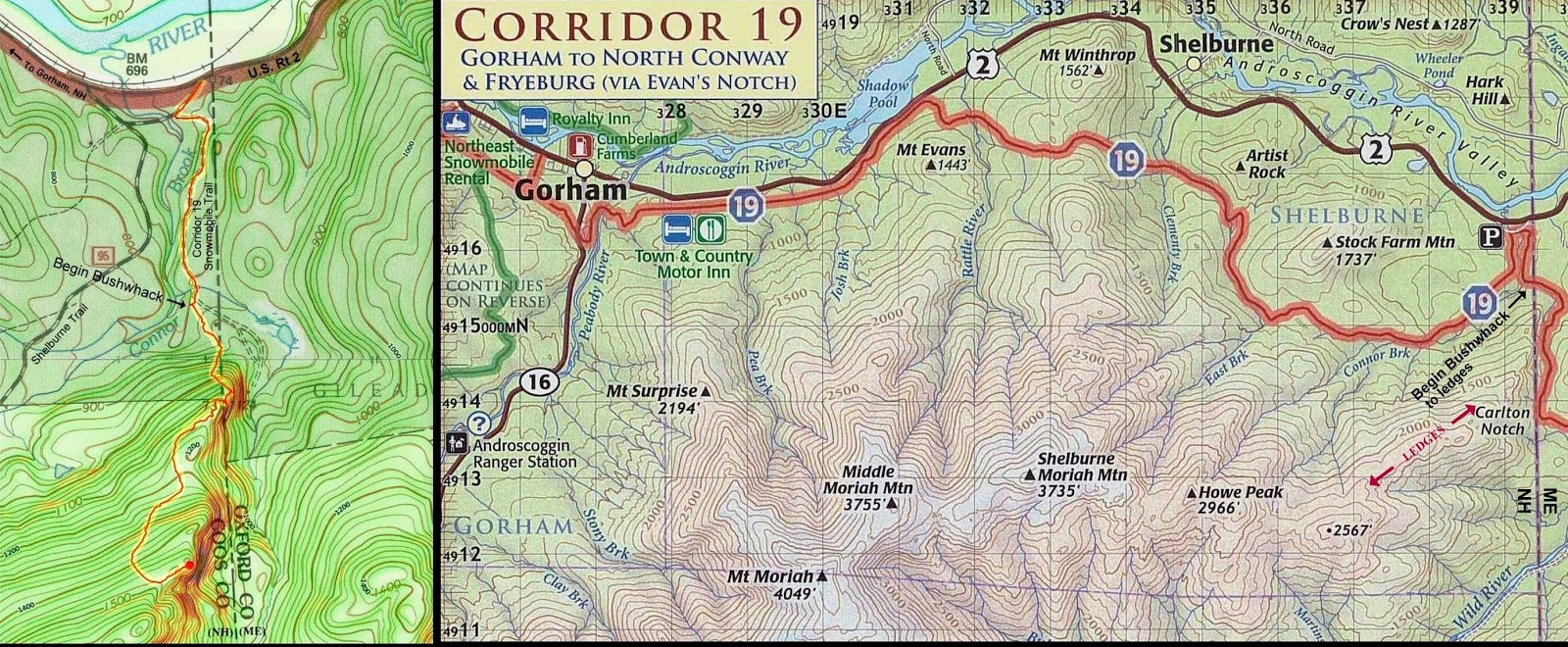
As seen in the next photo, the crossing conditions of Connor Brook looked rather sketchy. So, I opted to launch the bushwhack from Corridor 19 snowmobile trail rather than from the Shelburne Trail which would have entailed crossing the brook.
![](https://blogger.googleusercontent.com/img/b/R29vZ2xl/AVvXsEjR0OYi3iHIY4V1bNVtc7uViPjYE6UjyYshKCce3WCqQg-QY4szbC-84wy6KK6KoaLwyruMQdl5bu0IBjL9rXrfTxOiUyiFjq99bRS4uARgdeZTW1SXHOXeEXNITDH9CDoOe_4U7nLo9d4/s640/IMG_2776.jpg)
The vista from the ledges extends from Gammon and Caribou Mountain (far left) to East and West Royce (far right).
![](https://blogger.googleusercontent.com/img/b/R29vZ2xl/AVvXsEgb2p4XaRRy5j-oPnuEEQI5y42ZtFetd8veLOHDDtC6di_sRPAfPAB8QYU7cP1qYPNxvBiJim3xfQmeHj6C_wvCw9pl1_9EM2CONsOitya90oBd3Lc7ffCBFfLxrr2lP6_KlgZA12q43XY/s640/IMG_2755_stitchBv2.jpg)
The photo shown below was taken while peering down from the edge of one of the ledges.
![](https://blogger.googleusercontent.com/img/b/R29vZ2xl/AVvXsEhKF9CepFhcZTjYl5sNLDu8strcKg19-h5kKJWraxlICTjaPlDNhCHd0XZPcJkRhL3IH4LeX28wD44ukqsYQVsHtjW8Zyj4GNNvDV2js3W9oVijYiFRhqGuV0Y_I6vL93AKQJTFpHzicuA/s640/IMG_2767.jpg)
The next photo shows the type of open-woods that were encountered throughout most of my route to the ledges.
![](https://blogger.googleusercontent.com/img/b/R29vZ2xl/AVvXsEj73wYwQCHT3SLoVsB8KC1vdqVuOlNxb3Vql0aFuoHtanIwFz-xmy5zOsHuwVDBc5SbhOjXgvQeXDJ9N2Z_xSjkbsT1AbZFUfHBaAuk3iHDeSEuacSHFtz8N4ViXB-SVQ_JHFUjMCSvuFo/s640/IMG_2753.jpg)
~THE END ~
No comments:
Post a Comment