Pages

About Me

My photo
Bethlehem, New Hampshire, United States
E-mail contact: randonneur8@yahoo.com | Facebook: facebook.com/1HappyHikerNH

Text Above Search Box

SEARCH MY BLOG USING TEXT BOX SEEN BELOW:

28 October 2011

Heading Into the Woods Without a Plan

Have you ever done something that is difficult to explain to someone, including yourself?  For example,  have you ever headed into the woods with merely a sketchy idea as to where you might go?  It's rare that I embark upon a hike with a wishy-washy game plan, but that is what I did on this late autumn day of 28-Oct-2011.

Depending upon how much time remained after finishing up some errands in the Gorham area, I had in mind that I'd do a hike of some sort.  With less than 5 hours of daylight remaining, I pulled into the huge parking lot at the Appalachia trailhead.  I had my choice of parking spots since only three other cars were there!

Now that I'd arrived at a trailhead, it was time to formulate some semblance of a plan!  One thing I knew for certain was that the high peaks would be excluded from today's agenda.  Not only wasn't there enough time, but also I didn't have the proper equipment with me for this type of adventure at this time of year.   After some quick deliberation, I opted to begin my hike on the Brookbank Trail since that was a trail that I'd never hiked.  This route traverses the east bank of Snyder Brook and leads you to three named waterfalls, i.e. Gordon, Salroc, and Tama.  Of those three, the best photos I got were of Gordon and Tama which are shown below.

Gordon Fall

Tama Fall

Once the Brookbank Trail ended above Tama Falls, I decided to jump onto the Valley Way and head southward, but there was still no firm game plan in mind.  Upon coming to the junction where I could head eastward onto the Inlook Trail, I decided to take that option.   January 2009 was the last time I'd been on this trail, and so it seemed like a good time to make a return visit.  And besides, if I wasn't going to the high peaks today, at least I could get a look at Mts. Madison and Adams from the ledges at the upper end of this trail.
The weather forecast called for mostly sunny blue skies, but that didn't quite happen in the heavens above the high peaks in the northern Presidential Range.  Instead, the sky was predominately overcast and moody.  Also, there were gusty winds, not only at the ledges along the Inlook Trail, but certainly at the higher elevations as well.  The plumes of white that are seen in the next photo were caused by the wind tossing snow into the air.  That is not mist arising from the mountains!

After visiting the ledges along the Inlook Trail, I rambled over to Dome Rock to take in the views toward the Crescent Range and the Mahoosucs.   From here, the vista left little doubt that the colorful scenes of autumn are gone, disappeared, vanished . . . however you want to say it!   What many call "stick season" is now here with all its muted shades of tan and brown (next photo).

Well, since I still had a few hours of daylight remaining, I opted to continue onward from Dome Rock by taking the Kelton Trail southward with the thought of eventually working my way to a waterfall I'd never visited, i.e. Duck Fall (located at the point where the Watson Path crosses Snyder Brook).  It was a relatively short and easy trek to get to this spot.   Although this waterfall was attractive, it was, how shall we say it . . . small!

By now it was getting late in the day, and I so I decided it was time to start meandering northward back to the trailhead.  I retraced my steps along the Watson Path and followed it to the junction with the Valley Way.  I stopped here to consider if I should simply end my wandering journey and head directly for the trailhead, or embark upon another short sidetrack adventure.  It occurred to me that during all my treks in the northern Presidentials, I'd never taken the time to visit the Durand Scar.  Since it was just a short distance away, the decision was made to go for it!   And so, I crossed over the Valley Way and continued on the Watson Path to the Scar Trail, and then took the Scar Loop Trail.
From the Scar Loop Trail I got another nice view of Mts. Madison and Adams that was similar to the vista I'd seen earlier in the day from the ledges on the Inlook Trail.  However, by this time the gusty winds had subsided and the plumes of wind-driven snow were no longer seen.   The next snapshot shows a vista from the Scar Loop Trail.

Okay, after visiting the Durand Scar, it was definitely time to skedaddle back to the trailhead.  From the Scar Trail, I joined the Valley Way and followed it for quite some distance.   But, merely for the sake of doing one last thing that was just a little bit different, I decided to leave the Valley Way and use the combination of the Beechwood Way and Airline Trail as the final approach to the trailhead.
All along my route, there were definite signs of the approaching winter season, such as trailside icicles, and a light coating of snow underfoot (next photo).

Speaking of my route, it's doubtful that anyone would want to replicate it.  However, for anyone who might have a passing interest or curiosity, my route is highlighted on the map that is shown below.  As can be seen, I ended up doing sort of an elongated "figure 8" loop hike, which covered a distance of about 6 miles.

To sum it up, although this wasn't a well-planned hike, it was still an enjoyable romp in the woods, and it provided an opportunity to visit a few spots that were new to me.  This unplanned and meandering trek was largely enabled by the Randolph Mountain Club's vast network of interconnecting trails.  When hiking their trail system, rarely can it be said that "you can't get there from here"!

24 October 2011

An Autumn Trek to East Rattlesnake and Five Finger Point


The 1981 movie "On Golden Pond" immediately comes to mind each time I hike in the Lakes Region of NH.   As many readers will recall, this film starred Henry Fonda and Katherine Hepburn, along with Jane Fonda.  The story centers around an aging couple, Ethel and Norman Thayer, who spend each summer at their home on a lake called Golden Pond.
It’s little wonder that the filmmakers chose the Squam Lake area as the setting for this movie.  It is a gorgeous place all year-round, but especially picturesque in the autumn season.  With the colors of autumn starting to fade near my home in northern NH, I decided to drive south to the Lakes Region where colorful foliage remained vividly present on this 24th day of October.
To soak in as much of this beautiful day as possible, a rather convoluted route was chosen.  I began and ended my hike at the trailhead for the Butterworth Trail.   My route is highlighted in yellow on the map that is shown below.

From the trailhead for the Butterworth Trail, you get a pleasant view, even you begin to hike (see snapshot below)!

Regardless of which trails you hike in the Squam Lake region, it is pleasant and easygoing. And during the autumn season, there is plenty of color to delight the eye.  The snapshot below shows a scene along a typical segment of trail.

My route took me over the ledges on East Rattlesnake where there are sweeping vistas overlooking Squam Lake.  The next two photos were taken from the East Rattlesnake ledges.  The first snapshot is a broad overview.  The second photo is zoomed, and if you look closely, you can see a boater enjoying a terrific autumn day on the water. (NOTE: Clicking on any photo in this Blog will enlarge it.)


On previous occasions, I had visited the ledges on East Rattlesnake, but the next destination of this trek was new to me.  For whatever reason, I had never take the time to trek to Five Finger Point!

Wow!  I was totally amazed by the gorgeous scenery along the loop portion of the Five Finger Point Trail.  The next 4 photos show just a small selection of the many scenic spots along this trail.
A cove with wonderful reflections!

A cove with a sandy bottom that looks ideal for summertime fun!

 Yet another picturesque cove along the Five Finger Point Trail!

View of East Rattlesnake (1,289 ft) and West Rattlesnake (1,260 ft) mountains

In addition to scenes like those shown in the 4 photos shown above, you can also catch glimpses of many attractive homes that dot the shoreline.  The one shown in the next photo reminded me of Ethel and Norman Thayer's home from the "On Golden Pond" movie.

On the way home, I made a side trip to confirm a more direct route to the Five Finger Point Trail (just in case I might ever want to do that as a short stand-alone hike).  I took Pinehurst Road off of Rt. 113 and then made a right turn onto Bacon Road.  Immediately upon turning onto Bacon Road, there is a small (unsigned) parking area on the left side of the road.  After walking a few paces back to Pinehurst Road, I walked eastward along the road for about 100 yards and then exited left from the road at the trail signboard.  After following the yellow-blazed trail (Pasture Trail) for about 0.2 mile, I came to the beginning of the Five Finger Point Trail.
To sum it up, the chances are good that my trek to the Lakes Region will be the last time for experiencing the full splendor of autumn foliage, at least for this time around!  But, there is always next year to look forward to!  So now, it's time to start getting excited about the good times ahead for snowshoe hikes, and cross-country skiing!

16 October 2011

Big Deer and Little Deer Mountains (A Loop Hike in VT)

It has been nearly 8 years since my wife and I moved to Bethlehem, NH.  We are still awed by the natural beauty that abounds in this area.  And, we are still astounded by how little travel time is involved in reaching these picturesque places.  From our former home in the megalopolis of Philadelphia it took several hours of driving on congested roadways to escape the urban sprawl.  And even after enduring that ordeal, we still couldn't reach any destination that was remotely similar to what we now have literally at our doorstep!

This past Sunday (16-October), I drove to the neighboring State of Vermont to explore the hiking trails at Groton State Forest.  Oh my!  It was a really long road trip.  (Yeah!  It took less than an hour!)   Undoubtedly, many readers have visited this location and have hiked to Big Deer and Little Deer mountains.  However, this was my first time.  (Click HERE to access a website that I found useful for planning my hike.)

The roadways within the State Forest are closed for the season.  I parked at the entrance (off VT Route 232) and then walked the main access road to pick up the Osmore Pond Loop Trail.  Along the way, I did a couple of short off-trail forays to poke around in the nearby forest.  One such venture involved a short traipse off the road to take a closer look at a fireplace that could be seen sitting back in the woods (next photo).

As I understand it, this fireplace was a fixture within the Recreation Hall for a CCC camp that was located here in the early 1930s.  There are also cellar holes, stone fences, and other artifacts at this same location.

On a separate tramp through the woods (about a tenth of a mile or so from the old CCC camp), I came across the remains of a vintage automobile that perhaps dates back to the late 1920s.  There must be an interesting story as to how this old car ended up here in the middle of the forest!


After visiting the "Bonnie & Clyde" style car, I returned to the roadway which led me to the shoreline of Osmore Pond.  From here  I took a snapshot of Big Deer Mountain (next photo) which I would be visiting later in the day.

At the north end of Osmore Pond I began hiking the Osmore Pond Loop Trail southward to reach the Little Deer Trail.   It's a short and easy scamper along this trail to the top of Little Deer Mountain.  From the ledges on this petite mountain there is a very nice vista that includes a portion of Lake Groton (next photo).

After a brief visit to Little Deer, it was onward and upward to Big Deer!  Upon descending the Little Deer Trail, it was a short hop, skip and a jump to pick up the Big Deer Mountain Trail from the south end of the Osmore Pond Loop Trail.

Although there is a short-lived steep section on the final approach to Big Deer, it is overall a very easy hike.  Plus, the trail passes through some very attractive woods along the way (next photo).

There are two viewpoints atop Big Deer Mountain.  The blue-blazed trail leads you to one of them.  Whereas,  the other viewpoint is accessed via a spur trail that is unmarked, but it is quite obvious, and there is a well-worn treadway to follow.

From the viewpoint on the main trail, there is a view overlooking Lake Groton.  It is a vista that is very similar to that seen from Little Deer (shown earlier).  Also seen from here (as well as from Little Deer) is the pointed peak of Spruce Mountain (next photo).

There are views of high peaks in New Hampshire's White Mountains from the viewpoint at the end of  the main trail.  However, these views are even more prominent from the end of the unmarked spur path (see next two snapshots).

Shown below are high peaks in and around the Franconia Range (viewable with naked-eye, but photo is highly zoomed for a better photographic display of this vista).
(PLEASE NOTE: Clicking on this, or any other photo, will enlarge it.)

Seen in the next zoomed photo is Mt. Moosilauke, plus other surrounding mountains such as Black Mountain in Benton, NH.

After a thoroughly enjoyable visit atop Big Deer, I completed my loop by hiking northward on the Big Deer Trail to reach the trailhead located near the main access road for the Groton State Forest.

It bears mentioning that the trail system in this forest is very well maintained, and the treadways are well-worn but not worn-out (as can be the case for many popular trails).  In addition, the trail junctions are all very well marked.  Below is a collage of only a few of the many signs that I encountered on my hike.

Regarding the overall length of my loop hike, it's difficult to be precise due to some road-walking for which exact mileage is unknown to me.  I'd roughly guess it was about a 6 mile loop.  It took about 3 hours to complete at a leisurely pace.

To sum it up,  I was very pleasantly surprised by the quality of hiking that is available at Groton State Forest.  There are many more hikes at this facility that I'd like to do on other visits, such as Spruce Mountain and Owl's Head (yes . . . yet another peak with this name!).  All the hikes at Groton State Forest appear to be rather easygoing, and that's okay. 
Not every hike needs to be an epic trek to the high peaks. :-)

11 October 2011

A Return for Another Peek from Bald Cap Peak

Sometimes some things are so good that you simply can't resist going back for a second helping.   For me, that certain something was the ledges on Bald Cap Peak located near Shelburne, NH.   It's an autumn treat that I wanted to get one more taste of, even though I had just visited there 2-weeks prior with my friend Steve.

I was really happy that I decided to make a return visit.  The autumn colors were much richer than before.

Shown below is approximately the same view, but photographed 2-weeks apart.  This further illustrates what a color difference there was between my two visits to these ledges.

The next two snapshots were also taken from the ledges, and they serve to showcase the colorful autumn scenes on this 11th day of October.


While exploring the ledges, I found cairns in addition to those already seen by Steve and I during our visit.  As I understand it, there might have been a brief period of time (over a half century ago) when a segment of the Appalachian Trail followed a route over the ledges on Bald Cap Peak.  Possibly, these cairns are the leftovers from that routing. (NOTE: See Addendum at the end of this report.)
 
Shown below is a snapshot of one of the old cairns.

As already mentioned in one of my Blogs, getting to the ledges on Bald Cap Peak involves a bushwhack.  For this trek, the approach route was completely different from the frontal "attack" that was used for a similar adventure 2-weeks earlier.  This time, I left the Peabody Brook Trail at a point near the southwest end of Dream Lake and did an easy bushwhack of about a half-mile through open woods.
UPDATE: Since the time this report was written, the Shelburne Trails Club has constructed a hiking trail to Bald Cap Peak Ledges.  And therefore, a bushwhack is no longer required to reach this destination. Click HERE for more details).

After visiting the ledges, I returned to the Peabody Brook Trail and then continued northward along the trail for a brief visit to the viewpoint of Dream Lake at its northern tip.  I had a snack, and took a few photos (one of which is shown below).

If you have recently been to Dream Lake via the Peabody Brook Trail, then you already know that beaver activity has created a large pool of water in the middle of the trail.  Fortunately, there is a workaround via a mini-bushwhack through the adjacent woods.

For the return leg of my hike, I simply followed the Peabody Brook Trail back to the trailhead.

Okay, the next photos have nothing whatsoever to do with my trek to Bald Cap Peak and Dream Lake.  They were taken in Sugar Hill, NH on the day prior to my trek.  I simply thought they were autumn photos which were worthy of sharing! :-)


To sum it up,  although I went back for a "second-helping" of the ledges on Bald Cap Peak, I don't feel overstuffed.  
I'm just pleasantly full!
////////////////////////////////////////////

ADDENDUM (Added 20-Oct-2011):
This addendum relates to statements made in the original version of this report pertaining to the Appalachian Trail.
Larry Ely has provided me with the results of some excellent research he did regarding the Peabody Brook Trail (PBT) and the Appalachian Trail (AT) as it once existed in the Shelburne area.   Larry has served in leadership positions with both the Appalachian Mountain Club and Appalachian Trail Conservancy, and he is the current President of the Shelburne Trails Club.
The AT followed the Mahoosuc Trail from Gorham to Mt. Hayes and beyond until 1952/1953 when it was rerouted to the PBT.  The sheet maps included with the  White Mountain Guide (WMG) for the 1940, 1948, 1952, and 1955 editions showed  the PBT traversing the south end of Bald Cap Peak (BCP) and then swinging around to its east side.  However,  there is no written description for such a route in the WMGs.  Starting with the 1953 supplement to the WMG (and all subsequent editions of the WMG) the PBT is distinctly described as climbing directly to Dream Lake on the west side of BCP (and thus NOT going over the ledges on the south end of BCP).
Even though the sheet maps for early editions of the WMG seem to show a route for the PBT that involves Bald Cap Peak, Larry feels that the AT itself never followed such a route.  However, he adds that at one point in time,  there might well have been a trail that followed such a corridor.

10 October 2011

Autumn at Owl's Cliff


The title of this Blog report "Autumn at Owl's Cliff" seems like it would be a great title for a novel.  But, this report will just be a "short story", at best.

My trek to Owl's Cliff was 9.4 miles round-trip.  As outlined on the map that is shown below, the route involved walking Rob Brook Road, plus hiking a segment of the Brunel Trail, as well as hiking the short spur trail to Owl's Cliff.
(Clicking on the map, or any photo, will enlarge the image.)

The walk along Rob Brook Road is pleasant, especially during the colorful autumn season.  Shown in the next photo is a typical scene along this road.

Upon arrival at the Brunel Trail, I noticed that the sign said 2.7 miles to Owl's Cliff, whereas my map showed 2.1 miles (1.9 miles on Brunel Trail + 0.2 mile on the spur trail).  I don't know why there is mileage discrepancy.  But regardless of the actual mileage, I made it to Owl's Cliff in just a tad over an hour after leaving Rob Brook Road.

Just before reaching the viewpoint on Owl's Cliff, there is a very old sign (shown below) which gives a brief history of the 1963 fire that occurred there.  I was tempted to pull out my handkerchief and give it a cleaning, but opted not to do so.  Maybe next time! :-)

I arrived at the Owl's Cliff viewpoint and was greeted by a remarkable display of autumn colors.  The combination of my plain-vanilla "point and shoot" camera, plus the angle of the sun, resulted in photos that don't do justice to what was seen in-person.  Nonetheless, shown below are a few scenes.  Perhaps these snapshots will be good enough to provide some idea of the views on this 10th day of October 2011.

High peaks in the Sandwich Range as seen looking across the lowlands filled with autumn colors.

Mt. Chocorua

Green's Cliff

The main viewing ledge on Owl's Cliff, as seen from a lower ledge

As with many of my hikes, I got my usual late start (near the "crack of noon"). Therefore, I didn't have a lot of time to do much exploration once I arrived a Owl's Cliff.  However, I did tramp through the woods for a distance in sort of a northwesterly direction away from the main cliffs.  I came to one precipice that was quite "airy".  The next snapshot shows a view from there.

Steve Smith, who is the consummate adventurer, has done some excellent off-trail explorations in this area.  (Click HERE for a report.)   Steve found locations on Owl's Cliff which enabled him to get some unique unobstructed views "around the corner" toward the Carrigain Notch.  The best I could do was to find a "through the trees" view that included Sawyer Pond and The Captain.  The result of my meager effort is shown below.

To sum it up, it was another terrific day to be out hiking in the Whites.  But, it was especially sweet since it's autumn and at the colors are nearly at their peak.

06 October 2011

To Ethan Pond . . . and Beyond!

Some readers may recognize the title of this Blog report as a play on words from the classic animated movie Toy Story, where Buzz Lightyear often uttered the catchphrase: "To infinity, and beyond!".

My hiking buddy Steve and I recently teamed up for a hiking adventure that took to us to Ethan Pond  . . .  and beyond!  En route to meet Steve, I saw a crowd gathered along Rt. 302 just a bit south of the Highland Center.  The center of attention was a moose standing a hundred feet or so from the edge of the highway.  I felt sorry for this rather morose moose.  It's almost as though it had been employed to stand there for the pleasure of the tourists, and it was thinking: "How much longer do I have to stand here before my replacement comes on duty!"

We met at the trailhead for the Kedron Flume Trail.  The early morning sun was illuminating the cliffs of Mt. Webster and enhancing the autumn colors.

Besides the bright sunshine, a couple of other weather features were also going on.  It was very cold (in the lower 40's) and the wind was brisk (to put it mildly!).  Despite the low temperature and invigorating wind, we quickly warmed up during the climb to our first rest stop at Kedron Flume.  Of course, we took a few snapshots at this location.

From Kedron Flume, we continued up the trail to the junction with the Ethan Pond Trail.  In late March 2010, I had made a trek similar to the one being undertaken by Steve and I on this 6th day of October 2011.  The stark contrast between the weather conditions for these two hikes is shown in the next photo.

Our next stop of the day was at Ethan Pond where it was very, very cold.  The wind was whipping up whitecaps on the surface of the water.  Wind-driven waves were lapping at the shoreline and making sounds that you'd expect to hear along a seacoast!

It felt nearly as cold as it did during my visit to this pond in late March.  But, it was a much cheerier and colorful scene than the austere wintery scene with deep snow all around. The composite photo below compares the scene at my March visit to the one in October.

After a brief stopover at Ethan Pond, we moved onward to the "beyond" segment of our trek!  This involved trekking westward along the Ethan Pond trail for a little over a mile past Ethan Pond.  We then headed off-trail for a bushwhack to an unnamed pond, and from there we climbed to a band of ledges located at about 3,000 ft elevation.  The map below might be useful in providing a general idea of the locations of our off-trail destinations.
(Clicking on this map, or any photo, will enlarge the image.) 

The unnamed pond was a true wilderness pond.  There were plenty of moose hoof prints along the shoreline.  Moose are probably about the only visitors that this remote body of water ever sees!  The pond was picturesque, and the top of Mt. Carrigain could be seen on the horizon in the distance.

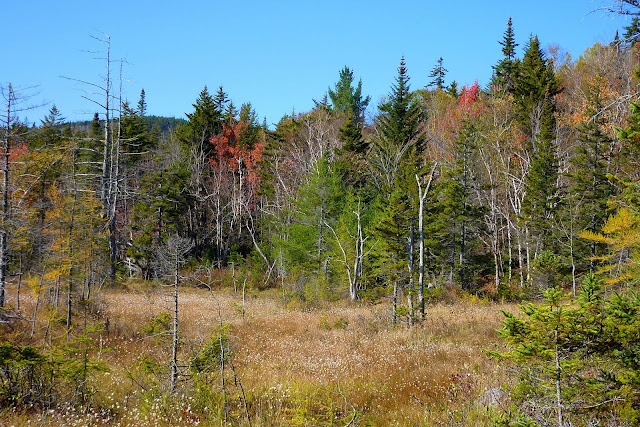
Although the pond was charming,  the surrounding shoreline had a unique beauty of its own.  There was colorful autumn foliage surrounding a carpet of cotton grass.  It made for a striking scene.

From the unnamed pond we bushwhacked to the 3,000 ft ledges.  The climb was steep, and in some spots was rugged and gnarly.  It was a much easier bushwhack in winter conditions when the deep snow evened out the "playing field".  Shown below is a snapshot looking up at these cliffy ledges from down below.

The views from these ledges are remarkable!  You are looking right into the throat of the Carrigain Notch as can be seen in the close-up photo shown below.

A wider angle of this vista is shown in the next photo which includes not only the mountains surrounding the Carrigain Notch, but also the Hancocks as well.

Shown below is a composite photo showing the view in late March versus the view on this early October day.

In addition to the vistas already shown, there are still other outstanding views looking eastward.  The next photo includes well known landmarks such as nearby Mt. Willey, and Stairs Mountain and Mt. Resolution on the distant horizon.  And of course, at the base of Mt. Willey is Ethan Pond which we had visited earlier in the day.

And once again, here is a winter versus autumn photo of this same view.

After soaking in our fill of the magnificent views we packed up and started the homeward bound leg of our journey.  We descended from the ledges via a completely different route than was used for our ascent.  It was much smoother!

En route back to the trailhead, we made one more off-trail excursion by doing a short bushwhack to a wetland area that we had seen from our rocky perch less than an hour ago.  From this spot we were able to look back at the eastern end of the band of ledges, as seen in the next snapshot which was taken from the edge of this wetland area.

And shown below is one last photo.  As we were descending, the evening sun was backlighting the red maples which made them appear to be on fire!

To sum it up, it would be an exaggeration to say that this adventure was like an outer space visit "to infinity and beyond"!  However, I can say that it was pretty darn good!