
BACKGROUND:
During a
speaking tour, the renowned mountaineer named George Mallory was asked why he
wanted to scale Mt. Everest. He is
famously quoted as having replied with the retort: "Because it's there."
Some
might rightfully ask why I would choose to hike to a seemingly insignificant
destination such as the col between two mountains, namely Mt. Tremont and
Bartlett Haystack. Perhaps my first
inclination would be to offer a response similar to George Mallory’s, i.e.
“Because it’s there.” And in truth, the
col simply being “there” might easily have been enough incentive for me to visit
this location. :-) However in this particular
case, there were other reasons for my decision to hike to such a peculiar destination. I had three objectives which are described
later in this report.
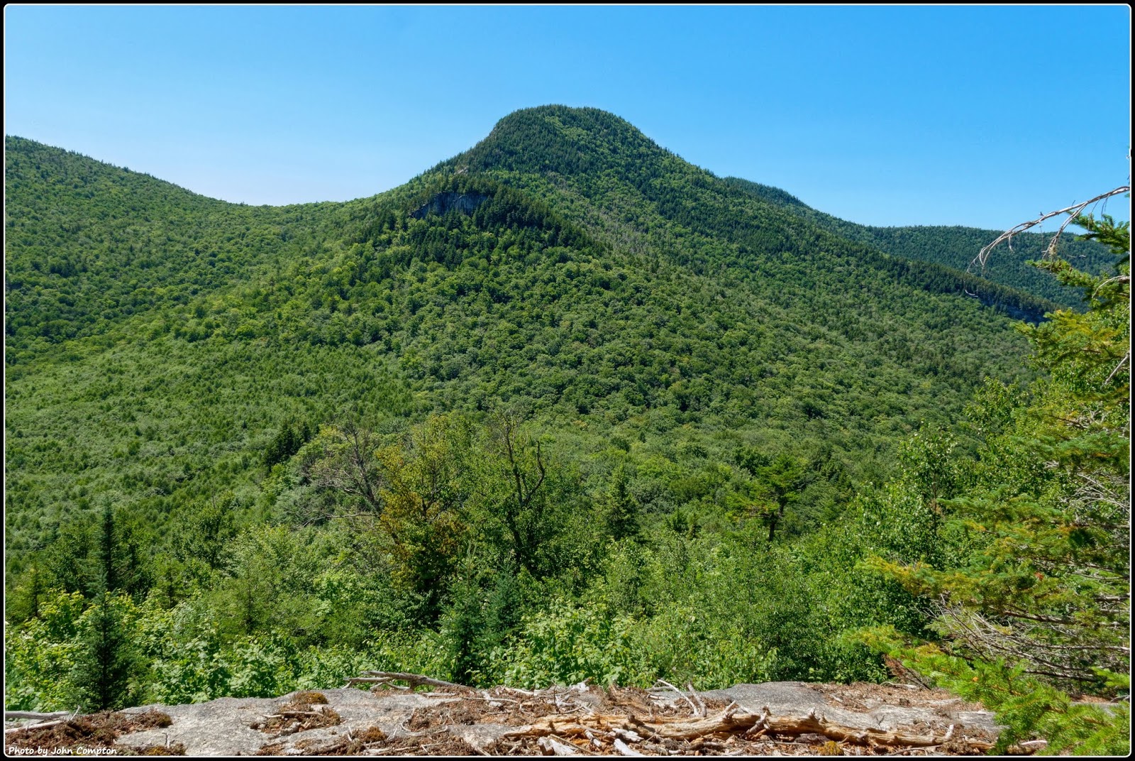
The
round-trip mileage for this trek was about 4.5 miles with an elevation gain of
about 1,500 ft. My travel route involved
a small segment (0.6 mile) of the Mt. Tremont Trail, plus a short bushwhack
(0.4 mile) to reach an old logging road which was followed for slightly over a
mile to the col between Mt. Tremont and Bartlett Haystack. From the col two short bushwhacks were
launched to separate ledges (one facing west, and the other facing southward).
 |
| My route of travel for this hike is depicted on this map by yellow highlighting. |
OBJECTIVES:
My three
objectives for this trek were as follows:
OBJECTIVE 1: Determine the “follow-ability” of an old
logging road leading to the col between Mt. Tremont and Bartlett Haystack. On previous adventures to this col, I had
come across the old logging road, but had only followed segments of it.
It was gratifying
to discover on this trek that the old logging road is still follow-able. Albeit,
the corridor has become narrow in spots due to encroachment of trees and
bushes. Also, there are a few places
where it is necessary to briefly leave the corridor to avoid a downed tree, or to
work around an area that is muddy due to clogged drainage.
For
future adventures, one never knows when it might come in handy to have this knowledge about the old logging road. :-)
 |
| The bushwhack between the Mt. Tremont Trail and the old logging road was through attractive open woods. Very little whacking of bushes was required. :-) |
 |
| I was pleasantly surprised to find that the old logging road was in relatively good shape and easy to follow. |
OBJECTIVE 2: Make a return visit to two
little ledges. One ledge is located at the north edge of the col, and the
other is located on the east side of the col.
There’s
not much to be said about this objective other than to say that my goal was
met. Both ledges were visited and I
enjoyed the views from each.
To give
some further perspective to these two ledges, I thought it might be helpful to
include a photo taken a few years ago when I bushwhacked to the huge cliff on
Mt. Tremont’s east end. This older photo shows
the two ledges that I visited on this July 2018 trek (see white labeling at
left side of photo).
 |
| The above photo was taken on another trek a few years PRIOR TO my July 2018 trek. The white labeling at left side of photo identifies the two ledges that I visited on this recent trek. |
 |
| This photo, taken on this July 2018 trek, was from a small ledge on the east side of the col. It provides an ‘in-your-face’ view of Mt. Tremont’s east end, and the cliff that is located there. |
 |
| This photo, also taken on my July 2018 trek, was from a small ledge at the north edge of the col. It provides a picturesque view that features Mt. Chocorua at top/center. |
 |
| Highly-zoomed view of Mt. Chocorua |
OBJECTIVE 3: Make a return visit to
something that shows up on some topographic maps as a tiny body of water located
at the trough of the col.
A) Previous
Visits to This Location:
Okay,
there is much to be said about this third objective. I had visited this spot several years ago,
once in the Springtime, and once during a particularly wet period in early
November. On both occasions, significant
water was indeed present at this location.
For this
current visit in late July 2018, conditions had been quite dry throughout the
region for an extended period of time.
And so, I was curious to see if any water would be present during a
prolonged dry spell.
Since
there is no detectable inlet or outlet for this body of water, it has long been
my suspicion that this is an ephemeral pool. These depressions typically only
contain water during periods of snow melt, or during prolonged rainy periods,
etc.
But, if
this is indeed merely an ephemeral pool, then one might think that topographic
maps would either totally ignore this landscape feature, or perhaps a mapping symbol might be used to depict it as a swampy area. However, such is not the case! Topographic maps in current-use depict this spot as being a small pond, i.e. a permanent feature on the
landscape.
 |
| Red arrow pointing to small body of water shown on USGS Quad map. |
 |
| Google Earth imagery is of little help. However, it does show an opening in the forest canopy at the spot where the body of water would be located (see red arrow pointing to the opening). |
Of further
interest is the fact that this body of water does NOT show up on any of the
vintage topographic maps that are available for viewing online. I suppose this could mean that it simply didn't
exist when those maps were made. Or, since
aerial photography had yet to be invented, perhaps no one knew it was there!
So, maybe
the answer as to why this body of water shows up on current-day topographic
maps is simply that there might be a shortage of resources for field-checking the
USGS maps. Without field-checking, it
could be that whenever several aerial photos show a sizeable amount of water at
a particular location, then it might end up being depicted on topographic maps
as a pond, lake, etc.
B) Findings
from my July 2018 trek to this location:
Since I
had long suspected this to be an ephemeral pool, it wasn’t overly surprising to
find absolutely no water whatsoever at this location during my July 2018
visit. There wasn’t even enough moisture
to dampen the soles of my boots! The
only thing seen was a large glade of ferns!
This finding
was in stark contrast to the significant water that I had seen on two previous
visits, one in late Spring, and one in late Autumn. Shown below is a snapshot taken during my
visit in late Autumn.
 |
| Photo taken in November 2010 shows the body of water at the col between Mt. Tremont and Bartlett Haystack. |
Even
though I wasn’t overly surprised that no water was found on this visit, I did begin to
have doubts as to whether I was at the right location! And so, I checked, and re-checked, my GPS to make certain that I was at
the waypoint taken for this location on each of my previous visits. My GPS showed me being at the right spot. And furthermore, the map that is loaded on my GPS
showed me standing in the middle of the “pond”!
But, just
to be certain that there wasn’t something odd happening with my GPS, I did some
further exploring by walking about 100 yards in all directions from where the
“pond” was supposed to be. Still, no water was
found.
In the process of
meandering around, I completely forgot to take a photo of the fern glade that
had replaced the “pond”. Fortunately, I
have a photo (see below) from another trek to a different location. It shows a small portion
of a large fern glade that is nearly identical to what I saw on my July 2018
trek.

And so,
for the time being at least, this ends the saga of the “now you see it, now you
don’t” body of water located at the col between Mt. Tremont and Bartlett
Haystack.
TO SUM IT UP:
The
ephemeral pool (or whatever it might be) that is described in this report is
unnamed. That being the case, perhaps a
good way of ending this report would be to quote an excerpt from a poem
entitled “The Unnamed Lake” which was written by Frederick George Scott
(1861-1944). You can read the entirety of this poem by clicking/tapping on this
LINK.
“It sleeps among the thousand
hills
Where no man ever trod,
And only nature's music fills the silences . . .
Where no man ever trod,
And only nature's music fills the silences . . .
'Twas in the grey of early dawn
when first the lake we spied . . .
Returning whence we came,
We passed in silence, and the lake
We left without a name.”
2 comments:
Hi John,
I also find it strange that an ephemeral pond would be shown on a current topo map. I enjoyed reading your speculations about why the pond was not shown on an old topo map but is shown on one now. Any or all of your hypotheses are plausible!
Based on your photos the col looked like a fine destination for your "fact-finding" mission—loved the sun-dappled logging road pic.
And lastly, I also enjoyed the poem "The Unnamed Lake"—as you said, a very fitting ending to your report!
Many thanks, as always, Rita for reading my blog and sharing your thoughts.
All the best,
John
Post a Comment