
Yesterday (04-December) was a day when I wanted to hike,
but with an overcast sky and intermittent drizzle, it was difficult to generate
enthusiasm for venturing forth. Nonetheless,
by late morning I decided to drive over to the Appalachia trailhead and just do
a short, low-elevation loop of some sort.
However, on the way over there, I had a change of heart. It would be much more fun to do something new,
rather than the "same old, same old".
I have a friend who is a resident of Shelburne, NH, and I
recalled him telling me of lovely walks he had taken along Leadmine Brook, and that
he had even encountered some cascades on his treks. That thought sparked another memory that I
had about a pathway diverting off the
Centennial Trail which I'd spotted a few years ago. Hmmm! That might also be fun to investigate!
And so, now that I was armed with two ideas for brand new
adventures, the needle on my enthusiasm gauge shot over to
"high". This was despite the
fact that my windshield wipers were on "intermittent wipe", and
the sky was dreary and grey.
Weather conditions had improved somewhat by the time I
reached the turnoff onto Leadmine Road in Shelburne. At least my windshield wipers were no longer
needed! I parked at a spot along the road
where my friend had said it would be okay to do so. Then, I began my trek, which was initially along
Leadmine Road itself, but then eventually I made my way to the brook and
followed along its bank for some distance.
Leadmine Brook is indeed picturesque. The next photo shows a portion of the brook.

Leadmine Brook in
Shelburne, NH
Eventually, I came to a cascade. I suspect this is only one of a series of
cascades on this brook. However, I
wasn't equipped to wander further upstream in search of other cascades. And besides, I didn't want to eat all the
"candy" in the jar on this outing.
Instead, I wanted to save something in the "jar" to savor on
another adventure!
Shown below is the cascade that I just mentioned. As you can see, it’s a mixed bag
of frozen and flowing water.

After taking a few minutes to admire the cascade and take
some photos, I turned around and headed back to my car. I was eager to embark on the second half of
my improvised adventure. From Leadmine
Road, I drove about a mile to Hogan Road where I parked at the trailhead for
the Centennial Trail.
Just a few hundred feet from the trailhead, the Centennial
Trail makes a hard left turn. It is at
that point where an unofficial pathway continues straight ahead. This pathway is quite well worn and prominent
at first. Eventually, it becomes less apparent,
but is still followable. Perhaps the
pathway is so well-worn at the beginning because some hikers miss the
Centennial Trail's hard left turn and continue straight ahead until it's realized that they are not on the official trail.
Regardless, my suspicion about this pathway was that it
would eventually lead to an overlook from a nearby ledge. Although the pathway became fainter and
fainter, and meandered in one direction and then another, I stuck with it. Sure enough, in less than 30 minutes, it
eventually took me to a ledge. That was
nice, except the overcast weather conditions prevented me from seeing any
distant views toward the Presidential and Carter-Moriah Range. The next two photos are representative of the
"view" that I had.

View from unnamed
ledge looking southwesterly toward cloud-obscured Presidential Range

View of Reflection
Pond from unnamed ledge
And so, after hanging out for awhile on the unnamed
ledge, I headed back down to my car. But
rather than returning via the meandering pathway, I took a more direct route by
simply bushwhacking through the open hardwoods.
On the way home, I made a stop along Route 2 at the pull-off
area for Reflection Pond. From here I was
able to see a small sliver of Giant Falls off in the distance (next photo).
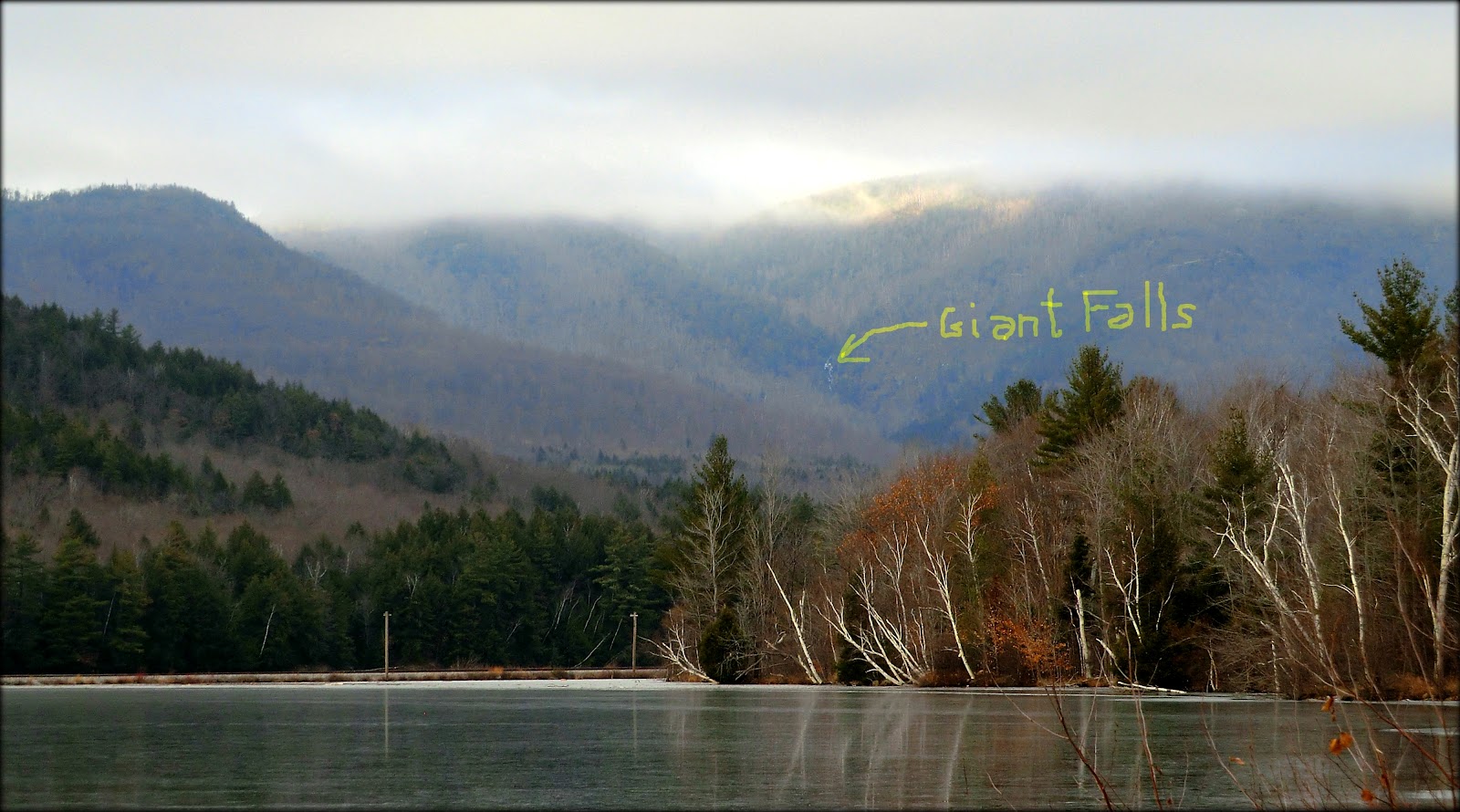
Small sliver of
Giant Falls as seen from Route 2 pull-off area at Reflection Pond
Despite the overcast, there were some muted reflections
in Reflection Pond as sunset approached.

Muted reflections in
Reflection Pond, as sunset approached
As we all know, weather can
sometimes change quickly in the mountains.
By the time I reached the Randolph area along Route 2, there was some
patchy blue sky! Unbelievable! Once again, I pulled off the road and took
some snapshots, one of which is shown below.

Patches of
blue sky over the Presidential Range, as viewed from Route 2 in Randolph
And, just as I was approaching
my home, I spotted a grove of white birch that was set "ablaze" by
the reddish-colored clouds at "twilight's last gleaming". So, once again, I pulled to the side of the
road to take a snapshot! It was a
pleasant ending to a day that began with unpleasant weather.

White birch
set "ablaze" by the reddish colored clouds at sunset
For anyone who might be interested in the location of the two places I
visited on this trek, they are marked on the map shown below. (Click on map to enlarge it.)

Map showing location of
the two spots visited on this trek
To sum it up, this type of adventure
would certainly not be everyone's "cup of tea". However, for me this improvised trek was far
more thrilling and fun than doing a traditional hike to familiar places.
11 comments:
John,
I think you've added a new variation of the concept of a "crawl". There are Pub Crawls, Office Crawls and now we have...hmmm...let's see-"sunset crawl" or maybe "weather crawl" ???? Love the last two photos
Marty
Very nice! This post proves that even a drizzly day can turn into a great day for a hike. I admire your ability to improvise on the fly!
The two places you choose for your treks are beautiful spots. Leadmine Brook is quite picturesque (again, Tim wonders if there are fish in this stream), and—even from "unofficial" pathways—you always manage to find overlooks with awesome views.
I absolutely love the white birch in front of the red sky. You usually manage to be in the right place at the right time for great sunset pictures!
I think there was plenty of candy in the jar on this hike, John—especially the "eye candy" in your great photos!
Hi Rita,
What a lovely set of comments! Thank you!
Regarding Tim’s question about the presence of fish in Leadmine Brook, I honestly don’t know. However, I must say that Tim’s keen interest in fishing has raised my awareness level regarding fish. Now, each time I wander along a brook, or cross one, I’m always on the lookout for fish. However, I never see any. So, I’m uncertain if that means there are no fish, or I’m just not seeing them??
Thanks again for your very kind remarks!
John
I did go a bit overboard with all the road-stops on the way home from my hike! :)
Glad you liked the last two snapshots!
Thanks for posting your comments.
John
Nice hike - good way to turn a mediocre day into one with a little adventure. Your last two shots are really great! I find that I often get some really good pictures on the way home, rather than on the hike itself. That's what happened to me yesterday; I was on Tom and 10 minutes into the descent the clouds lifted and I got fantastic views of the Presis through the trees and on my drive home. No matter, though, the day wasn't really about views, but just being out and enjoying the trail and woods.
Hi Summerset,
Wow! Do I ever agree 100% with your statement about hiking isn’t entirely about the views, but rather is more about just simply being out and enjoying the woods.
Also, I agree that there are many times when the views travelling to/from the hike are equally as good (and sometimes better) than those experienced during the actual hike. I don’t feel that makes one better or worse than the other. It simply means that a day spent hiking can be (and should be) as much about the journey, as it is about the destination itself.
Thank you for the great comments!
John
Hi again John,
It's always fun to look for fish in a stream and, just because you don't see them, doesn't mean they aren't there! Fish are very wary creatures and usually try to hide from predators (like us). So when they see our shadows cross over the waters they may be hiding in deep pools or in the "undercuts" along the banks. Sometimes we will see them in the middle of a stream though, stationary—just letting the current wash over them. It's best to use polarized sunglasses to be able to cut through the glare in the water to see them. Even though I don't catch fish it's always fun to see them (especially big ones) in the water, and I think a healthy population of fish proves that the waters—and the ecosystems—are healthy too.
That's probably more than you wanted to know!
Au contraire! The info you provided is indeed what I wanted to know about fish-life in mountain streams! The overall hiking experience is enhanced by having knowledge such as this.
Thanks Rita for taking time to post this . . . very much appreciated!
John
Views, the journey or views while traveling are all good, and one is not any better than another, they're just different from one another. In some cases, we're fortunate enough to experience more than one of those things in the same trip and that makes the experience all the richer. I am always thankful that I get to experience what I do - I am blessed in many ways.
Thanks for the wonderful post! I think this ledge is the one I've had my eye on as viewed from Rte. 2, although it's difficult to confirm with all the interesting ledge you see poking up from the ridges as you look accross the river.
A walk up Leadmine Brook has been on my to do list for a while, so thanks for some preliminary insights. Another adventure I am looking forward to in the vicinity is an old trail I had seen on a older map; although I see the route on some old USGS quads, I can't remember where in my collection I saw the name Sinclair Trail (I think that's the name I remember).
I thought when I saw this post you might be wandering towards this old route, I would'nt be surprised if this one is on your radar also.
Hi Andrew and Lindsay,
Glad that you enjoyed this report! Turnabout is fair play! Many of your posts have intrigued me and provided inspiration for new adventures!
Yes, the now-abandoned Sinclair Trail has been on my radar for awhile. One of my Shelburne contacts told me a couple years ago that the trail is still “follow-able” at the lower elevations. However, at the higher elevations, conifers have encroached on the trail corridor, and it then becomes a real challenge to follow. Regardless, reaching the Appalachian Trail is still doable by just continuing to head in a northerly direction. Could do a loop by heading eastward on the AT to pick up the Peabody Brook Trail for a descent back to the starting point.
John
Post a Comment