
On a crisp 10th day of December, I did a low elevation exploration at the base of the eastern side of the Moats. The idea for this adventure was sparked by a report by Steve Smith that is posted on his Mountain Wandering blog (Click HERE to read his report.)
Steve's report, as always, has a treasure trove of interesting information. One item that was of particular interest to me was a waterfall that Steve visited which is called Thompson Falls. This one is located on Moat Brook at the base of the Moat Mountains, and is not to be confused with another Thompson Falls at the base of Wildcat Mountain. In addition to Thompson Falls, my "bottom of the Moats" adventure also included a visit to a low-lying ledge at about 1,450 ft elevation (more about this later in my report).
My trek was launched from a Forest Road designated as FR 379. Access to this road is now gated at the north end of High Street. (During the summer months you can drive and park at an access point that is closer.) I don't know what factors trigger the closure of a road for winter travel. However, I can say that on the day of my hike, there was absolutely no snow on the roadways or surrounding forest floor. The photo below shows these snow-free conditions.

There are two spots along FR 379 where you can leave the road and reach Thompson Falls via an unmarked trail. As I've attempted to depict on the map below, there is what I'll call an eastern and a western trailhead. The eastern trailhead is difficult to locate, whereas the western trailhead is a very obvious (but unmarked) path on the east side of FR 379. (Clicking on the map, or any photo, will slightly enlarge it.)

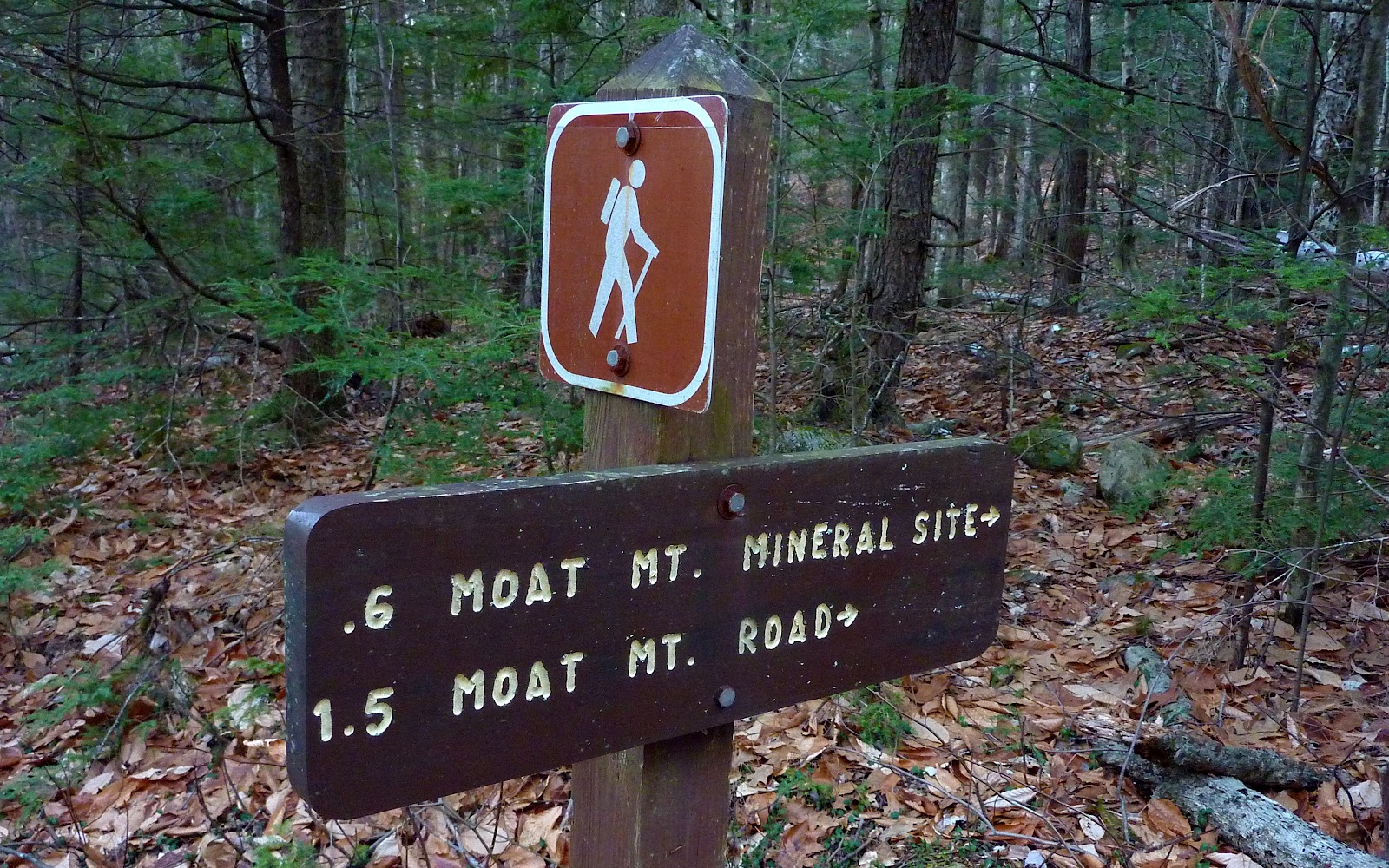
As you trek northbound on FR 379, you will know that you're within about 5 minutes of reaching the unmarked "western trailhead" for Thompson Falls when you see the sign shown in the photo below.
Once the unmarked trail is located, it is only a very short distance (1,000 ft or less) before you reach Thompson Falls. Below are several photos taken of the falls. As Steve Smith states in his blog, this was a favorite location of 19th century artist Benjamin Champney. "Thompson Falls and the Saco Valley" is considered one of his finest paintings.


After visiting Thompson Falls, I returned to FR 379 and crossed to the other side of the road to begin a short (0.7 mile) bushwhack in a westerly direction to access some ledges at about 1,450 ft elevation. In planning for this hike, I had seen these ledges on Google Earth and thought they would make a nice addition to the trek to Thompson Falls.
Although my trek to the ledges was technically a bushwhack, I was able to move as quickly as I could on a hiking trail. The entire route up to the ledges consisted of open hardwood forest with very little undergrowth. I arrived at the ledges in less than 45 minutes from the time that I left FR 379.
These unnamed ledges are located on an unnamed ridge that is just one ridge over (to the south) from Red Ridge. Due to their close proximity to each other, these two locations have many similarities. For one thing, the unnamed ledges have a reddish coloration similar to the ledges on Red Ridge.

Also, the views from the unnamed ledges are similar to those from Red Ridge. The next 3 photos show a sampling of the views from the unnamed ledges.
Shown below is a northeasterly view overlooking White Horse Ledge (immediate foreground). A few of the other more recognizable landmarks are Kearsarge North (right side of photo), and the massive bare ledges on South Baldface (on distant horizon, just left of center).

The next photo is an eastward view showing the bare ski slopes of Cranmore Mountain, along with Black Cap Mountain, plus other peaks in the Green Hill Preserves that overlook North Conway, NH.

The northwesterly view toward the Carter Range was mostly obscured by clouds, however I zoomed in on Carter Notch as it briefly emerged from the cloud cover.

During my short bushwhack to and from the unnamed ledges, I passed directly over one of the many mountain bike trails that are located in this vicinity. It was tempting to incorporate the bike trail system into my return route. However, as mentioned at the beginning of this report, there was no snow in this area, plus it was a beautiful sunny day. As a result of these ideal conditions, there were several bikers on the trails, and I certainly did not want to be involved in a hiker-biker collision! And so, I ended up taking the same route back to the car that I had used on the outbound portion of my trek.
For anyone interested, there is an excellent map that shows the bike trails in this area. This map was newly revised in 2011 and is called Conway Area Mountain Biking Trail Map, and it's published by Mountain Cycle Guide Service. Among other places, this map is available at The Mountain Wanderer Map & Book Store in Lincoln, NH.
To sum it up, this was an enjoyable trek, especially since I visited a waterfall and ledges that were both new to me. And, as I've indicated in some previous blogs, I love doing things that are new to me. Admittedly, this was not an epic undertaking such as a winter trek to the high peaks. About the only thing of an epic nature was the amount of road-walking that was involved. My overall trek was nearly 8 miles (round-trip). I'd guesstimate that about 6 of those miles were spent walking along forest roads. But it didn't matter to me. It was still a fun adventure!
///////////////////////////////////////////////////////////////


///////////////////////////////////////////////////////////////
ADDENDUM (added 13-Dec-2011)
The comment posted by Rita Wechter prompted me to gather some more information about Benjamin Champney and his connection to Thompson Falls (the waterfall located at the base of the Moat Mountains, not the one at the base of Wildcat Mountain). Champney describes the discovery of Thompson Falls in his book Sixty Years' Art and Artists (Click HERE for full text.)
"One day, Mr. Thompson, the landlord, said he knew that there was a waterfall behind the White Horse Ledge because he had heard its roar while he was in the logging camp in that neighborhood in winter. He gave us directions for finding it, fitted us out with a mountain wagon, loaned us his son William for a driver and guide. We drove through all the wood roads in vain, and were about to give up the search, when young Durand and myself determined to make a last effort, and after traveling through the dense woods for half a mile we found the stream, and following it down heard the rush of waters, and soon caught a glimpse of the chaotic masses of broken, ledgy rocks. We at once named it Thompson's Falls, and, hastening back to our comrades, we gave them such glowing accounts of our discovery that we all wished to return the next day for sketching, and we did, and every day for a week William drove us over, and we painted the wild scene. It was, however, a hard place to find until we had blazed the trees, and cut away many impediments."
Shown below is Benjamin Champney's oil painting of 1855 that is entitled: "Thompson Falls and the Saco Valley". (This image is in the public domain on the Internet.)

The view depicted in Champney's painting is now obstructed by trees. And it's questionable as to whether this exact view was ever available since artists of the era were know to sometimes embellish the views in their artwork. However, by using the "magic" of Google Earth, I can see that an unimpeded view could result in a scene that is somewhat similar to Champney's painting.
Shown below is a collage that includes two snapshots taken on my trek, as well as Champney's painting. One of my snapshots was taken from a 1,450 ft ledge which sits high above Thompson Falls, and my other snapshot was taken from the top of Thompson Falls. By looking at my two snapshots in conjunction with Champney's painting, maybe you can sort of get an idea of the vista that might have been available to Champney in the mid 19th century.

9 comments:
John, amazing post! These are views that I would never see or know about without your posts. Thank you for sharing.
Hi Grant! It’s as much fun to share these experiences as it is to discover places that are new to me. It’s nearly impossible to discover something totally new on each of my hikes, but I do try to work in some new component or new twist, as often as possible.
Thanks for your comments!
John
Neat! I suppose due to lack of medieval castles in NH, these mountains would just have to do. LOL. Lovely discoveries, especially the falls and unlike what you'd probably find in a real moat.
John, your photos are amazing, as always. And I appreciate your detailed descriptions of hikes and forays into places unknown—I feel as though I'm trekking through New Hampshire along with you. If my husband and I ever get to NH we'll use your blog as our guide!
The Thompson Falls pics are awesome. I'll have to look for the painting by Benjamin Champney.
Great post!
Rita
Hi Rita,
Just as any FYI, you recent comment prompted me to gather some more information about Benjamin Champney and his connection to Thompson Falls.
An addendum was added to the BOTTOM of my recent Blog report. Among other things, I've included the image of the oil painting of Thompson Falls by Benjamin Champney.
Thank you so much for your comment!
John
John, your addendum is a perfect complement to this post. And you're right, piecing your snapshots together I really can envision the view of the falls as Benjamin Champney painted it.
I've looked at websites featuring Champney's paintings and I like most of his work. Have you seen his winter painting of Moat Mountain?
I think Mr. Champney would have appreciated your blog, John!
Rita
Hi Rita,
Yes, I have indeed seen Champney’s winter scene of the Moat Mountains. It’s a remarkable piece! As with you, I too like most of his work. Even his winter scenes possess sort of a warm, cozy feeling.
Thanks again for giving me the impetus to gather some additional material to include as an addendum to my Blog posting.
John
Fantastic John. Adding the history to the great journeys to such interesting locations (combined with amazing images) adds up a real treat for us readers!
Thank you Mark for such a thoughtful response!
John
Post a Comment