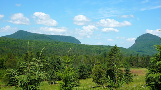
Willoughby State Forest covers 7,600 acres. The main attraction is Lake Willoughby which is a glacial lake reaching a depth of over 300 ft. in some places. It's bordered on the east by Mt. Pisgah (2,751 feet), and on the west by Mt. Hor (2,648 feet). Because of how it is dramatically situated between steep cliffs on either side, it has a close resemblance to a Norwegian fjord.
My 10-July hike was sort of a follow-up to a trek that I'd done in this same area on 08-May-2011 when I visited Mt. Pisgah. (Please click HERE to read that report.)
On this most recent hike, I went to several lookouts on the opposite side of the lake, including the summit area of Mt. Hor. My hike was about 7 miles round-trip. The route I followed is highlighted in yellow in the map shown below (click on it to enlarge it). The numbers on this map are keyed to trail descriptions which can be accessed via an online map. (Please click HERE to view that map and the trail descriptions.)
Yet another excellent resource for maps and trail descriptions in the Lake Willoughby area is contained in a book entitled "Northeast Kingdom Mountain Trail Guide" by Luke O'Brien. This book was published by the NorthWoods Stewardship Center in partnership with the Green Mountain Club of VT.
As you are approaching the Lake Willoughby area while driving north on Route 5A, the vision of Mt. Pisgah and Mt. Hor suddenly pops into view (photo below). Once you see this, then you're only minutes away from the trailheads for the trails on either side of Lake Willoughby.
On this particular day, my hike began at the trailhead for the Herbert Hawkes Trail. Yes, "Herbert" is misspelled on the trailhead sign shown below!
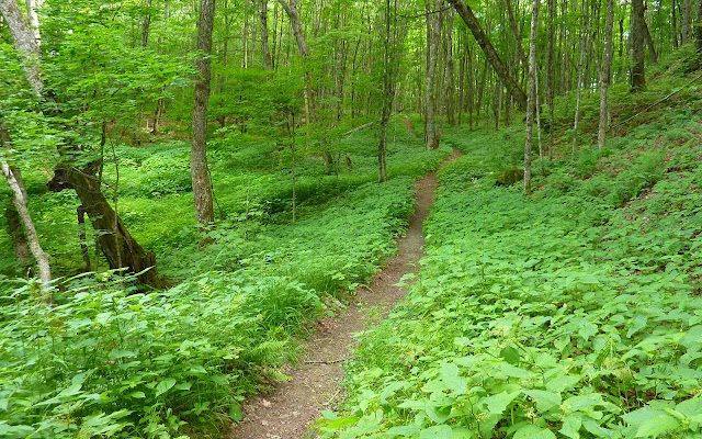
All the trails that I hiked were very well maintained and quite attractive. Especially striking is the segment near the start of the Herbert Hawkes Trail!
The first stop of the day was at the viewpoint located just a short distance from the summit of Mt. Hor. Although this outlook provides no views of Lake Willoughby, there are nice views to the west which include several small ponds within and adjacent to Willoughby State Forest. And, when looking southeasterly there is a partial view of the Burke Mountain ski area with mountains in New Hampshire visible on the distant horizon.
Views from Mt. Hor
After visiting the Mt. Hor outlook, I did a very short bushwhack (a few hundred yards) to the true summit of Mt. Hor. It is completely wooded, but nonetheless, there is a summit sign, as seen below.
Following my brief off-trail adventure, I returned to the trail system and hiked to four separate outlooks, which are situated at locations north and east of Mt. Hor. From these various viewpoints, there are partial views of Lake Willoughby, as well as the cliffs on Mt. Pisgah.
Views from various outlooks located northeast of Mt. Hor
The last outlook that I visited had a unique feature which was signaled by a faded sign which read in part: CAUTION! HOLD CHILDREN; LEASH DOGS.
Upon taking a few more steps it became very clear why such a sign had been erected. As shown in the composite photo below, there are truly enormous fissures in the bedrock which I subsequently learned are 30 to 40 feet deep! In order to get to the outlook, you needed to take a giant step (or jump) over these huge chasms.
All too soon, the day was coming to an end, and so I trekked back to my car. As I was driving down the road from the trailhead, I decided to stop at a pullover spot to take one last photo. From this roadside outlook, one could see the awesome vision of Mt. Pisgah rising high above Lake Willoughby.
To sum it up, I don't know when I'll be returning to do some more hikes in Vermont's Northeast Kingdom, but I do know that I will be back! There are still many other places I want to visit in that area such as Wheeler Mountain, Burke Mountain, etc.


5 comments:
Nice! A trip to Vermont is in the plans for next summer - you certainly have upped my interest with the great photos.
Summerset, thanks for posting your comment!
VT does have some nice hiking venues. I've just recently started doing some hiking over there. I'd been under the impression that it's a long drive over there. However, I've discovered that for many VT hikes, the driving time is not significantly longer than for many trailheads that I visit in NH, and certainly no longer than some of the places that I hike in Maine.
John
Been looking for foundation for Arcadia resort built three times in 1800s in top of mount Pisgah supposidly on Native Battleground between Iroquois and Algonquin, where spirits are still fighting..up along Arcadia brook to t top, do you know anything about these stories our the old foundations? Thanks joanne
Joanne, the information you are seeking sounds intriguing. However, I’m unable to contribute anything relative to this topic.
Thanks for posting your query to my Blog.
John
Joanne email me j_r_s@comcast.net.
Post a Comment