Pages

About Me

My photo
Bethlehem, New Hampshire, United States
E-mail contact: randonneur8@yahoo.com | Facebook: facebook.com/1HappyHikerNH

Text Above Search Box

SEARCH MY BLOG USING TEXT BOX SEEN BELOW:

26 September 2012

Maintenance of Adopted Trails in the White Mountains of New Hampshire

Do you like being outdoors, and like knowing that your work has a positive impact on many people who hike the trails in New Hampshire each year?   If so, then perhaps becoming a Trail Adopter is something to consider!

Several organizations have programs whereby people can volunteer to do maintenance on hiking trails.  In the White Mountain region of New Hampshire, the two organizations with the largest trail adopter programs are the AMC (Appalachian Mountain Club) and the USFS (U.S. Forest Service).   In addition to the AMC and USFS, other organizations (e.g. Cohos Trail Association; Randolph Mountain Club; etc) have similar programs, plus there are many local trail clubs which provide opportunities for trail adoption.  As a Trail Adopter, your responsibilities include such tasks as cleaning out drainage structures (waterbars, ditches, and dips); trimming brush and removing downed trees from the trail corridor.
Currently, I am a Trail Adopter for six trails.  On the surface, that might sound like a lot.  However, many of my adopted trails cover a distance of less than a mile.  Also, a local snowmobile club performs some of the trail maintenance work on one of my longer adopted trails.  And besides, this activity seems more like fun to me than actual work!
I've recently completed the Autumn maintenance for five of my six trails.  On the chance that it might be of interest to some readers, this Blog report will provide some photos and brief commentary relative to this recent trail work.
For this round of trail maintenance, I began in the Great Gulf region where I have adopted a segment of the Osgood Trail which is only 0.8 mile.  And my other adopted trail in this region is the Osgood Cutoff, which is only 0.6 mile.  To reach my work site, I need to hike 1.8 miles along the Great Gulf Trail, which is a longer distance than my two trails combined!  Perhaps the following map will provide some perspective.  My adopted trails are highlighted in purple. 
(Click on the map to enlarge it.)
Map showing my adopted trails in the Great Gulf region

I don't mind hiking the 1.8 miles leading-up to the point where I begin my work.  It's a very pleasant walk which begins on a narrow suspension bridge which is restricted to pedestrian traffic.  From this bridge, there is a very scenic view of the Peabody River (see next photo).
View of Peabody River from hiker's suspension bridge

Within about 30 minutes of hiking, it's a welcoming sight 
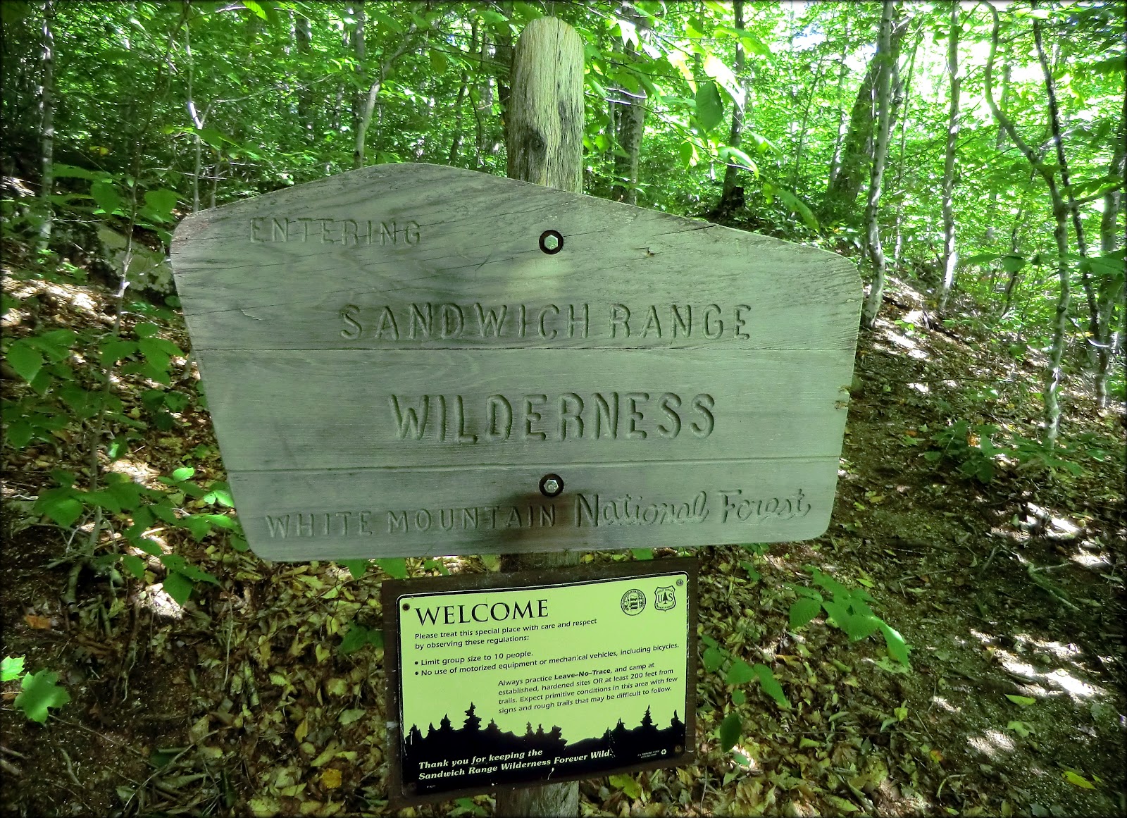
when the Great Gulf Wilderness sign comes into view.
Great Gulf Wilderness sign

I do my trail maintenance by hiking a counterclockwise loop which means that the Osgood Trail is the first trail to receive my attention, followed by the Osgood Cutoff.   By the time I've nearly completed my work on the Osgood Cutoff, I always take time to meander about 75 ft off the trail on an unmarked side path.  From this location there is a stunning vista of the Great Gulf.  It's a very nice "paycheck" for a day's work!
Great Gulf as viewed from side path off the Osgood Cutoff Trail

A few days following my trail maintenance work in the Great Gulf, I went to Ammonoosuc Lake (Crawford Notch area) to work on the Around-the-Lake Trail.  Over the years, I've met a surprising number of people who are unaware of this trail's existence!  Their initial thought is that I'm referring to the trail that goes around Saco Lake, which is just a short distance away to the southeast.  But in all fairness, the confusion is understandable.  The trailhead for Saco Lake, and the lake itself are visible from US Rt. 302, whereas neither Ammonoosuc Lake nor the trailhead are visible from the highway.

The Around-the-Lake Trail is highlighted in purple on the map that is shown below. (Click on map to enlarge it.)
Map showing Around-the-Lake Trail

This trail offers some nice lakeside views, particularly from its western and north shore.  The next photo shows one of those views.
View from shoreline of Ammonoosuc Lake

As mentioned earlier, the trailhead for the Around-the-Lake Trail isn't visible from the highway.  Also, there is no trailhead parking.  If you are a guest staying at the Highland Center, you of course can park in their lot and walk to the trailhead.  But otherwise, you'll need to park at the lot adjacent to the Crawford Station, or at the lot near the north end of Saco Lake, and then walk in behind the Highland Center to reach the trailhead.

The next two trails on the "hit list" for my Autumn maintenance were those located on Cherry Mountain.  Here I maintain the eastern portion of the Cherry Mountain Trail, as well as the Martha's Mile Trail.  Although the combined mileage for these two trails (4.6 miles) might seem like a lot of trail to maintain, please bear in mind that appearances can sometimes be deceiving!

Shown below is a map with my adopted trails highlighted in purple. (Click on map to enlarge it.)
Adopted trails on Cherry Mountain are highlighted in pink

The 3.6 mile length of the Cherry Mountain Trail is jointly maintained by a local snowmobile club.  During the summer months, it's basically just a wide grassy roadway which doesn't require much maintenance.  There was a drainage issue on the lower portion of this trail which required some time and effort during my Springtime maintenance.  But that situation now seems to be under control.

The Martha's Mile Trail is only 0.8 mile.  Not only is this a very short trail, but it's very easy to maintain.  There are no drainage issues, and usually there are few, if any, downed trees to be removed.   In case you're wondering, Martha's Mile becomes a "mile" by combining the 0.2 mile spur-trail between the Cherry Mountain Trail and the 0.8 mile Martha's Mile Trail.

The hiking community can be grateful to Bill Nichols (Littleton, NH) who took the initiative in the 1960s to restore the Martha's Mile Trail which had been abandoned for many years.  It provides an important link between the Owl's Head Trail (maintained by the Randolph Mountain Club) and the Cherry Mountain Trail.

As with your own children, it's difficult to pick a favorite.  However, of my adopted trails, the ones on Cherry Mountain rank highly in my personal favorability.  The mountain as a whole is attractive.  Shown below is a recent photo I took of Cherry Mountain as viewed from the Pondicherry Wildlife Refuge.
Cherry Mountain as viewed from the Pondicherry Wildlife Refuge

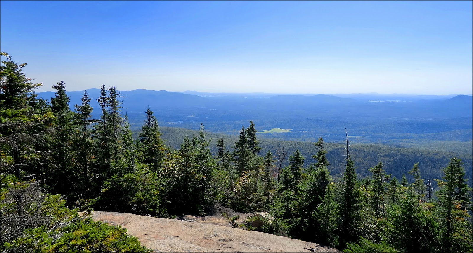
And as for the views from the mountain itself, the are magnificent, in my opinion.  Shown below is one of the views from the Owl's Head peak on Cherry Mountain.
View of Presidential Range from the Owl's Head peak on Cherry Mountain

Even traveling the road to the trailhead on Old Cherry Mountain Road can oftentimes provide a nice view of Mt. Deception from a roadside pond.  This vista is shown in the next photo which was taken on the way home from my recent trail maintenance work.
Late evening view of Mt. Deception from a roadside pond along the Old Cherry Mountain Road

And so, only one more adopted trail remains on list, and then my Autumn maintenance will be finished.  The one that awaits me is the Mt. Tremont Trail.   This 2.8 mile corridor is my "problem child".   That's not to say that I love it any less than my other trails.  But, as any parent with more than one child knows, some require more attention than others!

The main issue with this trail is that it's very prone to blowdowns.  For those unfamiliar with that term, it means trees that are toppled by wind and fall onto the trail!  Many of these blowdowns are within my ability to remove by saw and/or ax. However, there are some that are simply beyond my capacity and I need to fashion a workaround until the Forest Service can send a chain-saw crew for complete removal of the downed tree.

I'm uncertain exactly when I'll being doing maintenance on the Tremont Trail, but it will definitely be sometime well before the end of October.  Regardless of when I get to it, I'll know that at the top of Mt. Tremont there will be terrific views to reward me for my work.  A few of those views are shown below in a composite of photos taken during my trail maintenance in the Spring of 2012.
Composite of some of views available from summit of Mt. Tremont

To sum it up, being a Trail Adopter can be a very rewarding experience, especially if you like being outdoors, and like knowing that your work has a positive impact on many people who hike the trails each year.

18 September 2012

A Loop Hike to Mt. Paugus in the Sandwich Range Wilderness


Some terrific hikes can be launched from the trailhead in Wonalancet, NH.  However, I seldom travel to that location since my home in Bethlehem, NH is much nearer a huge number of trailheads not only in New Hampshire, but many in Vermont and Maine as well!  Despite the long drive, on 17-Sep-2012 I launched a hike to Mt. Paugus from the Ferncroft Road trailhead in Wonalancet, NH.  

The somewhat unusual name for this mountain was given around 1875 by a poet named Lucy Larcom.  The name was in remembrance of an Indian Chief named Paugus who lived in this region during the 1700s.  In prior times, the mountain had been known by various monikers including Hunchback, Deer, Frog Middle, Berry, and Bald.

It took me awhile to decide which trails to use.  There are an amazing number of trail combinations that can be used to visit this mountain from Wonalancet, plus there are a couple of different approaches from Kancamagus Highway (Rt. 112). In the end, I decided to hike up the Kelley Trail to the Lawrence Trail and follow it to Mt. Paugus.  Then on the return leg, I took the Lawrence Trail to the trail known as the Old Mast Road which I followed back to the trailhead.  My route is highlighted on the map below (Click on map to enlarge it.)
My route is highlighted in yellow

My final route was chosen because of an interest in the geologic history of the Kelley Trail.  At the upper end of this trail, there are gorges which were carved by torrents of glacial melt-water that gushed down this corridor during the retreat of the last continental glacier.  I was also interested in the American history linked with the Old Mast Road, which by comparison, is much more recent than the Kelley Trail's ice-age past.

As I understand it, in the early 1700s, the Royal Navy's supply of high quality timber and wood byproducts from Norway had been disrupted by a war between Russia and Sweden.  The Royal Navy was desperate for these materials and turned to the American colonies as an alternate source.  In particular demand was the Eastern White Pine which were used for the ship's main masts (and thus the name of Old Mast Road).  However, other trees such as hemlock and spruce were needed for other shipbuilding materials, such as rosin, pitch, and turpentine.  The Old Mast Road is an example of one of many corridors used for transporting these commodities off the mountain and into the supply chain.

Shown below is a composite of a photo taken on my hike along a segment of the Old Mast Road, along with an image showing something akin to what might have been happening on this corridor about 300 years ago.
Old Mast Road as it is today, and as it MIGHT have been several centuries ago

Okay, that's probably more than enough history about the hiking trail known as the Old Mast Road!  Earlier in this report I mentioned the glacial-carved gorges at the upper end of the Kelley Trail.   It was a photographic challenge to capture those chasms.  The following two snapshots are the best I could do.
Gorge carved by melting glacial runoff at upper end of Kelley Trail

Another view of gorge carved by melting glacial runoff at upper end of Kelley Trail

The next photo was taken at the trailhead where I began my hike.  What a lovely scene! It's almost enough to make you want to just spread out in the field and spend the day here!
Trailhead view

After spending a few minutes taking in the view at the trailhead, I headed for the trail and began my journey.  In about 30 minutes, I entered into the Sandwich Range Wilderness where I'd be hiking for the better part of the day.
Sandwich Range Wilderness sign

After passing the Wilderness sign, it seemed like no time at all before I arrived at the gorges at the upper end of the Kelley Trail.  In this gorge area, the trail passes over a rocky terrain which I understand can be quite slippery during wet weather conditions. However, on the day of my hike, conditions were very dry and traction was great!

At the end of the Kelley Trail, I hooked up with the Lawrence Trail.  My next destination would be the ledges on the south knob of Mt. Paugus.  On the way up to the ledges, there was a spot at one of the switchbacks which provided a limited view of a portion of the lower ledges on Mt. Paugus.  There is no trail to these lower ledges, but it might be an interesting bushwhack!  The next photo shows this view.
Trailside view of lower ledges on southern end of Mt. Paugus

Upon arrival at the south knob of Mt. Paugus, I did as the White Mountain Guide recommends.  I descended "50 yd. southwest from the knob over the ledges and through a belt of scrub to a large open ledge".  I've done some White Mountain hiking, but am far from being an expert in terms of views.  Nonetheless, it would seem to me that these ledges provide one of the finest views of two of New Hampshire's 4K peaks, i.e. Mt. Passaconaway and Mt. Whiteface.   In addition, there are views looking westward along the Rt. 112 corridor where you can see landmarks such as the ledges on Potash Mountain, as well as peaks in the distant Franconia Range, such as Mt. Flume and Mt. Liberty.

Shown below is a photo showing the views mentioned above.
Westward view from ledges on south knob of Mt. Paugus

Another prominent view from the south knob of Mt. Paugus is a southwesterly view looking toward the New Hampshire Lakes Region (next photo).
Southwesterly view looking toward the New Hampshire Lakes Region

After hanging out for quite awhile on the ledges, I headed back to the point where the Lawrence Trail ends on Mt. Paugus' south knob.  From there, I followed the Old Paugus Trail for just a short distance, and then diverged onto a side path that leads to a very nice view of Mt. Chocorua (next photo).
Mt. Chocorua as seen from a side-path off the Old Paugus Trail

By the time I finished admiring the view of Mt. Chocorua, it was already late afternoon, and so it was time to begin the return leg of my journey.

On my way back to the trailhead, I made a brief side trip on the Cabin Trail.  I knew from looking at maps that there should be a view of Mt. Paugus from this trail which would be just a short distance off the Lawrence Trail.  Sure enough, in less than 10 minutes I came to a spot where there was a limited view of the place that I had visited less than an hour ago.  This view is shown in the next photo.  Perhaps a reader can correct me if I'm wrong, but I think that the ledge that I visited on the south knob of Mt. Paugus is the small open area seen in the center of the photo at the top of the ridgeline.  For certain, I know it is NOT the massive ledge seen near the bottom of the snapshot.
Limited view of Mt. Paugus from Cabin Trail

Speaking of the massive ledge near the bottom of the photo shown above, I agree with Steve Smith's description of this ledge as being "similar to the almost desert-like scenery in the Mount Resolution area."  And speaking of Steve Smith, he published an excellent Blog report of a June 2011 visit to Mt. Paugus via a route different from mine (click HERE).

To sum it up, although it's a long drive for me to the Wonalancet area, this hike was definitely worth it!  I loved the views, and loved walking the trails which had so much history, some of which occurred only a few centuries ago, and some many thousands of years ago!  

14 September 2012

Nothing to Hate about a Trek to Baldpate!


When hiking to Old Speck a few weeks ago, the massive expanse of open rock on the East Peak of Baldpate Mountain was so readily apparent.  Ever since then, I've been eager to do a hike to the Baldpates (West Peak and East Peak), especially since this would be another hike that was new to me.   On 13-Sep-2012, I decided at the last minute to do this 8 mile round-trip trek.  I started from the Old Speck trailhead on Rt. 26 in Grafton Notch in the State of Maine.

This hike involves a 3,300 ft elevation gain, but there are only two spots that I feel qualify as truly steep.  One is the 0.8 mile climb from the Grafton Notch Shelter to the top of West Peak, and the other is the climb back up to West Peak on your return from East Peak.  Admittedly, the scramble up to East Peak is somewhat steep, but it's very short-lived.

The trek to the Baldpates is a lovely segment of the Appalachian Trail, and the trail conditions were excellent for the entire distance.  The steep climb from the Grafton Notch Shelter to West Peak is made easier by the magnificent rock work done by trail crews.  With little exaggeration, it almost seemed like climbing a set of rock stairs to the summit.  I tried to get a photo which would be representative of these "stairways", but couldn't seem to get an image that did justice to this splendid piece of work.

However, I was able to get a few decent snapshots that show some other elements of the trail.  Below is a photo composite which shows the following: an Appalachian Trail survey marker; one of the two ladders on the north side of West Peak; a pretty section of trail near the summit of West Peak.
Photo composite showing a few elements of the trail to the Baldpates

Regarding views from the two peaks, I think the vistas from East Peak are definitely better than those from West Peak.  However, West Peak does provide a great view of East Peak (next photo).
East Peak as viewed from West Peak

And, so as not to "short change" West Peak, there are  there are many fine views, such as the one shown in the next photo which is looking northward toward what I presume to be Lake Umbagog.  One thing I'm sure of, there is some definite autumn color beginning to show itself in the next photo.
Northward view from Baldpate's West Peak

On the way over to East Peak, there is another colorful view in the sag between West Peak and East Peak (next photo).
View of East Peak from sag between West Peak and East Peak

There were many more hikers out on the trail than what one might anticipate on a mid-week day.  The next photo shows a group of hikers descending East Peak.  This particular group didn't consist of Appalachian Trail hikers.  They were just doing a multi-day backpacking trip in the mountains of western Maine.
Group of hikers descending East Peak

As I neared the top of East Peak, there was a terrific view looking southward toward West Peak.   Clearly visible was the ribbon of trail that I had just descended on its north face.   Even more impressive was seeing Old Speck Mountain looming just ahead on the right, and the countless numbers of peaks in several mountain ranges, such as the Mahoosuc Range, and Presidential Range.
West Peak viewed from East Peak, along with Old Speck (far right), plus countless other peaks

Once I reached the top of East Peak, I was struck by all the color on the mountaintop (next photo).
Colorful East Peak mountaintop

I was also impressed by the stone-line corridor that the trail-crew had constructed in an effort to keep hikers on the trail, rather than wandering all over the mountaintop and damaging the fragile alpine vegetation.
Stone-line corridor constructed to keep hikers on the trail, and off the fragile alpine vegetation

The next photo merely shows the signage atop Baldpate's East Peak.
Signage on Baldpate's East Peak

Further regarding the signage, it must be quite a sight for southbound Appalachian Trail thru-hikers to see the scene shown in the next photo.  Behind this sign is a giant vista of several of the mountains in Maine and New Hampshire that they'll be traversing on their way to Georgia.
Trail sign with a giant vista of several of the mountains in Maine and New Hampshire

The next four (4) photos show some of the other views that are available from Baldpate's East Peak.
Windmill Farm in Roxbury, ME, with Ellis Pond in foreground, and pointy Mt. Blue in background

Southeasterly view: Lots of mountains! (Any ideas about the pointy peak just left of center on the farthest horizon, Chocorua, East Royce???)

Southwesterly view: Sunday River Whitecap (foreground); Sunday River Ski Resort (background)

Northeasterly view: In the center of photo (just over the first ridge) is Rumford Whitecap with its bare-rock top.  Hmmm! Might be an interesting hike! :-)

This last photo is one of those curiosity things which perhaps a reader will be able to answer.  Near the top of Baldpate's West Peak, on the north side, there is a greenish-colored blaze painted on the ledge.  A faint pathway can be seen at this point which leads through the scrubby conifers.   Was there once another trail to this peak that perhaps came up from a different direction?
Was this blaze associated with an abandoned trail to Baldpate's West Peak?

To sum it up,  perhaps the title of this report pretty much says it all.  There's nothing to hate about a trek to Baldpate!  This hike was particularly enjoyable since the weather was superb, and most importantly, it was a hike I'd never done, which is always a thrill for me.  

08 September 2012

East Mountain, Vermont: The Most Unusual Hike I've Ever Done!


It was on my recent hike to Brousseau Mountain (click HERE) that I first heard about East Mountain.  I met a hiker at the top of Brousseau who pointed out the faint outlines of structures atop a mountain way off in the distance.  He explained that these buildings were part of an abandoned U.S. Air Force Base on East Mountain in Essex County, VT.  He further indicated that this site is accessible via public land which is administered by Vermont's Agency of Natural Resources (ANR).

Since I'm always on the lookout for new and different places for hiking, this tidbit of information piqued my curiosity.  I consulted several maps to determine the location of East Mountain.  It was surprising to learn that it would only be about an hour's drive from my home in Bethlehem, NH to reach the starting point for a hike to this mountaintop.  
Okay, that was it!  I was hooked, and immediately started planning a hike!
(Depending on your Internet browser, clicking on the image below might enlarge it.)
MAP COMPOSITE: Topographic map, plus VT ANR map showing East Mountain

With some Internet research, I discovered that this now abandoned radar station was commissioned in 1952 by the US Air Force, and it was operational by 1955.  It was originally known as the North Concord Air Force Station, but later changed in 1962 to Lyndonville Air Force Station.  This facility saw most of its use during the Cold War era.  It was one of many ground-based radar stations that were scattered around the U.S. at the time, and was used to seek out Russian planes or missiles entering U.S air space.  The site was abandoned in 1963, and the lonely, rundown buildings now serve as a reminder of the Cold War.

This station gained some notoriety in 1961 when supposedly it reported a UFO sighting which lasted roughly eighteen minutes, and occurred just a few hours before the alleged abduction of Barney and Betty Hill near North Woodstock, NH.  Books have been written about this UFO incident, and there was a TV movie starring James Earl Jones and Estelle Parsons.

My Internet research about East Mountain (3,438 ft  elevation) also revealed that it ranks as the highest point in Essex County, VT, and that it ranks as 46th on the list of Vermont's 50 highest peaks.  Also, this mountain is 29th on the list known as New England Fifty Finest Peaks.  It's not my thing, but for those readers who are list-oriented and are unfamiliar with the "50 Finest" criteria, click HERE for more information.

Therefore, with having done my "homework" about East Mountain, on 07-Sep-2012 I eagerly launched my adventure!  There are several ways to reach the locked gate on Radar Road, which is the starting point for the 8-mile round-trip hike.  The route I chose from Bethlehem was to travel to US Rt. 2 in Lancaster, NH to hook up with VT Rt. 102, and then turn off onto Granby Road which leads to Radar Road.

Upon parking my car near the gate, I noticed a guy in a pickup truck parked right at the gate.  As it turned out, he's an employee of the State who was replacing the lock which had been damaged by vandalism.  I confirmed with him that it was permissible to hike the abandoned road to East Mountain.  His only admonition was that it's considered unsafe to try getting a view by climbing the abandoned military buildings at the top of the mountain.

I had read several trip reports on the Internet about folks who had hiked this mountain, and some said they had climbed the stairways on the old buildings and got some fabulous views.  Whereas others said there was "no way" they would ever attempt to climb on those rusted structures.   From the outset, I rather suspected that I would be among those opting NOT to do any climbing!  If I were to ever suffer the misfortune of being injured while hiking, my preference would be to do something such as slipping on a wet rock, rather than falling from a rusty set of stairs on an abandoned building!

The deserted road leading up the abandoned military installation is a well preserved corridor in the middle of the woods.  It appears that it is still lightly-used by those who administer this land.  There are long stretches of this roadway where the asphalt is still very much intact, even after being laid down nearly 50 years ago!  It was actually a very pleasant walk with nothing to be seen but trees in any direction.  And while climbing higher and higher, it was interesting to see the trees gradually changing from hardwoods to spruce and fir.

The next photo composite shows snapshots of the roadway taken at various points along the way.
Snapshots of  roadway taken at various points along the way to top of mountain

About halfway up the mountain, there are the remains of the buildings which were used to feed and house the staff that worked at the radar facility at the top of the mountain. Shown below is a composite photo of the exterior and interior of the dining hall.
Exterior and interior of the Dining Hall

Shortly after leaving the abandoned dining hall and barracks area, there is an opening where you look across a meadow and see some of the buildings associated with the main radar facility at the top of the mountain.
Distant view of buildings associated with main radar facility at top of mountain

From various points near the upper end of the roadway, there are "eye-of-the-needle" views of distant mountains.  The next photo shows one of those views.  I'm uncertain, but this particular vista might show Mts. Garfield and Lafayette in NH.  I was looking southward when this photo was taken.
Possibly Mts. Garfield and Lafayette in NH

Upon arrival at the decaying radar station at the top of the mountain, it sort of felt like a scene from one of those disaster movies where you emerge into a world that has been devastated by a horrific catastrophe, like a nuclear war, or something of that magnitude.  This feeling is magnified by having just walked up a 4-mile long paved road without any vehicular traffic at any point along the way.

The next 3 photos show some of the many buildings at the abandoned Air Force facility atop East Mountain in Vermont.


Time was taken to explore all of the buildings, but mostly from the outside.  They have been pretty well boarded up to keep people out.  However, there were a few doors that have been pried open to gain access to the stairwells that lead to the top of the structure.  

I poked my head inside of these opened doorways and saw enough to quickly dispel any thoughts of climbing the stairs to seek out a view.  First of all, the interior of these buildings are dank and as dark as sin.  Through the dim lighting, I could see holes in the flooring, as well as pieces of every imaginable type of debris.  Also, there were disconcerting sounds of loose pieces of metal flapping in the wind.  And to top it off, there were signs posted on the buildings regarding asbestos danger (see photo below).
Asbestos warning signs

Some readers are probably asking why I ever undertook an 8-mile round-trip hike to such an unattractive place.  In response, I'd offer that the mileage went by very quickly since the "trail" was generally a paved surface from start to finish.  Of course, the decrepit buildings are definitely an eyesore.  Nonetheless, the surrounding landscape is attractive, and the setting is quite remote.

But the most compelling reason for undertaking this adventure was because of it being something new to me, which always has a huge appeal.  Also, by engaging in something new, it jolted me from my routine routes of travel, and thereby provided the opportunity to drive through some picturesque Vermont countryside and villages that I'd never visited.  Particularly quaint was the village was Granby, VT with a total population of 88 as of the 2010 Census, thereby making it the least populated incorporated town in the State.
Post Office in Granby, VT
 Granby, VT Central School

To sum it up, I have no regrets for having done this rather strange hike.   The 8-mile round-trip journey (with an elevation gain of about 1,700 ft) provided a great workout, and it led me to an unusual place through some beautiful and remote forestland in Vermont.
/ / / / / / / / / / / / / / / / / / / /


ADDENDUM (added 10-Sep2012):
Shown below are some photos which were generously provided to me by a reader.  They show some of the views that can be had by climbing around on the old buildings.  I'm very grateful for the photos, especially since they allow me to see views that I'll likely never experience first-hand! :-)  I just cannot see myself ever climbing the rusted stairwells inside those buildings.


Also included in this addendum is a composite which shows a photo that I took while visiting this abandoned site in 2012, and compares it to a photo taken in 1962.  I think both snapshots show the same building, but from different vantage points.  You'll undoubtedly note in the 1962 photo that there was a "protective bubble" on top of the structure.  As I understand it, this was used to shield  the sensitive radar equipment from the weather.

And lastly, with some additional Internet research, I came up with the image that is shown below.   Apparently this abandoned site was written up in a Rutland, VT newspaper back in the year 2000.