Pages

About Me

My photo
Bethlehem, New Hampshire, United States
E-mail contact: randonneur8@yahoo.com | Facebook: facebook.com/1HappyHikerNH

Text Above Search Box

SEARCH MY BLOG USING TEXT BOX SEEN BELOW:

29 April 2011

A Mud-Season Meander

There are times (especially during the spring mud-season) when I'll pick out a logging road on public land and simply meander. Sometimes I'll stay on the road, and other times I'll do some short bushwhacks off the road at various points along the way. These meanderings are just a simple walk in the woods, and are they are done mainly just for exercise. There are no great expectations of any panoramic vistas, or magnificent waterfalls!

This past Friday (29-Apr-2011), I opted to roam along a road located within the public land tract known as the Randolph Community Forest. There are many ways to access this Forest. My point of access was a gated road on the north side of U.S. Route 2 about a tenth of a mile west of the trailhead for the Castle Trail (Bowman, NH).

I would encourage you to read a very interesting and well-written publication about the Randolph Community Forest that is available on the RMC (Randolph Mountain Club) website (Click HERE). And just to give you a feel for the size of the Randolph Community Forest, presented below is an excerpt from that publication.

"On December 4, 2001, the Town of Randolph took title to a 10,000-acre tract of land and became the owner of the largest town forest in New Hampshire. For the Town, this was the culmination of a multiyear effort to preserve more than 13,000 acres strategically located between two sections of the White Mountain National Forest (WMNF) lands. The effort was initiated by the Town of Randolph and involved the U.S. Forest Service (USFS), the Trust for Public Lands, and the New Hampshire Division of Forests and Lands."

As I trekked along this logging road in the Randolph Community Forest, I could tell that this would be unlike my other mundane meanderings on this type of road. For one thing, there are nice views both on and off this road!

The snapshot below shows a view from the road (Mt. Jefferson prominently displayed).
Also, you can wander off the road to get views such as shown in the snapshot below. Yes, vistas such as shown below are from an old logging-cut, which to some folks is sort of like cheating to get such a view. When I go hiking, logging-cuts are certainly not my destination. However, if I happen to come across one that provides a nice view, then I'm not opposed to taking a peek!
By doing a short bushwhack off the road, I was able to get a distant through-the-trees view of a portion of the Franconia Range, as shown below.
Also by wandering off the road here and there, I was able to enjoy many wildflowers that were either in full-bloom, or about to bloom.
Other off-the-road meanderings led me to things such as a picturesque wetland area, a nice stand of birch trees, and I spotted what I think is a clavicle bone from a moose. All these are shown in the photo collage below.
The map below represents just a small segment of the Randolph Community Forest (green portion at upper left of screen).  However, this map serves to show the general vicinity of the area where I roamed during my 29-April hike. (NOTE: If you click on the map, it becomes slightly larger.)
Admittedly, it's just my opinion, but I thought the trek on/off a logging-road through the Randolph Community Forest was interesting. Therefore, I decided to share this experience via my Blog. But please be assured, my more typical humdrum ramblings along logging roads will remain "un-Blogged"!! :)


-------------------
Leaving a comment via this Blog is always appreciated. However, if you prefer to ask a question or make a comment via a personal E-mail, then you may contact me at: randonneur8 at yahoo dot com.

27 April 2011

A Timeless Hike: Bald Mountain – Artist's Bluff Loop

On most Wednesdays I have an obligation which results in so little time for hiking that I usually don't bother to go out. However, on this particular Wednesday (27-April) I opted to take the hour and half that was available to me and do the short loop-hike over Bald Mountain and Artist's Bluff. It seemed like a good "fit" since it would take less than 15 minutes to drive from my home in Bethlehem to the trailhead located at the top of the Franconia Notch. And besides, it had it been several years since I'd done this short hike and so it seemed like a good time for a refresher course!

Probably most everyone who is reading this report has done this loop-hike at least once. It is a timeless hike that folks have been doing since the mid 1800s. Possibly there were some early trekkers who made their way to Bald Mountain and Artist's Bluff even before the Profile House opened in 1853. This long-gone hotel once occupied the space that is now the parking lot for the Cannon Mountain Tramway. Click HERE if you're interested in reading more about the history of the Profile House.

As I was looking through the photos that I took on my short hike, it struck me that if you can ignore the intrusion of I-93, today's view is basically the same as seen by hikers over 150 years ago.

Just for the fun of it, I grabbed some historical images from the Internet to compare to my photos. Shown below are two photo collages. The first collage compares one of my snapshots to an oil painting done in 1887 by Edward Hill. And the second collage compares an old postcard to one of my snapshots. The oil painting and the postcard both show the old Profile House resting at the south end of Echo Lake.
And, even though most readers have similar snapshots in their collection, nonetheless shown below are a few additional photos taken during this brief hike.

View from Bald Mountain
View from a Ledge between Bald Mountain and Artist's Bluff
View from Artist's Bluff
After my hike, I took a quick jaunt down to the shore of Echo Lake. The wind was whipping up small waves and whitecaps!
The trails involved in this hike were the Bald Mtn/Artist's Bluff Path, plus the Short Circuit Trail which connects the two ends of the Bald Mtn/Artist's Bluff Path, and thus enables you to return to the same trailhead where you parked.

With a total distance of about 1.4 miles, I think this loop hike is ideal for anyone seeking a short and extremely satisfying White Mountain adventure!
-------------------
Leaving a comment via this Blog is always appreciated. However, if you prefer to ask a question or make a comment via a personal E-mail, then you may contact me at: randonneur8 at yahoo dot com.

26 April 2011

Traveling Way South of New Hampshire

Last week (18-25 April, 2011) my wife and I traveled way south of New Hampshire to visit family located in the States of Delaware and North Carolina. In neither location did I have the opportunity to do much in the way of hiking. However, it was a really nice visit. And, at both locations, the Spring Season has definitely "sprung"! Plants are in full bloom, the grass is green, and most folks have already mowed their lawns multiple times.

The Wilmington, DE location that we visited is part of the megalopolis of Philadelphia, PA and Camden, NJ. In such a populous area, there are very few hiking venues that are densely forested. However, I managed to work in a short stroll in a park-like setting in the suburbs of Wilmington, and here I was able to capture the image of a rainbow while looking across a grassy field.

Our visit to North Carolina is in the three-city area known as the Piedmont Triad (Greensboro, Winston-Salem, High Point). This is also quite a populous area. However, not far from the Triad area, just off the 4-lane highways, there is Hanging Rock State Park. This location has over 18 miles of wooded passageways that lead you to picturesque cascades and waterfalls and rocky ledges.

Since the family members consisted of folks of varying ages and ability, our hike at Hanging Rock State Park was limited to mild-mannered treks to waterfalls and cascades. Shown in the snapshots below are two of the spots we visited.
Hiking to the above destinations was quite pleasant. Along the way, the woods were full of flowering plants such as shown in the photo-collage below.
The woods themselves were a lovely shade of Spring-green, and also had a few flowering trees thrown in here and there. Shown in the first of the two photos below, is a typical woods scene. The second photo also includes a portion of the Spring-green forest, plus an attractive wooden fence that we encountered along one of the trails.
In close proximity to each of the waterfall locations, there was a sign such as shown in the photo below. The "hazards" at these spots are far less than those encountered at waterfall locations in the Whites. My assumption is that there is some sort of liability issue which requires the State of NC to erect these signs.
So, as said earlier, we had an enjoyable visit. Also, it was fun and interesting to travel to NC and DE by car. We could see the Spring Season gradually progress as we drove southward through various States along the way. It was equally fun and interesting to watch the Spring Season progress backwards as we drove northward on our return trip back to New Hampshire. And quite honestly, I was thrilled to see that there were still remnants of snow on north-facing slopes and on the mountaintops. I'm a huge fan of the brief Spring/Summer seasons that we experience in northern New Hampshire! There is no place like home, and the White Mountains of NH are truly one heck of a nice "home"!
------------------
Leaving a comment via this Blog is always appreciated. However, if you prefer to ask a question or make a comment via a personal E-mail, then you may contact me at: randonneur8 at yahoo dot com.

15 April 2011

MAHOOSUC TRIPLE-PLAY: Dryad Fall; Dream Lake; plus an Unnamed Ledge

My game-plan for 15-April-2011 was to hike the Austin Brook Trail to the Dryad Fall Trail. I would then follow the Dryad Fall Trail to the short spur trail leading to Dryad Fall (a place I'd never visited). Then after visiting the falls, I would continue onward to Dream Lake, but along the way I planned to leave the trail for a short bushwack to a ledge overlooking the Presidential Range. Perhaps the map shown below will better illustrate my game-plan.
Shortly after setting foot on the Austin Brook Trail, I began to wonder if the "game" would have to be forfeited due to field conditions! This predominately south-facing trail had more snow on it than I had anticipated. My initial concern wasn't due to an equipment issue since I had snowshoes strapped to my pack. My unease was about the character of the snow itself, i.e. would it be firm and supportive, or miserably gloppy and sticky?

It didn't take long to determine that it was "game on"! Overall, the snow conditions were great. Mother Nature had done an excellent job of hardening the snowpack by providing an overnight temperature in the low 20s.

There were a few stretches of bare ground along the route, as shown in the photo below.
However, the predominant conditions encountered for most of the hike were like what is shown in the following photo. You can judge from my snowshoe track just how firm and supportive the snowpack was on this particular day.
As indicated above, my first stop was at Dryad Fall. Click HERE for a link that provides some interesting and useful information about this waterfall. As indicated in this link, the brook that feeds this waterfall has a small drainage basin. And so, it's best to visit this spot at times of high water. Otherwise, it's my understanding that you are likely to be looking at just a tall wet cliff!

Dryad Fall has an upper tier with a 25 ft drop, and a lower tier with a drop of approximately 300 ft.  A short spur-trail takes you to a small flat ledge at the base of the upper tier which is to your right. Immediately to your left is the top of the lower tier with its precipitous 300 ft drop. Obviously, one needs to be extremely cautious when attempting to view and photograph from this spot!

So, shown below are two photos. The first snapshot shows the upper tier of Dryad Fall, and the second one shows the lower tier.

I returned to the main trail after my visit to the waterfall and then continued onward toward Dream Lake.  Above Dryad Fall, the snowpack was roughly calculated to be about 2.5 ft deep.  My crude measurements were taken at various points by pushing my trekking pole to the bottom of a few moose-created postholes that extended down to bare earth.

As mentioned earlier, my game-plan called for a short off-trail excursion en route to Dream Lake in order to explore a small ledge that overlooks the Presidential Range. With a fantastic combination of wide-open hardwoods and a very firm snowpack, I was able to bushwhack to the ledge in less than 15 minutes.

Just as was the case for Dryad Fall, this was my first visit to this particular ledge. The view from this spot was pretty good, at least in my opinion! Shown below is a snapshot taken from this unnamed ledge.
And, through the "magic of zoom", I captured a highly magnified image of Mt. Washington while standing on this ledge.
After having lunch on the ledge, I once again returned to the main trail and pushed onward to Dream Lake, which was my final destination. For this particular day, this was the only destination that I had previously visited! This was done a year or so ago when I used the Peabody Brook Trail as my approach route.

I particularly like the view of the Presidents resting on the horizon at the end of Dream Lake. Shown below is a snapshot of this view. Although the photo is just slightly zoomed, it doesn't misrepresent the view with the naked eye.
After lingering for a bit around the shoreline of Dream Lake, I returned to the trailhead via the same trails that were used for the outbound portion of my journey. I did make one stop along the way to visit the reflecting pool of water just a few hundred yards from the trailhead for the Austin Brook Trail. Shown below is a photo of this scenic little spot.
And speaking of the Austin Brook Trailhead, for anyone who has been there, you'll recognize the photo below. Although there might be other trailheads in the Whites that have a turnstile, I personally haven't come across any others.
TO WRAP IT UP, the journey described above was my triple-play in the "Mahoosuc League". Even though there was snow on the "playing field", it was firm and supportive and had no impact on completing my game-plan for the day. It was another wonderful day in the Whites!
-------------------
Leaving a comment via this Blog is always appreciated. However, if you prefer to ask a question or make a comment via a personal E-mail, then you may contact me at: randonneur8 at yahoo dot com.

12 April 2011

Bickford and Scarface – Now There's a Pair!

Nearly due east of the Skookumchuck trailhead are three little mountains: Bickford (2,368 ft), Scarface (2,802 ft) and Big Bickford (3,261 ft). Since bushwhacking is the only means of access, these mountains only have a few occasional visitors.

On 12-April, I visited Bickford and Scarface mountains.  Every so often, it's a nice change of pace to pay a visit these two little guys. Getting to them is a pleasant trek through open hardwoods, and both mountains have a little ledge that provides an interesting view southward toward Cannon Mountain.

For anyone unfamiliar these mountains, the map shown below will help to help pinpoint their location.
My bushwack on this particular day took me through some mixed snow conditions. As shown in the side-by-side photos below, sometimes the ground was completely snow-free, whereas at other times, there were large patches of snow.
Along the way, I came upon a couple of interesting things . . . like a dead porcupine! Maybe this prickly critter was a meal for a Fisher (click HERE for information about "Fisher Cats")?
A short distance away from the dead porcupine, I spotted a small patch of fern that was alive and perky. It was refreshing to see some green vegetation beginning to emerge!
With having to navigate my way through occasional patches of snow, it took about 45 minutes to reach the tiny ledge on Bickford Mountain. Shown below is the view from there.
Next on my hit list was Scarface. It took about another 45 minutes to bushwhack over to this mountain. The view toward Cannon Mountain from Scarface is very similar to the view from Bickford. Although it's a more open view from Scarface, I personally think that the view from Bickford is just as good. The little ledge on Scarface does provide a limited view toward Lafayette which Bickford doesn't have (or if it does, then I have yet to find it).

Shown below are two views from Scarface Mountain.
So, as indicated in the title of this little report, Bickford and Scarface are quite a pair! They provide a pleasant few hours of hiking and a few views to boot!

For a longer hike, a loop can be done by continuing on over to Big Bickford, and then shoot southward to pick up the Skookumchuck Trail and follow it back to the trailhead on US Rt. 3.

ADDENDUM (Added on 14-April-2011)

Since Bickford Mountain isn't shown on all maps, it caused me to wonder if perhaps I had picked up some erroneous information somewhere along the way. So, to relieve my self-doubt, I did some additional research and came up with material which I think verifies that "Bickford Mtn" is an officially-recognized Place Name, and it is separate and distinct from "Big Bickford Mtn".

However, whoever incorporated "Mtn" into the name "Bickford Mtn" has caused some confusion!! 

According to GNIS (Geographic Names Information System), the place that is named "Bickford Mtn" is NOT classified as a summit, but rather it is classified as a ridge (with a high point of 2,368 ft).  Whereas, Scarface Mtn and Big Bickford Mtn are BOTH classified as a summit.  Have your eyes glazed over yet?! :) 

For anyone interested in what I found, I've posted the two images shown below. They both came from the website Topoquest (click HERE to access that site).


-------------------
Leaving a comment via this Blog is always appreciated. However, if you prefer to ask a question or make a comment via a personal E-mail, then you may contact me at: randonneur8 at yahoo dot com.

08 April 2011

Mt. Webster: Wish I Had Gotten an Earlier Start!

Mt. Webster . . . the one in the Crawford Notch! With so many magnificent mountains here in the Whites, it would be difficult for me to pick a favorite. However, I do like Mt. Webster a lot. I like to look at it, and I like to climb it!

On 08-April-2011, I puttered around the house doing this and that, and before I knew it, the morning was gone! My plan for the day was to climb to the actual summit of Mt. Webster. However, I could see that just wasn't going to happen, not with a start time of nearly 2 PM, plus the need to be home for a 6:30 PM obligation. So, I did the best I could with what I had, which is all anyone can do!

Even with the late start and the need to finish early, I knew it would be possible to at least reach the first set of ledges on Mt. Webster. From the trailhead, I took a snapshot of my ledgy objective located atop the south end of Mt. Webster, and then off I went. (The smaller peak to the right of Webster is unnamed, but my friend Ben has dubbed it as "Mt. Linda".)
The treadway had a relatively firm base, and it was even firm enough to support someone who had recently bare-booted the trail without creating too many postholes along the way. There's still a lot of deep snow on either side of the trail, particularly higher up on the trail, as evidenced in the snapshot below which shows a trail-blaze only a foot or so above the top of the snowpack.
I don't know the precise mileage (probably 1+ mile from the trailhead) however anyone who has ever hiked this trail will likely know the spot that I'll try to describe. It's the spot which involves a tricky scramble across the top of an old slide. Anyway, traction is definitely an issue at this spot and at several other spots above it for the next tenth of a mile or so. Ice, of course, is the culprit! I was able (barely) to negotiate these spot with the gripping power provided by my MSR snowshoes. However, I would've felt much more comfortable if I'd been wearing crampons to traverse these icy spots.

Having successfully negotiated the icy stretches of trail, it wasn't long before I arrived at the first outcropping of ledges on Mt. Webster. I really like the views from here! My favorite is looking southward down the Crawford Notch.
It's also impressive to see Mt. Carrigain sort of standing head and shoulders above the others on the horizon.
And then, there's that wonderfully intimidating view of Mt. Willey staring you right in the face! No need for a zoom lens!
At the north end of the "Willey mass", there are the cliffs of Mt. Willard. I enjoy gazing at Willard's cliffs from Webster, but it's a bit more impressive to view Webster's cliffs from Willard! . . . Hmmm!  Willey, Willard, Webster . . . sort of sounds like: "Peter Piper picked a peck of pickled peppers"! Regardless, shown below is a snapshot taken from Webster showing Willard at the end of Willey!
Just as a side-note, it's interesting to compare the Willard hike to the Webster hike.  It's nearly the same distance to the cliffs on Mt. Willard (1.6 miles) as it is to the first open ledge on Mt. Webster (1.8 miles). However, the elevation gains are quite different, i.e. 900 ft for Willard vs. 1,750 ft for Webster. I know in my mind that there is nearly twice as much elevation gain for Webster vs. Willard, but quite honestly, it doesn't seem TWICE AS HARD to climb to those first open ledges on Webster!

Okay, after taking some snapshots and sitting for a bit to enjoy the views, it was time to leave. It was such a nice sunny day in early spring. This made it ever so difficult to stop myself from continuing upward on the trail which was already broken out beyond this first set of ledges. So, if you go up there soon, the fingernail marks in the snow are the result of me dragging me back down the trail!

Although I was kicking myself for getting such a late start, it was some consolation to know that the mountain isn't going anywhere. It will still be there to climb on another beautiful day!
-------------------

Leaving a comment via this Blog is always appreciated. However, if you prefer to ask a question or make a comment via a personal E-mail, then you may contact me at: randonneur8 at yahoo dot com.

07 April 2011

Squam Lake, Smarts Brook, 100K Miles

As weird as it might seem, there is a connection between Squam Lake, Smarts Brook and 100K miles. Well, at least there was for me on 07-April-2011 which was a day that I had some business in Concord. On my way back to my home in Bethlehem, NH, I exited off I-93 on two occasions to do some short hikes.

My first stopover was at Exit 24 (Ashland) to do a short hike up the Old Bridal Path to take a quick peek at Squam Lake from West Rattlesnake. Shown below are two snapshots taken during this jaunt.  No "ice-out" yet!  (Click HERE for some brief additional information about "ice-out".)
Following this little mini-adventure, I drove north on I-93 and got off at Exit 28 (Campton) and drove to the trailhead for the Smarts Brook Trail. From this trailhead, I picked up the Pine Flats XC Trail and hiked along Smarts Brook where there were some very attractive ice formations.

And so, where does the 100K miles come into play, you might ask? Well, the odometer on my car reached the 100,000 mile mark as I was approaching The Basin in the Franconia Notch. The photo below shows it at 99999, just before the big "Milestone Event".
I'm always looking for weird connections to make. Luckily, there's never a shortage of material! :)

And speaking of connections, if you're interested, you can connect to my recent Blog report about Black Mountain (Jackson, NH) where I've added an ADDENDUM which includes some interesting historical information about a tower that once stood on Black Mountain (click HERE to connect to that report).


-----------------------
Leaving a comment via this Blog is always appreciated. However, if you prefer to ask a question or make a comment via a personal E-mail, then you may contact me at: randonneur8 at yahoo dot com.

03 April 2011

Black Mountain – Jackson (Second of 2 Hikes on 1 Day)


The trek to Black Mountain was my backup ("Plan B") after completing a trek earlier in the day to Hall's Ledge (click HERE for my Blog report for that trek).

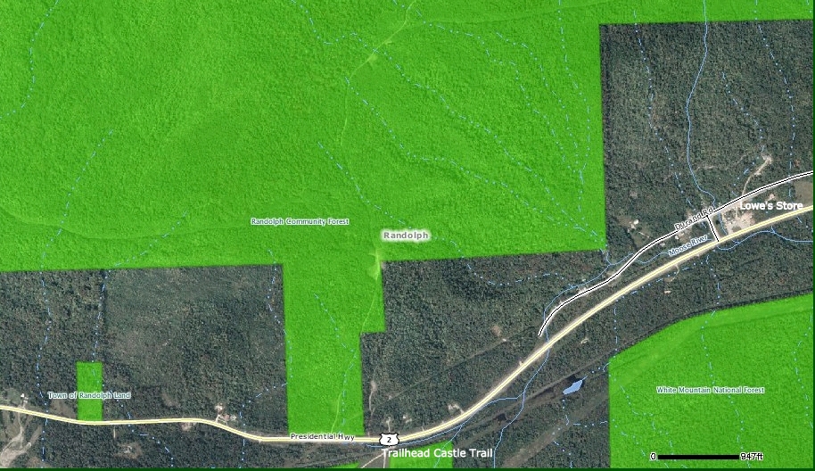
My original plan for this past Sunday (03-April-2011) was to do a quick trek up to Hall's Ledge from the trailhead on Rt. 16, and then do a bushwhack in the vicinity of the Carter Notch Road. However, on my descent from Hall's Ledge, I decided to scrap my bushwhack plans since the snowpack was beginning to soften considerably in the short time-span between my ascent and descent from Hall's Ledge. My "Plan B" was to hike up the Black Mountain Ski Trail to the Black Mountain Cabin and then onward to the 2,757 ft knob at the south end of Black Mountain.

Although it's about a 1,450 ft elevation gain from the parking area on Melloon Road to the 2,757 ft knob on Black Mountain, it sure doesn't seem like a super-intense climb. Possibly this perception is due to it being such a wide trail that doubles as hiking trail and a XC-ski trail. Or possibly it's because the grade is relatively moderate for most of the 1.6 mile trek, although there are a few short pitches that have some steepness to them.

Regardless, on the day of my hike, the snow on the trail was soft, but didn't stick to my snowshoes. It took less than an hour to reach the Black Mountain Cabin.  As some might already know, you can make reservations to stay at this USFS cabin via the Internet (click HERE for details).
Whether you're staying overnight, or just visiting, you've got a nice view of the Presidentials from the cabin's doorstep!!
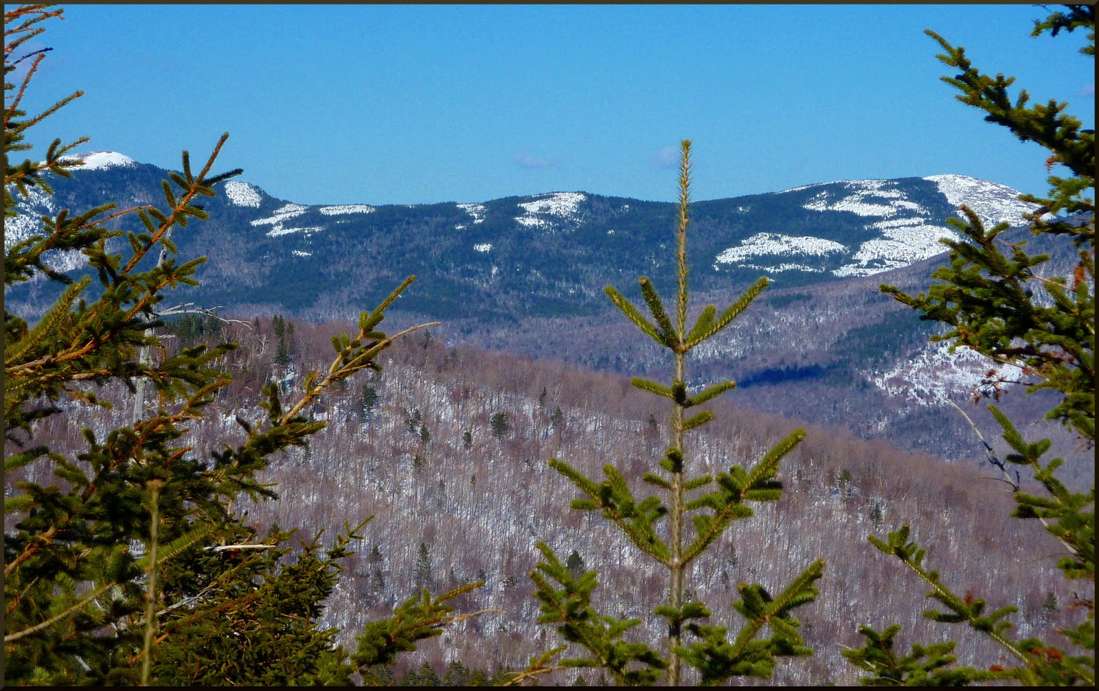
After my brief visit at the cabin, I continued onward for the additional 0.3 mile to the viewpoint at the 2,757 ft knob on Black Mountain's ridge. I really like the very up-close view of Carter Notch that's available from this spot.
From this same spot, there is also a view toward the Presidential Range.
And, there is even a view toward the Baldfaces, although it's a bit obstructed by trees.
Adding Black Mountain to my trek to Hall's Ledge resulted in a combined elevation gain that is greater than for treks to many of the NH 4,000 footers!! But, so be it. Those two little destinations were what I opted to do on this particular day.

And, all things considered, I was sort of happy that things worked out such that I implemented my "plan B" for a hike to Black Mountain. It is a nice hike, BUT it's really too short for me to do as a "stand-alone". So, it was nice to be able to combine it with my hike to Hall's Ledge earlier in the day.
------------------
ADDENDUM: (Added 08-Apr-2011)
I am most grateful to David Govatski of Jefferson, NH for providing me with some photos of a tower that once stood on the 2,757 ft knob at the south end of Black Mountain. It's the spot where I took several of the snapshots for this Blog report. The tower stood from 1913 to 1947.

A couple of old photos are shown below. And they are followed by a brief chronological history of the tower as written by David Govatski.


AMC Walter Rockwood Davis Memorial Tower on Black Mountain in Jackson, New Hampshire

A Brief Chronological History
By David Govatski

1. Appalachia magazine for October 1914 on page 197 states that “the number of Reservations has been increased this year by the conveyance to the club of 30 acres of land upon the middle summit of Black Mountain in Jackson, New Hampshire, to be known as the Walter R. Davis Memorial Reservation. An observation tower, forty feet high, has been erected, upon which a memorial tablet will be placed; and it is understood that some exercises, appropriate to the occasion, will take place upon the Reservation, during the February meeting of the Snow-Shoe Section.”

2. The late Walter R. Davis is mentioned on page 190 of the Appalachia magazine for October 1914. He was a member of the Excursion Committee and especially remembered as an officer of the Snow-Shoe section.

3. The June 1915 Appalachia on page 306 states that the club is considering “fencing the reservation to keep cattle from trespassing.”

4. The AMC Annual Report for 1924 reports that a February snowshoe trip found the railing on the upper observation platform to be in such poor condition that it would collapse upon leaning on it. This was repaired by James Garland of Intervale who reported that several timbers were rotten and replaced.

5. The AMC Annual Report for 1929 states that the tower was rebuilt in 1929 and the spring in the east pasture was cleared.

6. The AMC Annual Report for 1932 mentions several hundred people a year were using the tower.

7. Chairman W. Ballard of the Trustees of Real Estate said in the AMC Annual Report for 1932 that the club wishes to turn over several reservations including the Davis Tract to a public agency. (Depression related financial issues for the club can be read between the lines).

8. The 1934 AMC White Mountain Guide on page 234 describes the East Pasture Trail from Fernald’s to the “Observatory” as being 2 miles and taking 1 hour 30 minutes.

9. The AMC Annual Report for 1936 states that the club is in the process of turning over most of its reservations to public agencies.

10. Donated to the U. S. Forest Service (WMNF) in 1937.

11. The 1940 and 1946 AMC White Mountain Guides continue to mention the “Observatory”.

12. The 1948 AMC White Mountain Guide on page 220 states that the “Davis Memorial Observatory formerly on one of the middle peaks (2,735 feet) and built by friends of Walter Rockwood Davis in 1913 was dismantled in 1947”.

13. A report titled “Club Properties – Past, Present & Tomorrow” by Fran Belcher of the AMC on 6 October 1977 states on page 5 that the Davis Reservation was acquired in 1913 on the summit of Black Mountain in the Town of Jackson and was 40 acres in size. (Item 1 above indicates it is 30 acres).

The story of the Walter Rockwood Davis Memorial Tower is a part of the rich history of the White Mountains. There is certainly more to be told beyond this brief chronology. The construction of the Black Mountain High Country Cabin by the WMNF also needs to be told.


ADDENDUM: (Added 04-Aug-2011)
On 31-July-2011, I did a trek to another peak located on Black Mountain.  Visiting this northernmost peak requires a bushwhack since there are no trails leading to it.  Please click HERE if you want to read my Blog report about that adventure.