
Plymouth Mountain:
For at least 5 years (or more) it has been on my mind to do the hike to Plymouth Mountain (2,187 ft. elevation). Okay, I finally did it, and am now wondering why I procrastinated for so long!
For at least 5 years (or more) it has been on my mind to do the hike to Plymouth Mountain (2,187 ft. elevation). Okay, I finally did it, and am now wondering why I procrastinated for so long!
It's a terrific hike which can easily be done in less
than 4 hours (round-trip), even if you go all the way to the summit. And, since this was my first visit to this
mountain, I did go all the way to the top of the mountain. However, the summit is wooded and
viewless. And so, for any future visits,
I'll likely stop at the ledge known as Pike's Peak. It's located about 0.4 mile below the
summit. It's easily accessible via a
side path and has marvelous 180-degree views.
The hike begins on the Fauver Link Trail which eventually
morphs seamlessly into the Sutherland Trail.
Directions to the trailhead and a complete trail description are
contained in the Southern New Hampshire
Trail Guide.
If I had to say anything disparaging about this hike, it
would be that the vistas are very far away (40 miles or so, as the crow flies). It's a wonderful "in-person"
experience to see so many of the high peaks in the White Mountains from one
spot. However, to make out any detail,
you really need binoculars. And
photographically speaking, a camera with zoom capability will certainly provide
more satisfying images.
Rainbow Falls:
Following my trek to Plymouth Mountain, there was more than enough time to pay a visit to Rainbow Falls, which would be yet another hike that was new to me!
It's only about a 1.5 mile drive from the Plymouth Mountain trailhead and the trailhead for the waterfall. As with the hike to Plymouth Mountain, the Southern New Hampshire Trail Guide also contains directions and a trail description for the hike to Rainbow Falls.
I did the loop that is described in the guidebook. However, if you just want a quick and easy visit to the waterfall, then I'd recommend doing a simple "out and back" trek via the Ruth Walter Trail which begins about 100 feet from the parking lot. Simply walk across the highway bridge on Cummings Hill Road, and look for the trail kiosk on your right.
The hike to the waterfall, and the waterfall itself, were both a very pleasant experience. It's easy to understand why this destination is a local favorite.
Photos:
Shown below are a series of photos taken from my trek to Plymouth Mountain and to Rainbow Falls. (There is poor resolution for the highly-zoomed photos, but they will at least provide a general idea as to to what can be seen.)
 |
| Pike's Peak ledge and a portion of the vista that can be seen from there |
 |
| Highly-zoomed image of Franconia Notch area from Pike's Peak ledge |
 |
| Highly-zoomed image looking northeasterly from Pike's Peak (ledges on Welch-Dickey are in foreground, and to the right on the horizon is a silhouette of Mt. Carrigain; behind Mt. Carrigain is a slice of snow-covered Mt. Washington) |
 |
| Highly-zoomed image of Squam Lake and the Ossipee Range |
 |
| This sign didn't appear to be firmly anchored, and so it might not always be present. But if it's there, then you'll know you're getting close to a sharp left turn (no signage) off the main trail to reach Pike's Peak via a short spur trail. |
 |
| This composite photo shows the sign at the summit, as well as the benchmark embedded on the rocky surface. |
 |
| Several wildflowers were in bloom. This composite is a sampling of just a few that were seen (from left to right: Dutchman's Breeches; Yellow Violet; Purple Trillium) |
 |
| As a sure sign that Springtime has arrived, there was a picturesque patch of False Hellebore (a.k.a. Indian Poke) |
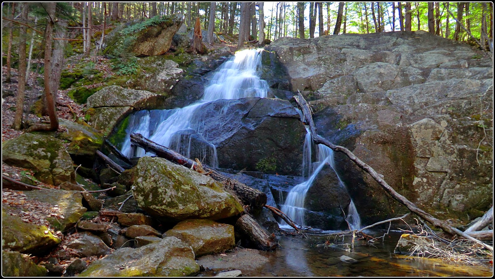 |
| Frontal view of Rainbow Falls |
 |
| Side view of Rainbow Falls |
 |
| Map showing locations of trailheads for Plymouth Mountain and Rainbow Falls, as well as GPS track for trail leading to Plymouth Mountain |
 |
| Map showing details regarding hike to Rainbow Falls (click to enlarge) |
8 comments:
What a great trek - it has been a while since I've been to Plymouth Mtn., but we took the same route you did. Nice little peak and perfect for this time of year if you're on the snow avoidance band wagon!
I see the snow is finally gone! These two hikes look like great destinations for spring. The wildflowers are amazing. I miss some of those eastern blooms. I also love the views from Pikes Peak.
And John, thanks for including information regarding two different ways to view Rainbow Falls. I sometimes travel with people who are not "long distance" hikers. It's nice for them to be able to view beautiful scenery with minimal effort!
I look forward to seeing more posts from New England in springtime!
Excellent report and John. I've been heading up to NH from Mass. via I93 from 30+ years. So the number of times I've driven by Plymouth Mtn is in the hundreds. And almost every time when the ledges come into view, I say I've got to hike that one of these days. So thanks for this report. As I did not know there were some falls to check out in the area as well.
Joe
Hi Summerset! This hike was a terrific opportunity to do something that was new to me, and also hitch a ride on the "snow avoidance bandwagon"! Guess you could say it was a "twofer"! :-)
Hi Rita! Well, although snow was absent from this hike, I just did a hike yesterday (11-May) at a similar elevation and hit patches of ankle-deep snow at several points along the route! But, it definitely melting away, and by June should be almost entirely gone.
Glad you appreciated the directions given for a simpler/easier trek to Rainbow Falls. Even for experienced hikers, it's good to know the simpler/easier way of reaching a destination for those occasions when time is limited.
Joe, glad you enjoyed the report! And yes, I can definitely relate to what you said about driving by Plymouth Mountain many times and thinking that I really should take the time to pay a visit. Since it's only a half-day hike, you could consider combining it with another half day hike, perhaps something like Percival/Morgan in the Holderness area.
If you keep going a few hundred yards past the summit, there is another spectacular overlook. It looks to the south, over Newfound Lake to Cardigan and Kearsarge Mountains. There's now a very official looking sign at the Plymouth Mtn. summit directing you the the "Newfound View" but then when you get to the overlook, it's posted No Trespassing, which was perplexing. We trespassed gently and the view was worth it.
Thanks Anonymous for taking time to post your comment with the added information about the “Newfound View”. Very much appreciated!
John
Post a Comment