
On a sunny day in late October, I did 3 hikes south of
Bethel, ME. Albany Mountain and Round
Mountain were both done as on-trail hikes, whereas the trek to Browns Ledge was a
bushwhack. As can be seen on the map
presented below, all three destinations are in the same general vicinity and
are just a short distance from each other.
 |
| Map showing locations of three hikes south of Bethel, ME (click to enlarge) |
1) Albany
Mountain
This hike began at the north trailhead near the Crocker Pond
Campground. The trail is now officially
known as the Albany Mountain Trail.
However, until signage at the trailhead sign can be replaced, the sign still
reads "Albany Notch Trail". The
trail was renamed when large segments of
the Albany Notch Trail were abandoned due to extensive flooding caused by
beaver activity.
 |
| Albany Notch Trail sign will eventually be replaced to read "Albany Mountain Trail" |
This trail is one of the best maintained trails that I've
hiked. Water bars are in great shape,
the trail is well-blazed, and the corridor is very well brushed out. Not much more you could ask for!
And to top things off, there is now a defined pathway
with a complete line of cairns that lead you about 0.2 mile southwest of the
summit to a spot described in the White Mountain Guide as "the best
viewpoint on the mountain". Previously,
this route was sketchy and required some light bushwhacking. This defined pathway is beneficial not only
to hikers, but also to the thin soil and fragile flora on the ledges since it
does away with multiple herd paths leading to this viewpoint.
The ledges on Albany Mountain afford panoramic views
which I think would be very dramatic during the peak of colorful Autumn foliage. However, this hike was done during a time of
year known as "stick season" when the leaves are off the trees and the forest is generally drab.
The photos shown below are just two of my personal
favorites from this hike. Rest assured
that in addition to these views, Albany Mountain provides many other fine
vistas of mountains, ponds, ledges.
 |
| Lakes in vicinity of Stoneham, ME. Keewaydin Lake is prominent, just left of center |
 |
| A small slice of snow-covered Mt. Washington viewed over a ridge of Speckled Mountain |
If you extend your trek to include the approximate 0.2
mile pathway to the ledges located southwest of the summit, the round-trip hike to Albany Mountain is a
little over 4 miles.
2) Round
Mountain
Round Mountain was a delightful surprise! For whatever reason, the Maine Mountain Guide
(10th edition) doesn't include this hike.
However, it is described on the Maine Trail Finder website (click HERE).
There is a sign posted at the trailhead which you can see
once you pull into the parking area.
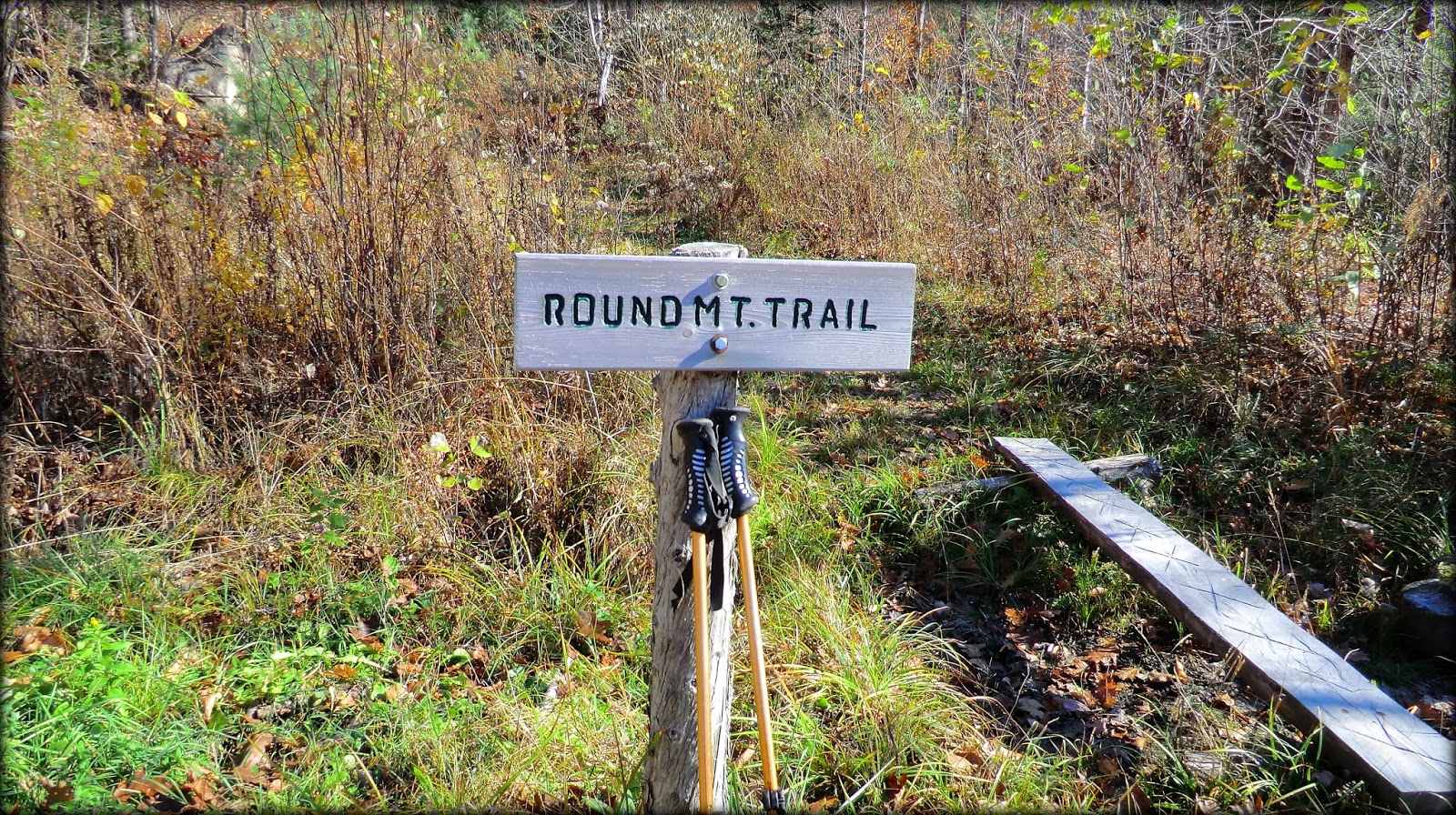 |
| Sign at trailhead for Round Mountain Trail |
Just a few steps beyond the trailhead is a sign-in logbook,
as well as a nice map which is shown below.
The yellow diamonds represent the various viewpoints along the route.
 |
| Trail map posted near trailhead (yellow diamonds represent viewpoints) |
The trail is very well maintained. Although it is unblazed, it is exceptionally
well-marked with cairns all along the route.
The next photo shows one of the more elaborate cairns.
 |
| One of the many cairns all along the corridor of the Round Mountain Trail |
Soon after
leaving the trailhead, you enter a predominately hardwood forest with many Red
Oak trees. Some of them are gnarled,
broken, and hollow, but still living.
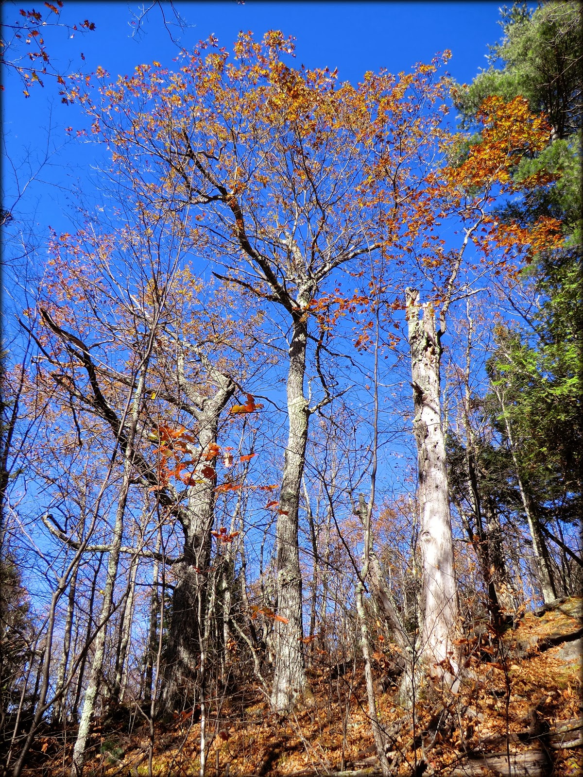 |
| Example of some of the stately oak trees along the Round Mountain Trail |
The trail has many steep spots, but there are several
switchbacks to provide relief. The
steepness moderates somewhat as you come closer to the Rock Castle Loop trail. However, the loop contains some of the
steepest sections of the entire route.
Doing the loop clockwise involves a steep ascent. And, of course, if you do the loop
counterclockwise, then it involves a steep descent. So, it's your choice as to which direction to
follow! My personal choice is to ascend
steeply, and so I chose the clockwise option. Regardless of how you do the
loop, there are three very fine viewpoints to enjoy along the route.
The next three photos provide examples of some of the
vistas that can be seen while hiking the Round Mountain Trail.
 |
| Huge line-up of peaks on western horizon, including Baldfaces, Presidentials, Carters, and many others |
 |
| Zoomed photo showcasing the peaks in Presidential and Carter mountain ranges |
 |
| Low-lying Oxford Hills area in foreground with peaks in Mahoosuc Range on horizon |
The Maine Trail Finder website lists this hike as 1.8
miles round-trip. However, this
description seems to have been written prior to the addition of the Rock Castle
Loop. My guess is that the round-trip
mileage with the loop would be slightly over 2 miles. And just as a side note, I commend those who
constructed the Rock Castle Loop. It's quite
obvious that a lot of work went into it!
3) Browns
Ledge
The open ledges portion of Browns Ledge are within the
boundary of the White Mountain National Forest, and these ledges can be
approached entirely on public land through open woodlands of hardwoods and
conifers. For my bushwhack, I parked along Flat Road and
did a short trek of about 0.3 mile (one-way) to reach the open ledges.
There are several pleasant views from Browns Ledge. But by far, the most striking sight is the vista
of Haystack Notch with a piece of Mt. Washington and the Carter Range visible
through the notch. Caribou Mountain is on
prominent display to the right of the notch, which serves to enhance the
overall scene.
 |
| Portion of Mt. Washington and Carter Range seen through Haystack Notch |
It
is somewhat common to find a bootleg trail leading to spots such as Browns
Ledge which are located just a relatively short distance from a roadway. Admittedly,
very little time was spent searching for such a trail, but nonetheless I found nothing.
Once on top of the ledge, an old cairn
was spotted near the northwest corner at the edge of the woods, but no readily apparent
pathway was associated with the cairn.
To sum it up, it was easy to do these three hikes in a matter of a few hours. All were relatively short, uncomplicated hikes, and it took only a few minutes to drive between the trailheads. And to top it off, each of these treks were new to me which always makes me 1HappyHiker! :-)
To sum it up, it was easy to do these three hikes in a matter of a few hours. All were relatively short, uncomplicated hikes, and it took only a few minutes to drive between the trailheads. And to top it off, each of these treks were new to me which always makes me 1HappyHiker! :-)
10 comments:
Fine report, John! Albany is one of the gems of the eastern WMNF. Glad to hear there's a defined route to those SW ledges. (Those ledges overlooking Albany Notch in your third photo look inviting.) Never heard of Round Mountain before - looks great! And I always wondered about the view from Brown's Ledge. Thanks for showing all these terrific views.
Steve
Thank you Steve for such kind words about my report!
Regarding those ledges you noticed in my third photo, I was trying to decide if those were located on the western wall of Albany Notch, or considering that this is a zoomed photo, I thought they might possibly be ledges on the western wall of Miles Notch?? Regardless, as you say, they do indeed look inviting! :-)
John
John,
You're right - looking at it a second time and seeing that it's zoomed, they are in Miles Notch. In fact, I went out onto a couple of them once on a whack up the south ridge of Miles Knob. There are some ledges on the west side of Albany Notch - less impressive than those in Miles Notch, but perhaps worth a visit.
Steve
Steve, many thanks for pinpointing the location of those ledges!
Maybe I’m thinking of something else, but now I seem to recall you mentioning a visit to those ledges when you, John G and I did that loop over Red Rock and Butters via the Miles Notch, and Great Brook Trail a couple of years ago.
John
Love that cairn from the Round Mountain Hike! And also the mature oaks—that's definitely an eastern forest.
It looks like you're really hitting the jackpot with these Maine hikes John.
I'm enjoying traveling along to Maine with you!
Hi Rita,
Regarding ‘hitting the jackpot’ with my recent hiking spree in Maine, there is definitely a lot to explore in western Maine just over the border from my home State of NH. Last year I did some ‘across the border’ explorations into neighboring Vermont, and this year I directed my attention to Maine. We’ll see what next year brings. I’d love to do some intense explorations of the Adirondacks in upstate New York. However, because of the long driving distance between NH and NY, day trips will be impractical. Therefore, I’ll need to develop a plan for an extended stay in that area.
Thank you for your comments. As always, I’m very appreciative.
John
I'll be moving to the area next week. Approx 4 miles away from this hikes starting point. It will be one of the 1st places I visit. Thanks for the info and the photos you provided. Cheers, JD
Hi JD! Welcome to the area!
It’s gratifying to know that you found my blog helpful.
Best wishes to you for happy trails!
John
Great post and photos! Did the Round Mt. & Rock Castle Loop on snowshoes today (1st time there). We were surprised by the many rewards of views, ledges, boulders("rock castle"), and forest. I happen to be acquainted with the creator of this trail who is a caretaker for a large landowner in that area. There are more great trails near Hutchinson Pond and, perhaps especially, Overset Pond and the Sanborn River near "Greenwood City" (gate just west of Patch Mtn. Rd., one mile west of Greenwood Rd., near west end of Rt. 219; Delorme Maine Atlas map 10, NW corner C5). This landowner has made some great contributions to public recreation and conservation!
As for Albany Mt. and Albany Notch in the WMNF, a little gem, described as partly abandoned due to "extensive beaver activity". I am involved with education and advocation for beaver and was at a public hearing on the proposed closure of the Notch loop trail. I advocated against the closing and advocated for relocation of sections of this (and Albany Mt. Trail) to better accommodate the very modest beaver presence and activity which would potentially vastly enhance the variety of interesting features, and the ecology for the area and the trail (actively beaver managed wetlands promote a profound biodiversity comparable to tropical rainforests and coral reefs!). (WMNF needs to be encouraged to come up to speed on comprehending this!--the WMNF is currently re-evaluating some of their monitoring and benchmarks for ecological health within the forest....please see: ecosystemengineers.wordpress.com, www.BeaversWW.org, www.martinezbeavers.org, thebeaverbelievers.com, info at WMNF: slemieux@fs.fed.us)
The Albany Mt. Trail adopter has indeed done a superb job firming up, maintaining and improving this trail, which must include the described .2 mi. sw summit trail and another shorter and lower outlook just uphill from the Albany Notch (old loop) jct. (sign). I am most impressed with the short detour/relocation of the trail nearer the trailhead that now utilizes a beaver dam for the footpath (which I had suggested to WMNF reps. at the aforementioned hearing and was told no way at that time). Unfortunately the beaver are somewhat inexplicably missing here now, but eventually some may find this site again in the future and perhaps continue the transformation of this potentially exceptional habitat niche. The old and abandoned section of the Notch trail is located largely on a problematically water attracting former timber haul road that does eventually reach another, now also abandoned, uniquely high altitude beaver site made of several interestingly terraced, and layered beaver dams of interest and fairly accessible with careful footing. The area can be negotiated by crossing on beaver dam(s) and at the upper (south) end will rejoin the slowly fading to brush, abandoned, and barely maintained Notch trail that climbs to the height of Albany Notch and rejoins the maintained trail. This has potential for wonderful backcountry skiing or snowshoeing in winter (though access is further due to unmaintained winter roads, Flat Rd. may be closest, or come from the south, Birch Av. off Virginia Lake Rd. and Keewaydin Lake, Stoneham). Please consider signing on to my petition to improve wildlife and habitat on Public Lands: Petitions.moveon.org/sign/wildlife-and-habitat
Rick, thank you so much for posting such interesting and thorough comments relative to my blog posting.
You have provided me with several ideas for new adventures in areas that are new to me, such as Hutchinson Pond, Overset Pond and the Sanborn River.
I enjoyed your insights regarding Albany Mountain and the Albany Notch area, and especially your compelling commentary about beaver-managed wetlands promoting biodiversity comparable to tropical rain forests and coral reefs.
John
Post a Comment