A few days ago I did a trek that included Mt. Wolf
(Kinsman Range) and Gordon Pond. This
trek is probably of little interest to most readers, and is on the outer
fringes of even being worthy of a Blog report.
And therefore, one might legitimately ask, you did this hike because . .
.??
As frequent readers of my Blog know, I'm currently on a
personal campaign to try to do something new on each of my hikes. The
"new" component can be things such as a trail, a destination, or even
something as simple as a direction of travel that is new and different for me.
And so, with this rather simplistic goal in mind, my rationale for
doing this particular hike was because I had never visited Gordon Pond, nor had
I ever hiked the Kinsman Ridge Trail (KRT) segment of the Appalachian Trail
that runs between the Beaver Brook trailhead and Mt. Wolf. On previous hikes, I had traversed all the
other pieces of the KRT, but not this one!
From the outset, I was fully aware that this particular "out
& back " trek would involve a roller coaster ride of PUDs (pointless ups
& downs), and that they would need to be navigated in both the outbound and inbound
legs of this adventure. Although
there indeed were a lot of PUDs, overall I didn't think they were overly
terrible.
On the way to Gordon Pond, the Kinsman Ridge Trail weaves its way though a forest that I found to be attractive, but others might be of a
different opinion. In terms of trailside
views, there is only one overlook (located about 2.4 miles from the Beaver
Brook trailhead), and it provides a somewhat restricted view of some of the high peaks in
the Franconia Range (next photo).

View of a portion of Franconia Range from an overlook on Kinsman Ridge
Trail
After trekking
another 0.9 mile northward from the overlook, I arrived at the junction where
the well-signed Gordon Pond Trail takes off to the east.
While merrily heading down the trail toward Gordon Pond, I suddenly realized that I must have completely blown past the little
spur path that takes you to the pond! I
backtracked and discovered that as you are headed eastward, the spur trail is
accessed via an abrupt left turn which is partially obscured by a large
boulder. I'd like to think that it's an
easy mistake to make! :-)
So, upon finally arriving at the shoreline of Gordon
Pond, I was immediately impressed with its beauty, and its remoteness! It is in the "middle of nowhere",
and there is a near zero chance that any condos or cabins will ever dot its
shoreline! The next snapshot shows
Gordon Pond as viewed from its south shore and is looking northward toward Mt.
Wolf.
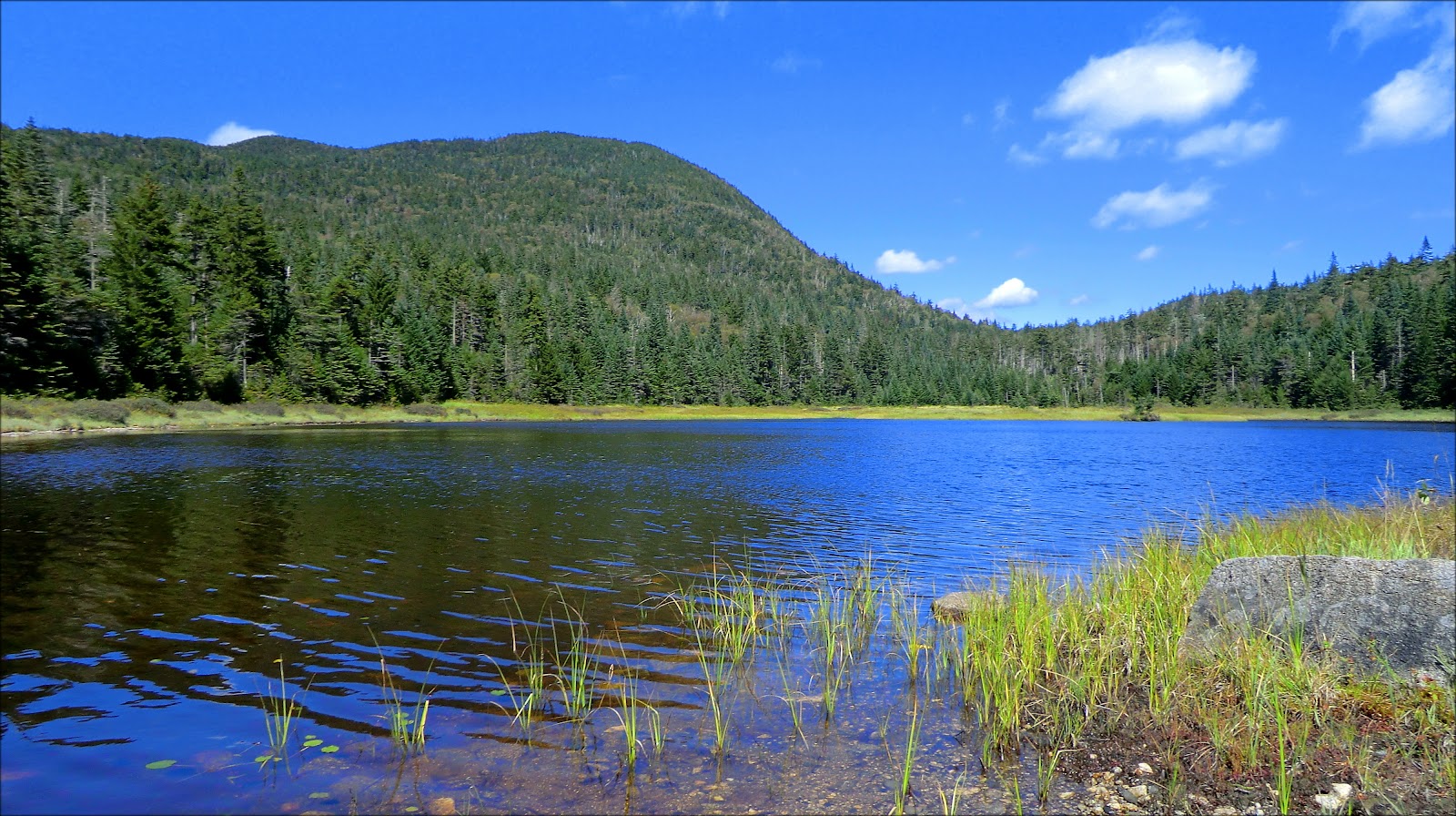
Gordon Pond as viewed from its south shore and looking
northward toward Mt. Wolf
I took some time to meander around a large portion of
Gordon Pond. I saw very little in the
way of wildlife. There were dragonflies
flitting about, and one duck took flight while I was there. Although there were plenty of moose prints
around the pond, I saw no moose. Nor did
I see or hear any fish jumping. It's
unknown to me if there even any fish in this pond. Perhaps a reader might know the answer.
After a leisurely visit to Gordon Pond, I made the short
trek back to the Kinsman Ridge Trail and continued northward toward Mt. Wolf. Along the way, I did a mini-bushwhack
to get a bird's eye view of Gordon Pond.
The first snapshot is highly-zoomed.
The second snapshot is an un-zoomed overview of the pond and surrounding
area.

Zoomed view of Gordon Pond from a location slightly off the Kinsman Ridge Trail

Un-zoomed overview of Gordon Pond and surrounding area
After my mini-bushwhack to look downward at Gordon Pond, I headed to the short spur trail located near Mt. Wolf's summit. This spur leads to an overlook which provides a nice view of
the Franconia Range, as well as other peaks to the east and southeast.

View from Mt. Wolf: Franconia Range high-peaks + Mt Pemigewasset cliffs (lower right)
Mt. Wolf was the terminus of this particular hike. After spending some time chatting with a
couple of Appalachian Trail thru-hikers, I left the outlook and headed back
down the trail. Along the way, I once
again stopped at the trailside overlook which is located about 0.9 mile south
of the Gordon Pond Trail junction. From here, I
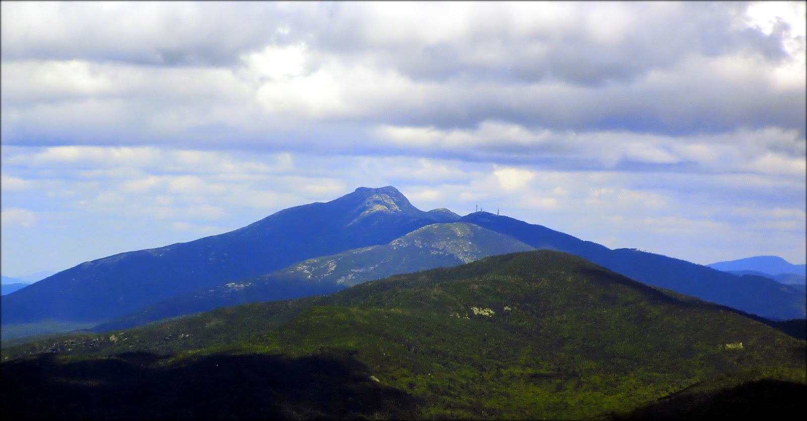
took a snapshot of Mts. Liberty and Flume as the shadows of early evening were stretching
across the lower portions of these shapely mountains.

Slightly zoomed photo of Mts. Liberty and Flume with shadows of early evening
Also visible from this overlook was the town of Lincoln,
as it lay nestled at the foot of the Loon Mountain ski area.

Town of Lincoln nestled at the foot of the Loon Mountain
ski area
As I approached the trailhead, the setting sun was
illuminating the leaves of the hobblebush which are just now starting to slip
into their autumn attire.
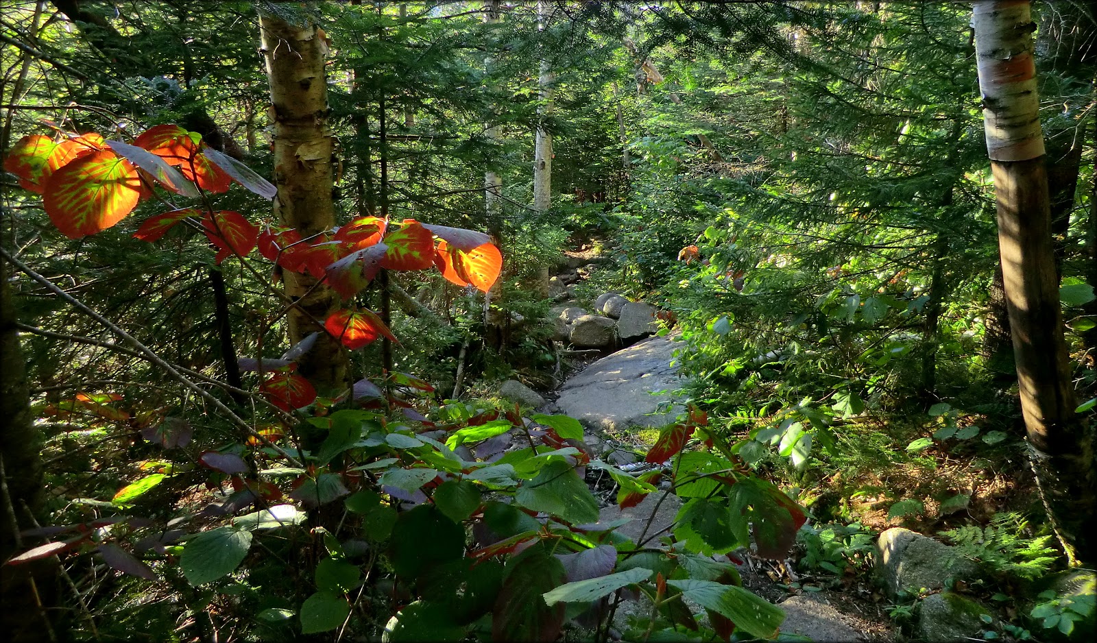
Hobblebush being illuminated by the setting sun
Most readers will likely be familiar with the area in
which this hike occurred. But perhaps the map shown below will be of some use in reviewing the route taken for this trek of about 9.8 miles (round-trip).
(Depending on your browser, clicking on the map might enlarge it.)
(Depending on your browser, clicking on the map might enlarge it.)

Map showing the route taken for this trek
To sum it up,
this trek won't go down in history as an epic adventure, but it certainly had
its joys. I have no regrets for taking
the time to finally visit Gordon Pond, and it was a personal triumph to finish
hiking the entire length of the Kinsman Ridge Trail.