Pages

About Me

My photo
Bethlehem, New Hampshire, United States
E-mail contact: randonneur8@yahoo.com | Facebook: facebook.com/1HappyHikerNH

Text Above Search Box

SEARCH MY BLOG USING TEXT BOX SEEN BELOW:

24 November 2015

A Trek to Mt. Avalon . . . Sort of!

Those who follow my blog might recall a statement made in a recent posting which indicated that many of my recent adventures have been "un-blog-worthy".  The trek described in this report comes very close to falling into that category.  However, I've reluctantly opted to post it anyway since at least there are some familiar locations and place names which are often lacking in many of my offbeat expeditions. So, here is a report of recent adventure that I consider as being just minimally "blog-worthy"! :-)

In mid-November 2015, it came to mind that it had been a while since I'd done a conventional hike to a traditional destination.  Thus, I began the day with the thought of doing a rather unadventurous loop by hiking to Mt. Avalon, then continuing onward to Mt. Field, and finally going on over to Mt. Tom, and from there head back to my starting point.

However, having done that on-trail loop (and other similar hikes) many times, I just couldn't muster the enthusiasm to do the 'same old, same old'.  And besides, I've lately developed a liking for hikes that are less time-consuming, which leaves time in the day to participate in other activities and pursue other interests.

And so, a short (and somewhat daft) loop was hastily crafted that involved hiking about 2 miles on-trail, and about 1 mile off-trail.  A general idea of my route is shown on the Google Earth image below.
General idea of the route taken for this trek
The bushwhack from the Avalon Trail to Mt. Avalon's south-facing ridgeline was relatively straightforward in terms of navigation.  Just leave the trail after the second brook crossing, then head south to where the ridgeline drops off precipitously to the Crawford Notch. That's it! The woods along my bushwhack route were generally okay, but I've definitely experienced better conditions.  Progress was slowed in some spots by patches of hobble bush, and an occasional jumble of downed trees.

As planned, I arrived at the crest of the south-facing 
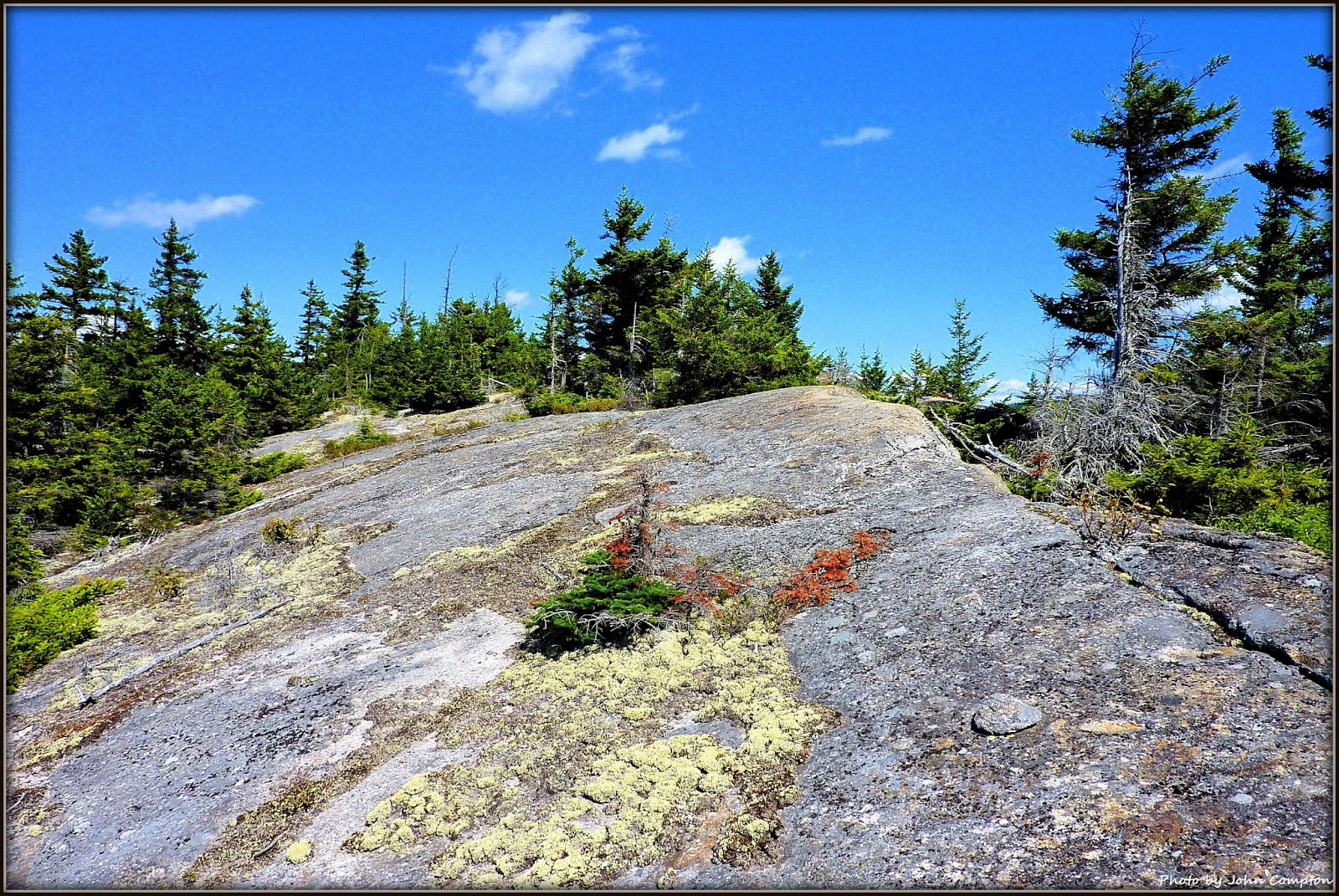
ridgeline at a point several tenths of a mile east of Mt. Avalon's summit.  Although there were no bare rock slabs that could be used for sitting and enjoying the vista, viewpoints were easy to find due to the sheer drop-off all along the ridgeline.  Shown below are a couple of snapshots taken from one of these lookouts. (As vividly displayed in these two photos, intense shadows form quickly in the mountains at mid-afternoon in mid-November!)
Looking southward down the Crawford Notch
Looking easterly toward Mt. Webster, Mt. Jackson and Mt. Pierce
After taking a few snapshots of the Crawford Notch views, a decision needed to be made as to which variety of "steep" to pursue.  Should I head steeply upward to the top of Mt. Avalon and then take the Mt. Avalon Trail back to my starting point?  Or, should I head steeply downward to the col between Mt. Avalon and Mt. Willard, and then head eastward for a short distance to intersect the Mt. Willard Trail and take it back to my starting point?

Since the woods along the ridgeline were relatively thick, it was decided that going downhill through somewhat thick woods might be better than pushing my way uphill through thick conifers and downed trees.  Overall, I think this turned out to be a good decision.  However, it should be noted that three separate bands of cliffs were unexpectedly encountered during my descent.  But, as bushwhackers know, you can almost always find a way to negotiate these obstacles.  And such was the case this time as well.

Upon reaching the col between Mt. Avalon and Mt. Willard, it was no surprise when swampy conditions were encountered.  I had visited this area on other occasions, and so it was anticipated that there would be a short tract of land requiring attentive foot placement to avoid sinking into the muck.  But, on the positive side, these wetlands provide an opening in the forest which allows for a unique view of Mt. Avalon.
Mt. Avalon as viewed from a wetlands area in the col between Mt. Avalon and Mt. Willard
It was a quick (less than 15 minutes) and easy bushwhack from the col to meet up with the Mt. Willard Trail.  While descending that trail, a short side path was taken to visit the little cascade at the spot known as Centennial Pool.
The small cascade just off the Mt. Willard Trail at the spot known as Centennial Pool
To sum it up, it's debatable as to whether this report was worthy of a blog posting, or whether it should have been thrown into my pile of other unpublished escapades that I consider as being "un-blog-worthy".  I fully appreciate that many hikers find treks such as this to be unappealing, especially since oftentimes there is no definitive destination, and whenever there is one, it's rarely on any "list".  And, I'm also mindful that although this style of hiking is enjoyable for me, perhaps for others, "not so much"! :-)

18 November 2015

A Trek to Popple Mountain near Jackson, NH

A) BACKGROUND INFORMATION:

In early November 2015, I did a trek to the ledges at the south end of Popple Mountain located near Jackson, NH.  To reach this destination, I turned onto Green Hill Road which is located on the west side of Rt. 16 in Jackson, NH.  In less than a mile, Green Hill Road becomes Iron Hill Road, and shortly after that, Meserve Brook Road (FR 325) splits off to the right.  I was able to drive for about 0.7 mile on Meserve Brook Road before coming to a locked gate where I parked my car at a small parking area.  Beyond that point, I hiked along Meserve Brook Road for about 2 miles before leaving the east side of the road for a short bushwhack (less than 0.2 mile) to the ledges.

It should be noted that in the winter, Meserve Brook Road becomes the Hall XC-Ski Trail for which a ski pass is required (click HERE for details).

Below is a map which provides a general idea of the route that was followed.
A map which provides a general idea of the route that was followed for this trek.
The following photo was taken from the Iron Mountain trailhead several years ago in the Springtime.  Clearly visible in this snapshot are the ledges on the south end of Popple Mountain.
Ledges on Popple Mountain as viewed from Iron Mountain trailhead
(photo taken several years ago in the Springtime)

B) PHOTOS TAKEN DURING MY TREK TO POPPLE MOUNTAIN:
Meserve Brook Road/Hall XC-Ski Trail makes for some nice walking, especially at this time of year.
Getting to the ledges on Popple Mountain involved bushwhacking eastward from the Hall XC-Ski Trail for about 0.2 mile through open woods such as shown in the above photo.
This is one of the locations on Popple Mountain's ledges from which photos were taken.
My favorite vista was this southeasterly view (Kearsarge North prominent on horizon at left; Iron Mountain just right of center).
Shooting into the southwest sun is always challenging for me.  Anyway, this view
includes such mountains as Chocorua; Bear Mtn; Mt. Passaconaway; Mt. Parker, and many others.
The unique profile of Stairs Mountain could be seen by looking nearly due west from the ledges on Popple Mountain.
This panorama shot shows the entire vista from the ledges at the south end of Popple Mountain.
To sum it up, this was a relatively short trek (less than 5 miles round-trip).  However, it was a very rewarding adventure since it involved visiting a place that was entirely new to me.
////////////////////////////////////////////////////////////////


ADDENDUM (added 05-Dec-2015):  Thanks to an article written by Peter Minnich in the 04-Apr-2013 edition of "The Mountain Ear", the following information was learned about Popple Mountain.

"The name 'Popple' is local dialect for a tree in the poplar family, most likely the trembling aspen (populus tremuloides), a common successional tree found throughout New England.  Numerous popple trees grow on the edges of the forest on the west side of the mountain, perhaps giving rise to the mountain's humble name.  Other than that, the origin of the mountain's name is a mystery.  There are no references to Popple Mountain in Sweetser, Mudge, or early AMC guides."

02 November 2015

West Baldface, or West Peak, North Baldface . . . Your Choice!

Perhaps a new term is being coined here, i.e. "un-blog-worthy"!  That term is how I would characterize the hikes that I've been doing over the past several weeks.  Therefore, I'm dusting off an old report about a trek that I did back in September 2010.  So, here goes!

Looking at a topographic map, there is a 2,941 ft peak that is situated nearly due east of the Wildcat Ridge and nearly due west of North Baldface.  It is unnamed on many topographic maps, but some peak-baggers refer to this mountain as "West Peak, North Baldface".  However, I think of it as simply West Baldface.

I decided to visit this little mountain not for peakbagging purposes, but rather because it would be something different to do, plus it looked like a good spot for some interesting views, particularly of the Baldfaces.

My trek was launched from the end of East Branch Road (near Slippery Brook Road in general vicinity of Jackson, NH).  I hiked northward along the East Branch Trail for several miles before turning eastward to follow old logging roads for another mile or so.  Eventually, I left the logging roads and bushwhacked up the west slope of West Baldface.  It was an easy bushwhack through ferns, birch and other hardwoods.

My route of travel is depicted on the map shown below.  It's not the greatest map, but at least it shows the hiking trails, as well as the old logging roads in this area.
My route of travel is highlighted in yellow on this map
There is no single spot on the summit where there is a 360 degree view, but views in all directions are available by moving around from spot to spot on the summit area.  Below are some photos from this trek.
Looking eastward toward North and South Baldface
Looking westward over Wildcat Ridge toward Mt. Washington (on horizon at top/center)
Looking northward toward the rocky ridge of Mt. Moriah that extends into the Wild River Valley
Looking southward toward peaks in the Sandwich Range and other surrounding mountains
Summit area of West Baldface
The East Branch was flowing in many spots, but at other spots, it was very still and "reflective".
This was a relatively easy trek since most of it was done either on-trail or on old logging roads, both of which were relatively flat with just an occasional slight pitch here and there.  The only significant climb was the short bushwhack between a logging road and the top of West Baldface.  I would roughly guesstimate that the hike was about 10 miles round trip.

To sum it up, this trek was done before Tropical Storm Irene which caused significant erosion in this area.  And as a result, it might now be challenging to travel portions of the route that I used for this hiking adventure.