Pages

About Me

My photo
Bethlehem, New Hampshire, United States
E-mail contact: randonneur8@yahoo.com | Facebook: facebook.com/1HappyHikerNH

Text Above Search Box

SEARCH MY BLOG USING TEXT BOX SEEN BELOW:

29 November 2011

Thanksgiving Journey 2011

After nearly 2,300 miles of highway travel over a 10 day period (November 19-28), my wife and I are back home in New Hampshire.  The purpose of this epic journey was to visit family and friends in the States of Kentucky, North Carolina and Delaware.   We explored the possibility of flying to these locations.  However, driving became the preferred option after considering the multiple flight changes involved in getting to our particular destinations.

Although we encountered some rain-free weather during our road trip, the photo below is fairly representative of weather conditions for a large chunk of our travels.  However, the rainy conditions were fine.  If it had been snow or ice, THEN it would have been a problem!

We spent approximately 2 days at each of the 3 places we visited.  As you might imagine with such a short visit, there was scarcely enough time to do much more than eat and chat about family-related topics.  During the course of our travels there was only one thing which might be of general interest.

While visiting family and friends in Ashland, KY we spent a few hours walking around the Port of Ashland. It is one component of a larger complex known as the Port of Huntington Tri-State which is the largest inland shipping port in the United States, both in terms of total tonnage and ton-miles.  This is due in large part to nearby coal and petroleum industries who load their products onto barges for shipment via the Ohio River which feeds into the Mississippi River system.

The snapshot below shows a portion of the port, as well as a nearby highway bridge that spans the Ohio River and connects the States of KY and OH.

And, the next snapshot shows a portion of the port from a different viewing perspective.

To protect communities along the river from flooding, floodwalls have been constructed.  Many cities, such as Ashland, have opted to adorn sections of the floodwall with huge murals to commemorate events of the city's history.  The snapshot below shows one such section of floodwall.

The next snapshot is a close-up view of one of the panels.  This particular panel was painted using a photo that was taken of a victory parade down the main street of Ashland to celebrate the end of WWII.

Shown below is another close-up photo of one of the panels on the floodwall.  This one is an artistic rendition of a scene along the river during the early days of the port's history.

Ashland is also renowned for the holiday lights that are erected each year in the massive park in the center of town.  Shown below is a snapshot of one of these festive light displays.

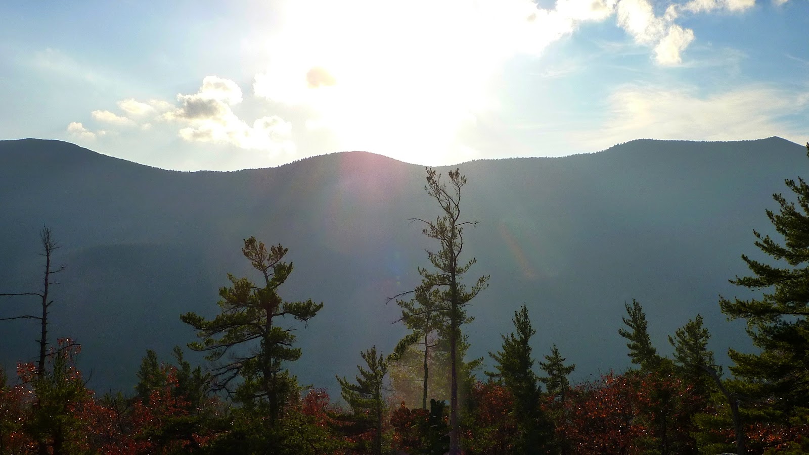
Okay, so that is about it in terms of items that might be of general interest.  There was no time to do any hiking other than some short strolls in local parks and neighborhoods.  These walks included some picturesque vignettes here and there, such as shown below.

To sum it up, our journey involved many miles of highway travel which was pleasurable in its own way, plus it provided a means to spend many enjoyable days visiting with family and friends.   Oh!  And I suppose it should also be mentioned that we had a total of 3 Thanksgiving meals, one at each of the locations we visited!  We eventually waddled our way back home to NH with full bellies and fond memories.

18 November 2011

Best Wishes for a Happy Thanksgiving!


Just want to let readers know that it will probably be awhile before I publish a new Blog report.  I'll be on an extended trip (11 days) to visit relatives.  Time and circumstances will most likely rule out any hikes of any significance while I'm away.

My travels will take me to the Midwest (KY), to the South (NC) and the Mid Atlantic (DE).   You can see my destinations and my general direction of travel on the map shown below.  If I happen to come across anything along the way that might be of general interest, then I'll post it here as a footnote, and/or I'll post it on my Facebook page (click HERE).

Best wishes to you for a Happy Thanksgiving holiday!

So long for awhile,
John

09 November 2011

A Short Gallop to White Horse Ledge

White Horse Ledge is such an alluring name.  As I understand it, this name was given because of a light-colored area on the face of this ledge which resembles a dashing white horse.  There is another nearby ledge called Cathedral Ledge which gets its name from a large cavity on the face of this ledge which is said to resemble a cathedral.

Both of these ledges are seen in the snapshot below which was taken from nearby Echo Lake on a day in February.  The wintery conditions seen here were definitely absent from my hike on a warm sunny Wednesday (09-November).

[White Horse Ledge is on the left, and Cathedral Ledge is on the right.  Clicking on this, or any photo in this report will slightly enlarge it.]

Perhaps it's obvious to some readers, but neither the horse nor the cathedral is readily apparent to me in the photo shown above.  However,  the snapshot does at least serve to show the relatively small distance between these two ledges.  Combining both of these destinations into a single hike is certainly not an all-day affair.  It is a short hike,  which is precisely why I opted to do this particular trek.  As mentioned previously in a few of my Blog reports, I only have a few hours available for hiking on Wednesdays, and therefore this type of jaunt is perfect for this situation.

As many readers know (and as is shown on the map below) there are several options for hiking to these two ledges.  Given my short time frame, I opted to drive up the auto road to the top of Cathedral Ledge and then begin my hike from there.  I parked and immediately headed for the trailhead for the Bryce Trail.  My plan was to go to Whitehorse Ledge first, and then upon my return, I'd pay a brief visit to Cathedral Ledge just before jumping in my car to head back to my home.

The Bryce Trail makes a relatively steep drop to the col between Cathedral and White Horse.  And of course, this meant I'd have a steep ascent on the return leg of my journey!  Upon arriving at the col, I picked up the White Horse Ledge Trail.  After a short and moderately steep climb, I arrived at White Horse Ledge where I could look back and see some of the rocky outcroppings on Cathedral Ledge (next photo).

From here, I could also peer down over the edge of the ledge and see Echo Lake (next photo).

Another nice vista was seen looking over the top of Cathedral Ledge with Humphrey's Ledge off in the distance, and the U-shaped Carter Notch visible on the horizon (next photo).

It was somewhat surprising that there was still some lingering autumn color, especially since we essentially have no color remaining near my home in Bethlehem which is just a short 40 minute drive to these ledges.

Not only were autumn colors visible in the distant views, but there were also colorful scenes literally right at your feet, such as those shown in the next two snapshots.


From White Horse Ledge I hiked a short distance to a spot near the junction of the Red Ridge Link trail.  This side-trip enabled me to get a view of the Moat Mountain Range.  However, I was looking directly into the sun which was low in the western sky.  The next snapshot was the best I could do under those unfavorable lighting conditions.

Well, as indicated earlier, the return leg of my journey was merely a retracing of the route that I had taken on the outbound leg.   Once I arrived back at my starting point on Cathedral Ledge, I hiked the couple hundred yards to the viewpoints.  One of my photos taken from here is shown below.   It shows the U-shaped Carter-Notch on the horizon over the top of Humphrey's Ledge which is mostly obscured by afternoon shadows.  It's a view that is similar to that seen from White Horse Ledge, but it is a slightly different perspective.

After completing my brief visit atop Cathedral Ledge I hopped into the car and drove down the auto road.  Since I still had about 15 minutes to spare, I parked at the base of the ledge and did a brief jaunt along one of the rock climbing trails to get a look at this massive hunk of rock from the bottom.   The next two snapshots show my "views from the bottom".


To sum it up, this was one of my better Wednesday wanderings.  It fit perfectly into my timeframe, and it was an unexpected bonus to experience a bit more autumn color before it disappears completely. 

07 November 2011

Cone Mountain: A Next-Door Neighbor to Welch-Dickey Mountains

Since the mid 1800s there have been hiking trails in the Waterville Valley area of New Hampshire.  One very popular trek is a loop hike that goes over Welch Mountain and Dickey Mountain (known collectively as simply Welch-Dickey). Located very nearby is a lesser-known peak named Cone Mountain which is separated from Welch-Dickey only by the narrow corridor known as Dickey Notch.


With the reduced daylight hours of late autumn, I'm now looking for shorter hiking adventures.  I'd briefly considered hiking the 4.4 mile Welch-Dickey Loop trail on this beautiful day of 07-November.  However, it had been awhile since I'd visited Cone Mountain and so I opted to go there instead.  There are no hiking trails leading to this mountaintop, but it can be accessed by a relatively short and easy bushwhack.

For anyone who is unfamiliar with this location, shown below is a photo of the map that is posted at the trailhead for the Welch-Dickey Trail.  Cone Mountain is circled in red. (NOTE: Clicking on any photo in this report will slightly enlarge it.)

Regarding my approach route to Cone Mountain, I used the Brown Ash Swamp Bike Trail.  It diverges from the Welch-Dickey Loop Trail at the junction shown in the next photo.  This bike trail traverses the Dickey Notch and provides a link to Mill Brook Road in the Thornton area.

I followed the Brown Ash Swamp Bike Trail to a point where I could head westward on public land to reach Cone Mountain.  There are sizeable chunks of private land in this area (as shown in white on the above map).   Actually, I purposely went further north on the bike trail than was necessary.  Going the extra distance enabled me to include a visit to a ledge at the northeastern end of a ridge leading up to the summit.

Most readers would probably agree that regardless of whether you're hiking on a trail or bushwhacking, the journey itself is often as delightful as the destination.  For this particular trek, there were picturesque scenes along the route such as shown in the next two snapshots.  The first one shows a beaver pond, and the second photo is simply a typical scene while bushwhacking through the open woods en route to the summit of Cone Mountain.


In terms of sweeping vistas of distant mountains, the ledge at the beginning of my climb provided nice views toward the Franconia Range (first photo), and Mt. Moosilauke (second photo).


From the summit of Cone Mountain, there are views similar to those shown above.  In addition, there is a nice view looking eastward toward nearby Welch-Dickey, plus the more distant peaks in the Sandwich Range.

Although Cone Mountain has no actual trail leading to it, the summit has a very impressive cairn which is a real work of art.   There must be an interesting story behind the construction of this masterpiece.  And, as you will also note in the snapshot shown below, the architect even included a stone bench to compliment this structure!

To sum it up, although this adventure was short in terms of time and distance, I still found it to be a very satisfying romp in the woods.


01 November 2011

Another Vermont Jaunt: Spruce Mountain and Peacham Bog

New hiking venues have opened up to me now that I've made the brilliant "discovery" that there are areas in eastern Vermont that require no more driving time than many of the areas where I hike in NH.  So, after a morning appointment in Littleton, NH on 01-November, I drove to I-93 and headed westward for another jaunt in Vermont.

Since it was late morning by the time I got underway, there was some doubt as to how much hiking could actually be done, especially with the shortened daylight hours of November.  The decision was made to start out by doing the 4.2 mile (round-trip) hike to Spruce Mountain.  The trailhead for this trek is located in the vicinity of Plainfield, VT.  Specific directions are located at the end of the page on the GrotonVT website (click HERE).

The next snapshot shows the signage at the trailhead.  The parking lot is quite roomy and can accommodate several cars.

The hike to the fire tower atop Spruce Mountain is overall pretty easy, but there are a few spots that are moderately steep.  And, I'll also add that there are many times during the latter part of the hike when it begins to look like you're just about to reach the top, but then you don't! :-)

I knew that there was someone else on the trail since there was one other car in the lot when I pulled in.  When I arrived at the fire tower, I discovered that the other hikers consisted of a Dad along with his young daughter who was comfortably tucked into a child carrier.  The happy couple are seen in the next snapshot.

Before setting off on this hike, I knew that this would be a "fire tower hike".  But quite honestly, this isn't my favorite type of hike.  For one thing, climbing these structures generally makes me uneasy.  Call it acrophobia, if you will.  My other issue is that the views from a fire tower seem somewhat "unnatural" or contrived.   I only climbed partway up the tower to one of the landings where I could peer over the treetops.  Since it was such a hazy day, I felt no urgency to increase my uneasiness by going all the way to the top!

After my "scary" fire tower adventure, I poked around and found some nearby ledges where I got some nice views.  As would be expected, they were also quite hazy.  However, from these ledges I felt that the vistas were more interesting since I could include some foreground foliage in my snapshots.  Fire tower views always seem a bit "sterile" to me.  It's almost like snapping photos of a room that is devoid of furnishings.  Okay, I promise, that is my last fire tower rant!

Shown below is a hazy photo (zoomed) that was taken from a ledge near the fire tower.  Way off in the distance on the horizon, you can sort of see some high peaks in the NH White Mountains, beginning with the Presidential Range on the left and stretching over to the Franconia Range on the right side of the photo.

On the way back down the mountain, I stopped to check out a little side-trail that I'd seen on the way up.  This short pathway leads through a huge crack between two boulders.  With other boulders overhead above the crack, it forms sort of a little covered passageway.  The next photo shows this trailside feature.

By the time I completed my hike to Spruce Mountain, it was mid afternoon, but there were still a few hours of daylight left in the day.  So, I decided to make the short drive eastward to try to work in a hike to Peacham Bog which is located in the middle of the Groton State Forest.  Along the way, I stopped to take a roadside snapshot which includes the distinctive profile of Vermont's iconic Camels Hump mountain.

I figured there might still be time to hike to Peacham Bog if I "short-circuited" the Peacham Bog Loop Trail by starting at a point where the trail crosses Coldwater Brook Road (a side road off the access road to Boulder Beach State Park). 
I had no idea if roadside parking would be available at this location, and so I was delighted when I found a spot where the shoulder of the road had been widened.  Presumably, this widening was done to provide for hiker parking since there was signage at this point to direct you to the trail.

It was a bit after 3:30 PM by the time I parked and gathered my gear.  However, there was still a good chance of being able to reach the scenic portion of Peacham Bog and be back at my car at least by sunset.  From the information I had with me, I knew that it was about 2 miles to get to the viewing platform when you begin at the traditional trailhead.  But from my starting point, I had no idea how far it would be, other than it would be less than 2 miles!  Whatever the distance was, it took about 45 minutes to reach the various viewpoints along the bog.

The next photo was taken en route to Peacham Bog.  My knowledge of VT mountains is limited.  I think this is Owl's Head mountain, but could be very wrong about that!

Shown below is a collection of a few views at Peacham Bog, along with a photo of the signage where I parked.

The next snapshot showcases one of the views at Peacham Bog that I particularly liked.

The hike to Peacham Bog was completed with about 15 minutes to spare before the sun would set.  I quickly hopped into the car for a short drive to Boulder Beach State Park.  Although there are cottages that clutter the shoreline of Lake Groton, it is still a picturesque spot.  Portions of the shoreline are lined with clusters of beautiful white birch trees.  At the northern end of the lake I could see Owls Head, Little Deer and Big Deer mountains which were all neatly lined up on the horizon.  Since I had just recently hiked to Little Deer and Big Deer it was exciting to see from this ground-level perspective (click HERE for my Blog report of that hike.)

A couple of snapshots taken from Boulder Beach are shown below.

To sum it up, it was terrific to do two more hikes in the neighboring State of VT.  Although neither of these destinations would be classified as a "blockbuster" hikes, they were nonetheless very enjoyable.  And after all, regardless of where your travels might take you, isn't it always a pleasurable experience just to be outdoors and hiking in the woods?! :-)