There's a branch off the Montalban Ridge called the Bemis
Ridge which includes the named peaks of Mt. Crawford, Mt. Hope, and Hart Ledge.
This ridge also includes an unnamed peak (approximately 2,180 ft elevation)
that is situated between Mt. Hope and Hart Ledge. Since this peak hasn't been given an official name by the U.S. Board of Geographic Names, some lighthearted
suggestions for a moniker have included: No-Hope; Hope-less; Little Hope,
etc. However, for the purposes of this
report I've decided to use the name
"South Hope" in deference to its geographic location in relation to
Mt. Hope.
My recent trek to South Hope in June 2014 was my second
visit. I had been there once before in
April 2010. The rationale for making a
return visit was twofold. I wanted to
visit a ledgy area on the south slope of Mt. Hope that seemed like it might
provide a unique profile view of South Hope.
Also, I wanted to experience a new route by going over the top of Mt.
Hope, and then onward to South Hope.
Both of my bushwhacks to South Hope were launched from
the Davis Path. Shown below is a map
which roughly depicts the routes that were used for my trek in 2010 and in 2014.
 |
| Map showing approximate route of travel for trek in 2010, and in 2014 (Click to enlarge) |
I cannot say that one route is more preferable than the
other. Both have their advantages and
disadvantages. In terms of distance, the
two routes are nearly identical with a round-trip mileage of about 5
miles. Of course, the shortest route
would be to park along Rt. 302 at a point nearly opposite South Hope, and then make
an ascent after fording the Saco River.
However, except at times of very low water, this could be a risky
venture!
It can truly be stated that both treks to this nameless
peak along the Bemis Ridge were very enjoyable adventures and provided some
fond memories. However, it has run its
course with me. And so, dare I say that
there is "little hope", or even "no hope" that I'll be
making a return visit to South Hope in the foreseeable future. :-)
Shown below are few snapshots associated with my South
Hope trek.
 |
| Shown here is the profile of 'South Hope' as viewed from a ledge on the south end of Mt. Hope. (On the horizon (left side of photo) are Bartlett Haystack and Bear Mountain) |
 |
| View from 'South Hope' looking northward. Mt. Hope dominates on far right, and to its left are Mts. Willey, Bemis, and Nancy. |
 |
| View from 'South Hope' looking northeasterly. Mt. Hope dominates on far left, and to its right is Mt. Resolution, followed by Mt. Parker on far right. |
 |
| View from 'South Hope' looking easterly. Mt. Parker dominates on far left. At the top center are the south cliffs of Iron Mountain. (The tops of Mts. Sable and Chandler are seen on the distant horizon between Parker and Iron Mountain.) |
 |
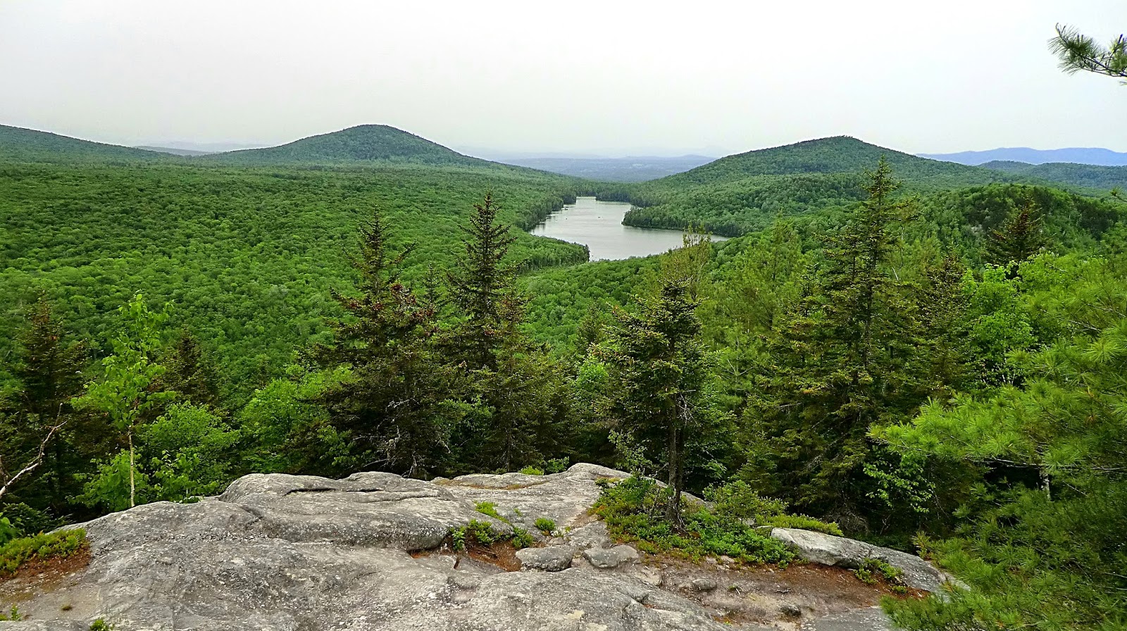
View from 'South Hope' looking westerly
along the Sawyer River Valley. Mt.
Tremont is on far left. Although I'm
uncertain, I think maybe Mt. Kancamagus and the Osceolas are on the distant horizon
in center of photo?
 |
This photo was taken on my earlier trek to South
Hope in April 2010. As compared to a similar
photo taken on my 2014 hike, it seems to be a better view of the Sawyer River Valley.
|
 |
As mentioned in my narrative, my 2014 route
of travel took me over the top of Mt. Hope.
Trees are now filling in the more open views that were once there, as
evidenced by this composite photo showing the westward view (top frame), and
the northward view (bottom frame).
|
~ THE END
~
= = = = = = = = = = = = = = = = = = =
A reader sent me a private
e-mail asking if there were ledges on 'South Hope' that were imperceptible from
the profile photo shown at the beginning of this report. There are indeed! Perhaps the best way to show these ledges is
via the Google Earth image presented below (click to enlarge).

= = = = = = = = = = = = = = = = = = =
ADDENDUM
(Added 18-June-2014):