Pages

About Me

My photo
Bethlehem, New Hampshire, United States
E-mail contact: randonneur8@yahoo.com | Facebook: facebook.com/1HappyHikerNH

Text Above Search Box

SEARCH MY BLOG USING TEXT BOX SEEN BELOW:

26 January 2014

In Praise of Hiking Adventures to Beaver Ponds

If you do some reading about beavers, you'll discover that their ability to change the landscape is second only to humans.  By building dams, beavers create wetlands which support biodiversity that rivals that of tropical rain forests.

In addition, there are also some aesthetic paybacks from beaver activity. The wetlands and ponds create natural clearings that allow open views of the surrounding terrain.  These vistas sometimes rival those seen from mountaintops and ledges.  Because of these viewing opportunities, I will sometimes seek out beaver ponds as a hiking destination.

Although I've visited beaver ponds at all seasons of the year, winter is a particularly opportune time since the ponds are frozen.  This allows easier access to these areas which are often surrounded by boggy areas that are difficult to traverse during warm weather months.

During the past few weeks of January, I've visited a couple of beaver ponds that were new destinations for me.  One of the ponds is located about a mile south of the Gale River Loop Road near Bethlehem, NH.  My journey to the pond was launched from a point near the trailhead for the Garfield Trail.  A logging road was used for the beginning part of the trek, and the final portion involved a bushwhack of about 0.5 mile which was overall relatively easy.  However, at one point I did encounter a nasty section of downed trees which required considerable zigzagging to work through the clutter.

Shown below are scenes from my visit to the beaver pond described above.  In the first two photos, the actual beaver pond in behind me.  The views are overlooking a wetlands/meadow area formed by beaver activity.
Southward vista of ridgeline between Mt. Garfield and North Lafayette
 Eastward vista of Twins on distant horizon (far left) and Mt. Garfield (right)
 Tracks made by a small animal who had also enjoyed a recent visit to the pond!
The preceding photos and text described the pond that was visited as part of a calculated and well-planned visit.  So now, here's the tale about a beaver pond that was visited sort of by accident.  As the expression goes, "Haste makes waste"!  Late in the day, an unexpected couple of hours became available for hiking.  Without taking time to thoroughly plan the trek and familiarize myself with the terrain, I hastily headed off for a bushwhack to a beaver pond on Cheney Brook (located on west side of the East Pond Trail).

Once I arrived at what I thought was my destination, I suspected something was wrong when the views weren't as I'd expected they would be.  However, I had no time to snoop around since daylight hours were waning, plus I needed to pick up my wife from work.  Later in the evening when comparing the photos I'd taken to those contained in Steve Smith's blog (click HERE), it became apparent that I'd overshot my mark and ended up at a smaller pond adjacent to the main pond.  TOTAL HUMILIATION!

Shown below is a Google Earth image of the two beaver ponds along Cheney Brook which I've dubbed as Big Cheney Pond and Little Cheney Pond.
Google Earth image showing "Big Cheney Pond" and "Little Cheney Pond"
And so with that bit of embarrassing explanation out of the way, here are some other details about this adventure.  I didn't run a GPS track, but roughly guesstimate that the round-trip mileage for this trek was about 3.7 miles.  Approximately 3 of those miles were on the East Pond Trail, and the remaining 0.7 involved bushwhacking.

En route to the spot where I'd begin my bushwhack, I needed to cross Pine Brook on the East Pond Trail.  The ice on the brook appeared thin, and it was punctuated with obvious gaps of open water.  I took a deep breath, hoped for the best,  and made the crossing without incident (other than frayed nerves)!

The photo shown below was taken as I approached the brook crossing on the return leg of my journey.  It appeared just as daunting, regardless of which side of the brook you were on!
The crossing of Pine Brook on the East Pond Trail
The early part of the bushwhack took me through some rather thick patches of conifers.  But before long, I was walking through a picturesque stand of tall, stately trees.
Picturesque stand of tall, stately trees en route to beaver pond on Cheney Brook
Despite being at the smaller of the two ponds, and despite it being an unintended destination, the overall vista was still quite pleasant.  And on another positive note, I'm always very keen on visiting new places, and this certainly qualified.  However, I must add that it would be preferable to do these visits by design, rather than by chance!
Osceola ridge as viewed from a smaller beaver pond adjacent to the main pond)
To sum it up, besides visiting natural settings such as mountaintops, ledges, and waterfalls, the unheralded beaver ponds are yet another resource for adding variety to my hiking adventures.

16 January 2014

A Hike to Tin Mountain (Jackson, NH)

Tin Mountain (2,031 ft. elevation) is located in Jackson, NH and lies at the center of a 228 acre parcel of property owned by the Tin Mountain Conservation Center.  This was my first time hiking at this location.  A trail map is at the following link: http://www.tinmountain.org/wp-content/uploads/fieldstationmap.pdf

Judging from their map, I anticipated that this hike would be relatively short, and that was fine with me.  Although I'm a hiking enthusiast, I often prefer to spend only a portion of my day outdoors, and then have the rest of the day free for other activities.

Major destinations at this facility include: a small but attractive pond; the summit of Tin Mountain; plus an access shaft and pits from first known tin mines in North America.  On this particular hike I visited the pond and the summit of Tin Mountain.  However, I skipped doing a visit to the tin mines since I felt this could be better appreciated later in the year once the ground cover of snow is gone.

The trek to the pond is relatively short and probably is well within the capabilities of hikers of all age groups.  Regarding the hike to the summit of Tin Mountain, it also fits the category of short.  However, some might find it challenging since it involves a steep climb.  I roughly calculate that there is about a 650 ft elevation gain in a little less than a mile.

The remainder of this report will consist of a few photos taken on this hike.

Being unable to find an official name for this pond located on the Tin Mountain Conservation property,  I'll simply dub it as "Tin Mountain Pond".  This view is looking northeasterly across the pond with South Doublehead on the horizon.
Northeasterly view across "Tin Mountain Pond" with South Doublehead on horizon
From a ledge near Tin Mountain's summit there's a BIG view southward that includes the Moats; many peaks in the Sandwich Range; and a wide assortment of other peaks such as Mt. Tremont, Bartlett Haystack, etc.
Vista seen from ledge near Tin Mountain's summit
A zoomed view of the Moats from a ledge near Tin Mountain's summit
Along the Tin Mountain Loop Trail, there is a limited, partially obstructed view of the Presidential Range.
Limited, partially obstructed view of Presidential Range from Tin Mountain Loop Trail
There are tree-obstructed views of the Doubleheads from the summit area, and at various points along the Tin Mountain Loop Trail.
Tree-obstructed view of the Doubleheads from spot near Tin Mountain's summit
The woods at Tin Mountain Conservation Center are nice.  Although the tree shown in the photo is no longer among the living, it has a certain beauty, and still contributes to the forest's ecosystem.
Tree is no longer living, but has beauty, and still contributes to  forest's ecosystem
While descending Tin Mountain at late afternoon, there was a very pleasant southwesterly view.
Pleasant southwesterly view while descending Tin Mountain at late afternoon
The signage at the Tin Mountain Conservation Center is simple, and perhaps a bit unconventional!  Overall, the signage and blazing do a good job of leading you to where you want to go.  However, there are a few confusing spots, and therefore it would be a good idea to print out a copy of their online map to take with you on your hike.
Signage at Tin Mountain Conservation Center is simple, and bit unconventional
To sum it up, it can honestly be stated that hiking at this location exceeded my expectations.  More time than anticipated was spent here since the overall ambiance and views prompted me to adopt a leisurely pace.  During the summertime tourist season, this hike might be less pleasant.  But on this particular winter day, it was very enjoyable.

12 January 2014

Favorite Hikes for the Year 2013

Without a shred of doubt, my top pick for hikes done in 2013 was my trek to Tumbledown Mountain in the vicinity of Weld, ME.  The photo below is just one of the many taken on this hike.  It shows Tumbledown Pond as viewed from edge of a small tarn along the Parker Ridge Trail. (Click HERE for the complete set of photos from this trek.) 

Regarding my other outings for 2013, I logged a total of 158 outdoor adventures (includes hikes, as well as X-C skiing).  It was a challenge to narrow these down a reasonable number of favorites.  Regardless, listed below (by calendar month) is the selection that was finally chosen to be my favorites for 2013.

New Year's Day: Cross country skiing on the Mooseway Trail at Pondicherry

Early January: Mt. Willard as viewed from Sam Willey Trail

Mid January: Zoomed view from Jennings Peak showing Mad River Notch with portion of East Osceola on left, cliffs on west knob of Mt. Huntington in center, and portion of Mt. Kancamagus on right.

Early February: Bushwhack to beaver pond complex in Otis Brook drainage (located between Rocky Branch River and Iron Mountain).  Photo shows me having lunch at the beaver ponds (north end of Iron Mountain is in background).

Mid February: Found an intact moose antler while trekking on Reel Brook Trail for a day hike to Eliza Brook Shelter.

Late February: Trek to Mt. Monroe.  A heavy cloud cover remained on the high peaks, despite some forecasters who had predicted otherwise.  Still an enjoyable and memorable hike, but only got one worthwhile snapshot looking down the Ammonoosuc Ravine.

Early March:  Got some BIG views from a very short hike (less than 0.5 mile round-trip) to an old logging clearing at Fay State Forest (Lincoln/Woodstock, NH).  Particularly liked eastward vista of peaks along Kancamagus Highway corridor (Loon Mtn ski slopes on right).

Mid March: A bushwhack to various ledges and viewpoints in Mt. Langdon area.  A recent rain followed by sustained temperatures below freezing had created a hardened snowpack that was ideal for bushwhacking.  Could walk on top of the snow without sinking.  Much the same way as walking on a paved surface!

Mid April: A loop hike to Mt. Crawford involving a bushwhack approach to the summit from the west.  Photo shows Stairs Mountain with Mt. Resolution to its immediate right.

Late April: A bushwhack to South Sugarloaf (Zealand Road area).  Photo shows Presidential Range on the horizon.

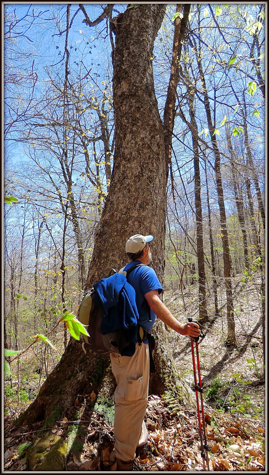
Early May: A bushwhack off the Haystack Notch Trail with Steve Smith.  Among many interesting things, we saw several large hardwoods, some of which might be over 150 years old.  Photo shows Steve admiring one of these large trees.

Mid May: A bushwhack to a cliff at east end of Mt. Tremont.  Photo shows southeasterly view featuring (left to right) Bear Mountain, Mt. Chocorua, Mt. Paugus.

Late May: Memorial Day weekend in the Adirondacks with wife Cheri.  Photo shows raging cascade along West Branch of Ausable River

Mid June: Hike to Rogers Ledge with my friend Marty.  Photo shows Square Mountain and Greens Ledge, as viewed from an off-trail ledge located just below and east of the Rogers Ledge summit.

Mid June: A loop hike involving old logging road, a bushwhack, the Mahoosuc Trail, and the Centennial Trail.  Photo shows a view of Presidential Range from ledges on Cascade Mountain.

Late June: A bushwhack to an old lead mine, and an unnamed cascade in the Lead Mine Brook drainage.  Photo shows the unnamed cascade which is a bit unusual in that the brook makes an abrupt 90 degree turn at bottom of cascade.

Early July: A trip to Rangeley, ME for hikes in region of Saddleback Mountain.  Photo shows The Horn as viewed from a tarn in the col between Saddleback Mountain and The Horn.

Mid July: A bushwhack to a small unnamed pond off the Hancock Notch Trail.  While en route, did a short side trip to get a view of The Captain.

Early August: A bushwhack to East Hale.  Photo shows Zealand Notch with Mt. Carrigain and neighboring peaks in the background.

Mid August: A bushwhack to top of Eagle Cliff Ridge (Franconia Notch).  Photo shows a vista from the south end of the ridge looking southward down I-93 (Cannon Cliffs at center right; Profile Lake at bottom right).

Early September: My very first hike to New Hampshire's Mt. Monadnock.  Photo taken as I was approaching the summit.

Mid September: My very first hike in the Bigelow Mountain Range.  Photo taken from Cranberry Peak looking eastward along the Bigelow Range toward Cranberry Pond and The Horns.

Late September: A bushwhack with Steve Smith to Little Tunnel Brook Ravine (located on north side of Mt. Moosilauke).  We saw many, many cascades along the route.  The photo shows the "grand prize" which is probably about 100-ft high.  And although this torrent of water is quite striking, it is unnamed!

Early October: A traditional hike to Mt. Pierce via Crawford Path.  The photo shows the view from the top of Mt. Pierce looking toward the Presidential Range.  The colors were so vibrant and surreal on this particular October day!

Mid October:  A bushwhack to The Hogsback in the Benton Range.  The photo shows a vista of Long Pond with Kinsmans and tops peaks in the Franconia Range in background.

Early November: A bushwhack to Cape Horn (Groveton, NH).  There are many picturesque and interesting views from the ridgeline along Cape Horn.  However, my favorite image from this trek was the vista of Cape Horn itself as I approached it while en route.

Mid November: A hike to Mt. Cube via Cross Rivendell with my friend Marty.  The photo show a vista from North Peak.  Upper Baker Pond is in foreground; followed by Mt. Moosilauke on horizon.

Early December: Had several enjoyable hiking experiences in early December by poking around the recently established Cooley-Jericho Community Forest located in Easton, NH.  Photo shows a trailside vista looking northward toward Vermont.

Christmas Eve: Hiked to Bog Ledge in northern Presidential Range using the following trails: The Link; Cliffway; Monaway; Amphibrach.  Photo shows King Ravine as viewed from Bog Ledge.

End of December: A loop hike to Middle and North Sugarloaf with my friend Marty.  Loop began and ended at parking lot for Twin Mountain Recreation Area in the town of Twin Mountain.  This hike incorporated: a segment of the old Glacial Ridge Road; a snowmobile trail; a portion of the Trestle Trail; entire length of the Sugarloaf Trail; and remnants of the Baby Twins Trail (abandoned long ago).  Photo shows a vista from Middle Sugarloaf that includes a portion of Zealand Valley with Mt. Tom and Mt. Field prominent on the horizon.

~ THE END ~