Most of my hiking is done within the State of New
Hampshire where I live. However, there
are many hiking opportunities in Vermont that are within an hour's drive from
my home in Bethlehem. On a Saturday in late July 2013, my friend
Marty and I decided to drive over to Vermont and hike in the Mt. Pisgah/Lake
Willoughby area which is located along Rt. 5A near Westmore, VT. This area lies within a region
known as the Northeast Kingdom.
Lake Willoughby is a glacial lake reaching a
depth of over 300 ft. in places. Because
of how it is dramatically situated between
the steep cliffs of Mt. Pisgah and Mt. Hor, it has a close resemblance
to a Norwegian fjord.
There is an interesting bit of history
associated with Lake Willoughby relating to the French & Indian War (1754-1763). In 1759, Robert Rogers led his Rangers on a
successful raid of the Abenaki
Indian settlement of St. Francis in Quebec, Canada. This
raid was in retaliation for the Abenaki attack on a retreating British unit
while under a flag of truce. After
the raid, Rogers and his men were pursued through northern Vermont by French
and Indian forces as they made their way back to base. As part of their escape route, the men hugged
the rough and rocky eastern shoreline of Lake Willoughby.
As you are approaching the Lake Willoughby area
while driving north on Route 5A, there is a surrealistic image of Mt. Hor and Mt.
Pisgah that suddenly comes into view (see photo below).
 |
| Mt. Hor (on left) and Mt. Pisgah (on right) as viewed from Route 5A |
Mt. Pisgah would, in some ways, be a new destination
for both Marty and me. This would be
Marty's first time ever to ascend this mountain, and it would be my first
ascent via the North Trail. My other two
treks to Mt. Pisgah have been via the South Trail. For both trails the elevation gain is
identical, i.e. 1,375 ft. However, the
hiking distances are slightly different.
The one-way distance for the North Trail is 2.2 miles, versus 1.7 miles
for the South Trail.
 |
| Map showing trails and major overlooks for the Mt. Pisgah hike |
The
three major outlooks from Mt. Pisgah are located on the north side of the
summit (see map shown above). You need to appreciate that all of these viewpoints
involve venturing out onto small ledges on the edge of the Willoughby Cliffs. The photo shown below doesn't do complete
justice to the rather precarious drop-offs at each of these outlooks.
 |
| Downward view from one of Mt. Pisgah's outlooks on the Willoughby Cliffs |
The next photo might serve to give some idea of
the rather small size of these outlooks.
This hiker is perched on an outlook peering down at me where I was
standing on a lower outlook.
 |
| Hiker perched on one of the small outlooks on the Willoughby Cliffs |
Although the drop-offs
at these outlooks might prove a bit unsettling to some, they do provide
dramatic vistas. The photos presented
below provide a couple of examples of the awesome views.
 |
| Northwesterly vista (massive cliffs on Mt. Wheeler on left side of photo) |
 |
| Slightly zoomed photo providing a closer view of Mt. Wheeler |
Just as a side note, the trek to Mt. Wheeler is another Vermont adventure that is definitely worth considering (click HERE for my Blog report about that hike).
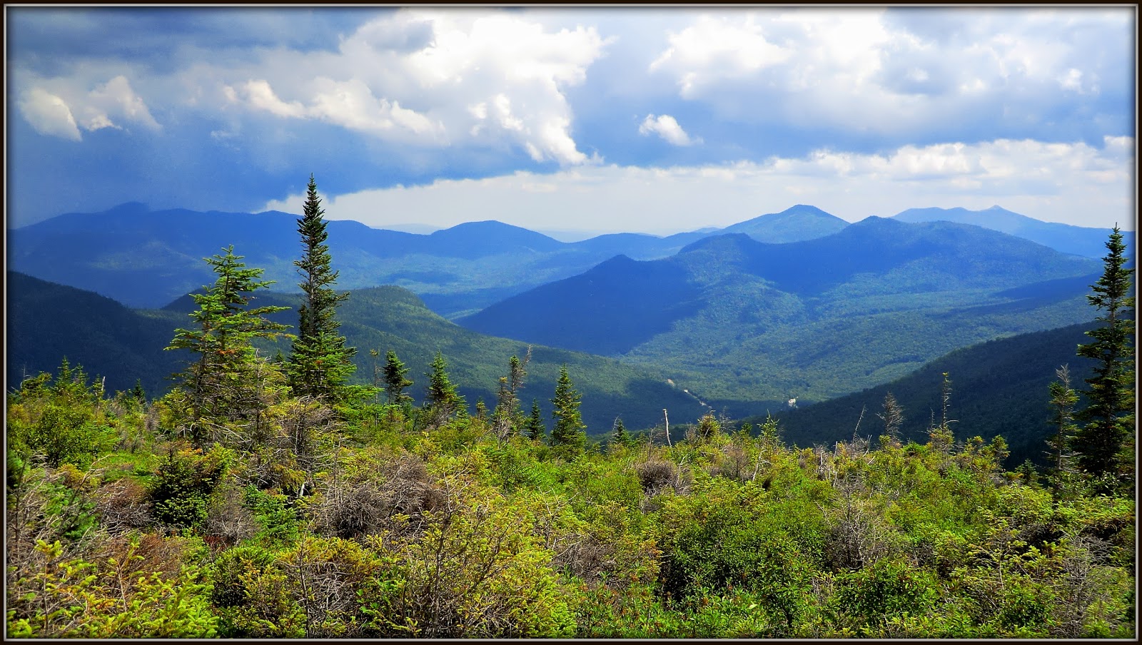
Looking nearly
due north from the outlooks on Mt. Pisgah you can see Lake Memphremagog. About 75% of this lake is in Canada (Quebec), with the remaining portion in the Vermont
towns of Derby and Newport. Along the
western shore of Lake Memphremagog are several prominent mountains, such as
Owl's Head, Elephantis, and the Sugar Loaf.
The next photo shows the Lake Memphremagog vista. It's a rather poor quality image. But please bear in mind that it's a highly zoomed
photo of landscape features that are nearly
25 miles away!
 |
| Zoomed photo of Lake Memphremagog located 25 miles north |
After
enjoying the views from the three overlooks atop the Willoughby Cliffs, Marty
and I continued onward to the top of Mt. Pisgah to experience the views from
ledges located just a couple hundred feet from the true summit.
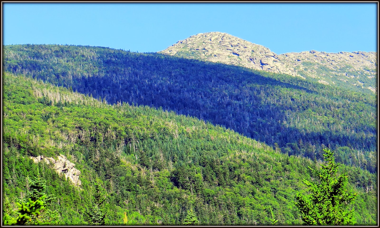
These
ledges provide a broad view looking down the West Branch of the Pamsumpsic River
Valley. Burke Mountain dominates the
landscape and is easily recognizable by its ski slopes. On the distant horizon, about 50 miles away,
you can see the White Mountains of New Hampshire, including
high peaks in the Presidential Range, Franconia Range, and other ranges as well.
Shown
below is just an example of one of the vistas from the ledges near the summit
of Mt. Pisgah.
 |
| Burke Mtn (foreground); peaks in Franconia Range and the Kinsmans (distant horizon) |
The
next photo probably will have little significance unless you've visited the
abandoned U.S. Airbase on East Mountain, VT.
From the summit ledges on Mt. Pisgah, I could faintly see one of the
many buildings that are still standing at the abandoned airbase.
The top
panel of this composite photo shows what could be seen through my binoculars
when looking at this mountaintop which is located about 15 miles to the
southeast. The bottom two panels show
images of some of the structures atop East Mountain that can be seen when visiting the site. (If you're interested in reading more about
this abandoned airbase, then click HERE for a Blog that I wrote after hiking to this
rather unusual place.)
 |
| Composite photo showing structures on abandoned U.S. Airbase atop East Mountain, VT |
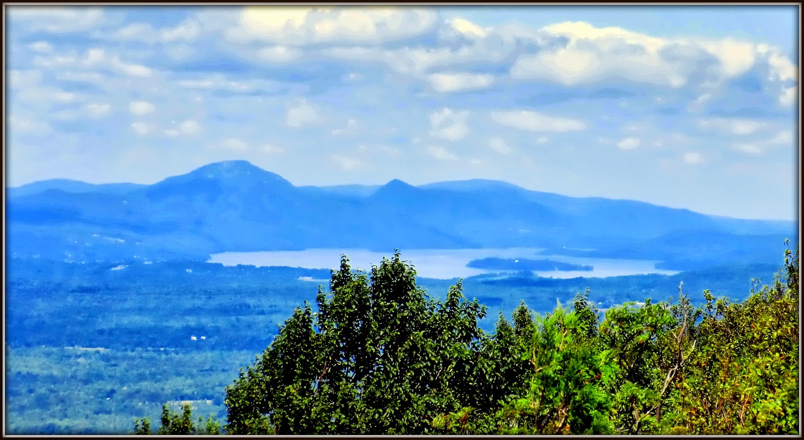
And so,
the narrative presented above provides a summary of our trek to various viewpoints atop
Mt. Pisgah. After we arrived back at the
trailhead, we decided to do a short 0.2 mile "hike-ette" to the south
end of Lake Willoughby. From the south
end of the lake, there is a rather stunning view looking northward (see next
photo).
 |
| Looking northward from Lake Willoughby's south shore |
From this vantage point, Marty and I could get a good look at the Willoughby Cliffs where we had literally
"hung out" earlier in the day!
 |
| Willoughby Cliffs on Mt. Pisgah's west side |
On the
far left side of the above photo, you will notice that there is a seagull who
apparently flew in to spend the day admiring the vistas at Lake Willoughby! The
next photo shows a close up image of that touristy seagull.
 |
| Seagull "tourist" enjoying the day at Lake Willoughby |
To sum it up, in addition to the area around Lake Willoughby, there
are numerous other excellent hiking opportunities in the Northeast Kingdom of
Vermont. Many of these hikes are
described in a book published by The NorthWoods Stewardship Center
(in partnership with the Green Mountain Club of VT) which is entitled
"Northeast Kingdom Mountain Trail Guide" by Luke O'Brien.