Pages

About Me

My photo
Bethlehem, New Hampshire, United States
E-mail contact: randonneur8@yahoo.com | Facebook: facebook.com/1HappyHikerNH

Text Above Search Box

SEARCH MY BLOG USING TEXT BOX SEEN BELOW:

29 April 2013

South Sugarloaf: The Neglected Member of the Sugarloaf Family


At one time or another, probably many readers have hiked the trails to North and Middle Sugarloaf mountains located near Twin Mountain, NH.  Both of these little mountains offer a "big bang for the buck" in terms of views.  Meanwhile, the nearby mountain known as South Sugarloaf is sort of the neglected member of the "Sugarloaf family".  It doesn't get nearly as many visitors since it is trail-less. A bushwhack is required to reach its summit.

On 28-Apr-2013, I bushwhacked to South Sugarloaf.  It was my third time for doing so.  For my previous visits, two different launch points off the Zealand Road were used to reach this mountain.   For this recent visit, my bushwhack was launched from the snowmobile trail that runs on the east side of Tuttle Brook and goes for a considerable distance up the Tuttle Brook drainage in the direction of South Sugarloaf.  In this report, I'll refer to this as the "Tuttle Brook route".

Shown below is a photo of the three Sugarloaf mountains as viewed from the intersection of Rt. 3 and Rt. 302.  The yellow arrow provides a general idea of the route taken for my bushwhack.
Sugarloaf mountains viewed from intersection of Rt. 3 and Rt. 302
The "Tuttle Brook route", is the best of the three routes I've used to access South Sugarloaf.  As to why I've waited until now to use this corridor, perhaps I could rationalize that I was saving the best for last!  But in actuality, in the past when I've considered using this route,  the conditions were unsuitable for my tastes.  Either it was during the summer season when the snowmobile trails are filled with weeds/briars and blood-sucking ticks, or it was during snowmobile season, etc.   So, in my opinion, late spring, and mid autumn are the prime times to use snowmobile trails as hiking trails.

Following my weed-free, and tick-free,  trek along the snowmobile trails, it was eventually time to head off into the woods for the bushwhack portion of my journey to the summit of South Sugarloaf.  The vast majority of this off-trail portion was spent hiking through open woods such as shown in the next photo.
Open woods bushwhacking to South Sugarloaf
Most of the bushwhack was snow-free.  However, I did run into some lingering snow in the sag between South Sugarloaf and the massive ridgeline on the north side of Mt. Hale.  And, I also encountered a 
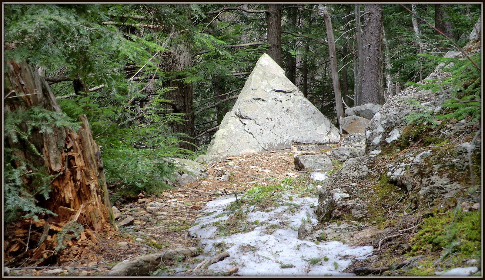
huge ice bulge which was easy enough to work around (next photo).
Ice bulge on the side of South Sugarloaf
On each of my visits to South Sugarloaf, I've been amazed at the orange/tan granular material on the summit area of this mountain. Geology (among many other areas) isn't one of my strong suits. However, I think this material is what is sometimes referred to as "rotten granite"?  Regardless, you can see some examples of this brightly colored material in the photo collage that is shown below. 
Examples of orange/tan colors atop South Sugarloaf
Among the many grand vistas from South Sugarloaf is the one looking across the Zealand Valley at Mts. Tom, Field, and Willey (next photo).
Mts. Tom, Field, Willey (right of center on horizon) as viewed from South Sugarloaf
However, the most impressive vista from South Sugarloaf is looking eastward toward the Presidential Range.
View of Presidential Range from South Sugarloaf
Another View of Presidential Range from South Sugarloaf
Okay . . . I spent far too much time basking in the warm sunshine on South Sugarloaf.  And as a result, I didn't have time to visit a ledge that I'd visited once before.  It's located at an elevation of about 3,360 ft  on a ridgeline at the north end of Mt. Hale.  As the crow flies,  it's only about 0.3 mile from where I was sitting.  It's a very worthy destination, and in retrospect, I wish I'd allowed time for a repeat visit.  The next photo shows this ledge as viewed from South Sugarloaf.
Ledge located on ridgeline at north end of Mt. Hale
From this ledge,  you can see all three of the Sugarloaf mountains, all lined up in a row.  First in line, is the orange/tan summit of South Sugarloaf, followed by Middle Sugarloaf with its massive south-facing cliff clearly visible.  And directly behind Middle Sugarloaf, you can see bits of the ledges atop North Sugarloaf.
South, Middle and North Sugarloaf viewed from ledge on ridge at north end of Mt Hale
To sum it up, this was my third visit to South Sugarloaf.  A different route was used for each of these bushwhack adventures.  All three routes have their good points, but my preference is for the "Tuttle Brook route".  As frequent readers of my Blog know, I'm keen on visiting new places, or familiar places via new routes.  Since I've now been to South Sugarloaf three times via three different routes, it might be quite a while before I make a return visit.  But who knows?  In mid Autumn, I might be up for a return visit. :-)

26 April 2013

Gentian Pond: A Mostly Snow-Free Trek to a Frozen Pond


On this particular day, the destination was only a secondary consideration.  My primary goal was to do a trek that would have little, if any, snow and ice along the route.

Gentian Pond is located at an elevation of nearly 2,200 ft, and is surrounded by steep ridges which limit the amount of direct sunlight it receives.   Given those conditions, I was uncertain what I'd find there in late April in terms of snow and ice.  However, I was fairly certain that the route to the pond would be relatively snow-free  since the Austin Brook Trail is predominantly a south-facing trail.

My supposition about the trail was pretty much on target.  The vast majority of this 3.5 mile trek was indeed free of ice and snow.  The next photo show a typical segment of the trail.
Trail was free of snow and ice for the vast majority of the trek
However, there were a few short segments of patchy snow beyond the junction with the Dryad Fall Trail where the Austin Brook Trail veers a bit from its south-facing orientation (next photo).
Just a few short segments of patchy snow beyond Dryad Fall Trail junction
When I arrived at Gentian Pond, it was as though winter had never left, or should I say that spring has yet to arrive?!  The pond was still ice-covered, and the shoreline still had a layer of very deep snow.  How deep was the snow?  Well, I only traveled a short distance along the shoreline because I was stepping into soft spots in the snow where the depth was well above my knee!

Given the deep snow conditions, and the fact that I'd purposely left my snowshoes at home, my exploration of the area was limited.  However, there was no real disappointment with being unable to do more exploration in the vicinity of Gentian Pond.  As indicated at the beginning of this report, I was uncertain what I'd find once I arrived at this location.

The next photo is the only decent view of the pond that I was able to capture.  
Gentian Pond as it appeared on 26-April-2013
Although the pond was still frozen, the nearby Gentian Pond Shelter was very inviting.  It has a southern exposure overlooking mountains in the Royce and Carter-Moriah range.  This provided a warm, sunny and dry spot to spread out and enjoy a beautiful day while eating lunch and savoring the view.  It's little wonder that this is a popular stopover for hikers traveling along the nearby Appalachian Trail. 
Gentian Pond Shelter
View from inside the Gentian Pond Shelter
Besides experiencing Gentian Pond, and besides a delightful lunch-break at the shelter, the hike itself was filled with several trailside views that were pleasing.   For example, just before the ascent to the plateau where Gentian Pond is located, there is a picturesque wetlands area that is dotted with several grassy islands (next photo).
Picturesque wetlands area which is dotted with several grassy islands
Also, along the route there is a trailside clearing where you can see Dryad Fall off in the distance.  As the crow flies, it's about 0.7 mile away.  Therefore, it requires a significant zoom to capture a snapshot of this far-away waterfall. Shown below is the best image I could capture with my "point and shoot" camera.
Zoomed view of Dryad Fall as seen from a distance of about 0.7 mile
While on the topic of waterfalls, my trek also included a short side trip on an unofficial trail in order to visit a series of cascades known as "Bowls and Pitchers".  This little trail (about 0.3 mile long) has a south and a north entrance.  Although neither entrance is signed, the trail itself is yellow-blazed and easy to follow.  There is no place to park for the south entrance, but it's an easy walk (less than 0.5 mile) from the trailhead parking for the Scudder Trail.  For the north entrance, there is a large wide spot on Mill Brook Road where you can park.  However, the north entrance is not quite as obvious, and the first part of the trail is very brushy.

The points mentioned above are labeled on the map shown below (click to enlarge).
Map showing location of "Bowls and Pitchers", plus unofficial trail leading to it
The "Bowls and Pitchers" cascade has been known by this name for at least several decades.  For example, there is mention of it on page 61 of my 1940 edition of the White Mountain Guide where it is described only as "interesting pot-holes in the stream".

One section of those "interesting pot-holes" is shown in the photo collage presented below.  Two different camera settings were used to photograph this cascade.   These are okay snapshots, but a REAL waterfall photographer is needed to more vividly capture their splendor!  My "point & shoot" camera has its limits!
Two different camera settings were used to photograph this cascade
Here is just one more bit of information about my route.   You can reach Gentian Pond by following the Austin Brook Trail all the way.  However, I chose to do a slight modification by parking at the trailhead for the Scudder Trail, and then walk along Mill Brook Road to the point where it intersects the Austin Brook Trail.  (Another parking option is to drive 0.9 mile beyond the Scudder Trail and then park at the wide spot along Mill Brook Road that I mentioned above.  This wide spot is located just a few hundred feet from where large boulders have been placed to block access.)

To sum it up, this hiking adventure was perhaps a good example of the notion that the journey can be just as worthy and rewarding as the destination itself.  My primary goal was met by journeying along a relatively snow-free trail, and I saw a number of beautiful sights along the way!

23 April 2013

A Loop Hike to Mt. Crawford

Perhaps it's a rather brazen statement to make, but it will be difficult for me to ever do a hike again to Mt. Crawford using a simple "out and back" route via the Davis Path.   Nonetheless, that's how I feel after having done a thoroughly enjoyable loop hike on 22-April.  The route is depicted on the GoogleEarth image shown below.  (The yellow line on this image is the Davis Path, and the red line is the approximate route taken for the bushwhack portion of this loop.)
Route of travel as depicted on GoogleEarth image (click to enlarge)
The idea for this hiking adventure came to me a few days ago when I was doing some general meandering off the Davis Path (click HERE for details about that trek).

During the short off-trail hike referenced above, I visited the unnamed brook that runs in the valley between the ridge to the east where the Davis Path is located, and the ridge to the west where there is no trail.  I noticed that the slope along the ridge on the west bank of the brook appeared very inviting as it rose northward.  This prompted me to look at a topographic map when I returned home.  One thing led to another, and it wasn't long before I was plotting out a course for the adventure that is the subject of this report.

The bushwhack portion of this loop hike seemed no steeper to me than the climb on the Davis Path.  Also, my round-trip hiking time of just under 5 hours was comparable to the book time (4 hours 38 minutes) that is listed for a conventional "out and back" trek using the Davis Path exclusively.

The vast majority of the hike was through open hardwoods.  However, there were a few short segments consisting of a mixture of conifers and hardwoods.  The longest portion of these mixed (and less open) areas was between the spot labeled above as "Ledge #2", and the point where open ledges begin to appear to the west of Mt. Crawford's summit.

And so, that is the background for this adventure.  The remainder of this report will consist mainly of photos with some brief narration about the photos.   I'll skip a presentation of the historical aspects associated with this trek.  Most readers of this Blog are already familiar with facts such as the Davis Path was constructed by Nathaniel T. P. Davis, and it has been in existence since 1845.

The first snapshot was taken on the outbound portion of my trek as I was ascending the lower part of the Davis Path.  For whatever reason, I'd never noticed this large triangular shaped boulder off the side of the trail.  It looked like a miniature pyramid when I first spotted it.
Trailside boulder shaped like a pyramid (located on lower portion of Davis Path)
Referring back to the Google Earth image shown above, you'll note that there are spots labeled as "Ledge #1", and "Ledge #2".  Although I encountered more than two ledges during the bushwhack, these are the ledges from which I took photos.

Shown below is the view from Ledge #1 looking southward (Mt. Tremont is in center of photo).
View from Ledge #1 looking southward (Mt. Tremont is in center of photo)
Ledge #2 consisted of a complex of several ledges.  Shown below are two snapshots taken from the Ledge #2 area.
Looking northward up the Crawford Notch from Ledge #2
Tops of Presidential Range as viewed from Ledge #2
After leaving Ledge #2, I headed eastward toward the summit of Mt. Crawford.   As mentioned earlier, the woods were less open for this portion of the journey.  However, within 20 minutes I started to hit the wide open ledges on the west side of Mt. Crawford (about 0.1 mile below the summit).  From here the imposing view of Stairs Mountain came into view.  The next photo is a zoomed view of that mountain with its unique stair step shaped cliffs.
Zoomed view of Stairs Mountain
Backing off from my zoomed view, here are two more snapshots which also include Stairs Mountain.  The first one shows the view to the north of Stairs, and the second one shows the view to the south of Stairs.
Stairs Mountain with the snow-capped Presidential Range behind it on the left
Stairs Mountain with Mt. Resolution to its immediate right
Besides Stairs Mountain, there are many other impressive views from these ledges located below the summit of Mt. Crawford's western side.  One such view is looking northwestward toward the Crawford Notch area (next photo).
Crawford Notch and surroundings as viewed from ledges below Mt. Crawford's  summit
After spending quite a bit of time enjoying the views from the ledges below the summit, it was time to make the final ascent to the top of Mt. Crawford and meet up with the Davis Path.  The next photo shows the scene looking up at the summit of Mt. Crawford from ledges on its western side.
Looking up at summit of Mt. Crawford from ledges on its western side
Once on top of the summit, I noticed the small memorial consisting of a bird sculpture surrounded by several colorful stones.   I posted an image on Facebook and asked if anyone had any details about this particular memorial.  In response, a Facebook Friend (Dan Szczesny) kindly provided me with a photo he had taken of this same memorial in October 2012.  By the way, Dan authors a great Blog (click HERE) which I'd encourage you to visit.

Although I still don't know any details about the memorial itself, it's interesting that it has endured on the mountaintop for at least several months (maybe longer).  The next photo is a composite image showing the memorial as it existed in October 2012 when Dan visited Mt. Crawford, and a photo showing its appearance on my April 2013 visit.  It's sort of amazing that it has remained pretty much intact over the months. The "Remember" stone is missing, but it might still be up there somewhere.  It could have been accidently kicked aside.
Memorial on Mt. Crawford as it existed in October 2012 vs. April 2013
Although viewed from a slightly higher vantage point, and from a slightly different angle, the vistas from the top of Mt. Crawford are similar to those that I presented in the photos taken from the ledges located 0.1 mile below the summit.

I lingered for just a short time on Mt. Crawford and then began my descent to the trailhead via the Davis Path.  Early on into my descent, I stopped to take a photo from one of the last open ledges before the trail is immersed in the trees for the remainder of the trip.  The vista in this photo is looking southward.  The Attitash ski slopes are on the left.  Various peaks in the Sandwich Range are on the distant horizon, including the sharply pointed peak of Mt. Chocorua (slightly right of center).
View from open ledge near the point where Davis Path becomes immersed in trees
To sum it up, I'll simply repeat what I said at the outset of this report. This was a thoroughly enjoyable loop hike.  It ranks highly in terms of my most favorite adventures to date.  But to each their own, as the saying goes.  Some might do this trek and come away with a totally different opinion!

//////////////////////////////////////////////// 
ADDENDUM:  Subsequent to this adventure, I did a similar trek in August 2015, but used a route that differs from the one described in this blog posting.  Click HERE to access my August 2015 posting.
////////////////////////////////////////////////

21 April 2013

A Surprise Repeat Visit to Cooley Hill (Easton, NH)


Well, I've officially "lost it"!  Upon sitting down to write this Blog report, I reviewed my hiking logbook.  I was shocked to discover that I'd hiked to Cooley Hill in February 2012.  When proposing this hike to my friend Marty, I told him that it had been several years since I'd last visited this location.  Oh well!  It was still a pleasant hike (again), and it was good to be back out on the trails with Marty who has been sidelined for several months with a foot injury that is now healed.

Cooley Hill is reached by hiking the Jericho Road Trail.  The trailhead is located on NH 116 (1.9 miles north of its junction with NH 112).  The White Mountain Guide describes the trail as ". . . originally constructed as a horse trail and mostly follows logging roads of varying ages".   And I also seem to recall reading somewhere that the trail corridor was used by the fire tower staff as their jeep road to access the fire tower.

This little-used trail is never overly steep.  It gains 1,250 ft elevation which is spread out over the trail's distance of about 3.2 miles.  On the day of this hike, the trail was basically in excellent condition.  However, it is early Springtime and therefore there were muddy spots, and a few widely scattered patches of snow/ice.

Regarding views, about 4 to 5 years ago, the Forest Service opened up a viewpoint on the east side of the trail about 0.1 mile from where the trail officially ends at the old Cooley Hill firetower.  There is no sign to mark the entrance to the short side path that leads to the viewpoint.  However, it is fairly obvious as you make your final approach to the firetower.  The next photo shows the viewpoint as you approach it.
Approach to viewpoint located about 0.1 mile from abandoned Cooley Hill firetower
The vista from the viewpoint is rather narrow, but does provide a pleasant look at peaks in the Franconia Range.
Franconia Range as viewed from side path near abandoned Cooley Hill firetower
Besides this official viewpoint, there are at least two other "unofficial" viewpoints.  One is located at about 1.7 miles from the trailhead (at about 2,000 ft elevation).  If you do a short 400 ft bushwhack eastward from the trail, you'll find an old logging cut that provides a view of the Kinsmans (see photo below).
North and South Kinsman as viewed from old logging cut
Another "unofficial" viewpoint is reached by following a snowmobile trail for a few tenths of a mile northward beyond the ruins of the old firetower.  From this corridor you can see features in Vermont's Northeast Kingdom region, such as shown in the next two snapshots.
Willoughby Gap as viewed from a point north of abandoned Cooley Hill firetower
Burke Mountain and surrounding mountains in Vermont's Northeast Kingdom region
Okay, so what about the firetower that I've mentioned above!  About all I know is that it was a 40 ft tower built in the 1930s and removed in the 1950s.  The photo below shows the ruins of this old tower.
Abandoned Cooley Hill firetower
Marty and I came across some trailside items that grabbed our attention.  One of these objects was an odd-looking tree.  I'm uncertain if it qualifies as an "Ent" from Tolkien's "Lord of the Rings", but it was interesting nonetheless.
An "Ent-like" tree from Tolkien's "Lord of the Rings"?
Another curious trailside item was something that appears to be the result of a person who might have stopped to practice their wood sculpturing skills (next photo).  Not exactly sure, but maybe this represents the face of a wolf, or a dog?
Perhaps someone stopped along the trail to practice their wood sculpturing skills?
And lastly, at several points along the trail we saw a lot of moose sign, including antler rub (next photo).
One of several spots where there was evidence of "antler rub"
To sum it up, it's so baffling as to why I'd forgotten about doing this same hike just a little over a year ago.  But regardless of the hiking venue, it was good to be back out on the trails again with Marty. 

16 April 2013

A Loop Hike at Cockermouth Forest (near Plymouth, NH)


The Cockermouth Forest came under the stewardship of the SPNHF (Society for the Protection of New Hampshire Forests) in 1991 when William Wadsworth donated 1,002 acres of his property as part of his estate plan.  The name “Cockermouth Forest" has historical significance.  The forest is located in the town of Groton which was known from 1760 to 1790 as the town of Cockermouth.   For more information about the Cockermouth Forest, click HERE.

As the crow flies, the entrance to the SPNHF land is only about 8 miles west of Plymouth, NH.  It's on North Groton Road where there is a sign that reads “Cockermouth Forest: John F. Woodhouse Trail”.  From there, you drive down a 300’ fairly passable road to a small parking area.  The sign is only visible when headed northbound on North Groton Road.  If you are travelling southbound, the entrance will be the first left after Orchard Hill Road.   (You can plug the following coordinates into mapping software, or to your GPS to see the precise location: N 43° 43' 40.45", W 71° 50' 32.28".)

From the very onset of this hike I was impressed!  Just a few steps away from the trailhead parking is a large sign (see next photo) with a canister that contains trail maps.
Sign at trailhead
Highlighted in yellow on the map below is the route for the 5.2 mile counterclockwise loop that I did on 15-April-2013.
Map showing the route for 5.2 mile loop hike
As I hiked the trail system, I continued to be impressed.  The trails overall are generally in good shape.  Also, they are well-blazed, and well-signed.  Some of the blazing and signage appears to be relatively recent.  The next photo is a collage of just a few of the many signs that I saw during the hike.
A few of the many trail signs seen along the hike
Also, on the portion of the hike that traverses Bald Knob and Mt. Crosby, there are a number of old trail markers left over from the days when volunteers from Camp Mowglis maintained trails on these mountains, as well as other nearby locations.
Old trail marker from days when Camp Mowglis maintained trails on these mountains
The majority of my hike was on snow-free trails, such as shown in the next photo.
Majority of my hike was on snow-free trails
However, there were several segments of trail that still had some significant snow, such as shown in the next photo.  Fortunately, these segments were short-lived, and were easily negotiated with bare boots.
A few segments of snow still had significant snow
Punch Brook (and its tributaries) weave its way through the trail system.  The next two snapshots show a couple of different aspects to this attractive brook.
Punch Brook flowing gently
Punch Brook flowing rapidly over a cascade
So, up to this point I've not mentioned the distant vistas that are available from the ledges on Bald Knob and on Mt. Crosby.   My first stop was Bald Knob where there were views in all directions.   However, my personal opinion was that the vista overlooking Newfound Lake was the most noteworthy scene from this location (see next photo).
Newfound Lake as viewed from Bald Knob
After exploring the many ledges on Bald Knob, I headed over to Mt. Crosby where the vistas were more impressive, in my opinion.  But before showing some examples of the views from Mt. Crosby, I feel compelled to bring up Cervantes' novel entitled "Don Quixote".  There is an episode where Don Quixote fights windmills that he imagines to be giants. An excerpt from this novel states:

"Just then they came in sight of thirty or forty windmills that rise from that plain.  And no sooner did Don Quixote see them that he said to his squire, Fortune is guiding our affairs better than we ourselves could have wished. Do you see over yonder, friend Sancho, thirty or forty hulking giants? I intend to do battle with them and slay them. With their spoils we shall begin to be rich for this is a righteous war and the removal of so foul a brood from off the face of the earth is a service God will bless."

My point to the above quote is that the views from the ledges on Mt. Crosby are marvelous, but there are wind turbines within your line of sight.  The next photo shows the wind turbines in the foreground with an impressive lineup of high peaks on the distant horizon that begin with Mt. Moosilauke (on left) to mountains in the Sandwich Range (on right). 
Lineup of high peaks on distant horizon Mt. Moosilauke (left); Sandwich Range (right)
It is possible to get a few views from Mt. Crosby that don't include wind turbines, but you need to work at it!  Shown below is one such view.
View from Mt. Crosby without wind turbines
At the summit of Mt. Crosby is a memorial plaque which is shown in the following photo.
Memorial plaque atop Mt. Crosby
After visiting Mt. Crosby, I headed westward to do something called the Cliffs Loop.  While en route, I stopped to take a look at the remains of an old homestead known as the Remick Place (circa 1830). 
Remains of an old homestead known as the Remick Place (circa 1830)
The Cliffs Loop was a fun scamper along a long narrow ledge. It sort of reminded me of a miniature version of a place known as The Hogsback (Benton, NH area) where I hiked about a year ago.  The next snapshot shows a segment of the ledge along the Cliffs Loop.
A segment of the ledge along the Cliffs Loop
From various points along the ledges on the Cliffs Loop, I could see portions of Little Pond through the treetops, such as shown in the next photo.
A portion of Little Pond seen through the treetops from ledges on Cliffs Loop
Also seen from Cliffs Loop was a view of Mt. Cube (next photo)
Mt. Cube as viewed from ledges on Cliffs Loop
However, the view from the Cliffs Loop that I liked the best was from the backside of the loop.  From here, I got a view of the two peaks that I'd visited earlier in the day, i.e. Mt. Crosby and Bald Knob (see next photo).
Mt. Crosby and Bald Knob as viewed from the backside of ledges on the Cliffs Loop
To sum it up, this trek to Cockermouth Forest is something that has been on my list to do for a couple of years.  It was a pleasurable experience and very worthwhile.