Pages

About Me

My photo
Bethlehem, New Hampshire, United States
E-mail contact: randonneur8@yahoo.com | Facebook: facebook.com/1HappyHikerNH

Text Above Search Box

SEARCH MY BLOG USING TEXT BOX SEEN BELOW:

27 October 2012

A Little Bit of This and That: Zealand and Crawford Notch Areas


First of all, I wasn't going to write up these two adventures since I felt they would have limited appeal.  Then, once I decided to go ahead and write about them, I couldn't decide whether to split it into two uninteresting reports, or just do it all in one dose.   In the end, it was decided to employ a single-dose regimen, rather than do a divided dosage! :-)

As the title states, these recent treks were a combination of a little bit of this, and a little bit of that.  These adventures were half-day affairs.  And both can be done in a single day, especially since they can be launched from trailheads that are only about 20 minutes apart on the Route 302 corridor.

I should also probably state from the outset that this report isn't about pretty pictures.  In the areas where I hiked, much of the "pretty" is gone since most of the autumn leaves have fallen and we're left with the drab colors of "stick-season".

So, with that lengthy introduction, here are some words and photos of my recent adventures which are presented in the order in which they were done.

PART 1 (Zealand Area):

This trek was launched from the trailhead for the Zealand Trail at the end of Zealand Road.  My final destination was a little unnamed pond which is located just a few tenths of a mile due south of the Zeacliff Trail.  A book-time of 2'15" is listed for the 3.8 mile trek from the Zealand trailhead to the Zeacliff Trail.  However, it is a flat walk along an old railroad grade, and it can easily be done in well under 2 hours.   Reaching the unnamed pond takes about 30 minutes from the time you leave the junction of the Ethan Pond and Zeacliff Trail.

If you're unfamiliar with the location of this pond, perhaps it will be helpful to take a look at the combination GoogleEarth/topographic map that is shown below (click on image to enlarge it).
 Google Earth/topo map combination showing location of unnamed pond

I've visited this pond on one other occasion, but it was several years ago.  For whatever reason, I had a hankering to make a return visit.   And actually, it was as good of an excuse as any just to visit the remote Zealand Notch area.  Even though it is stick-season, the sights are still impressive!

From the Ethan Pond/Zeacliff Trail junction, there is the view of massive Mt. Carrigain silhouetted on the southern horizon.  From this angle, it almost looks like a huge elephant in repose that is looming in the distance.
Mt. Carrigain looking like an elephant in repose (head on left, rear-end on right)

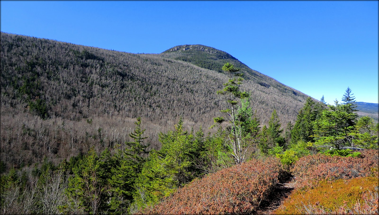
Besides the vision of Mt. Carrigain, there are other impressive vistas, such as the rocky precipices of Zeacliff far above you, and the "right in your face" collection of cliffs and broken rocks on Whitewall Mountain's western wall.
 Rocky precipices of Zeacliff

Cliffs and broken rocks on Whitewall Mountain's west face

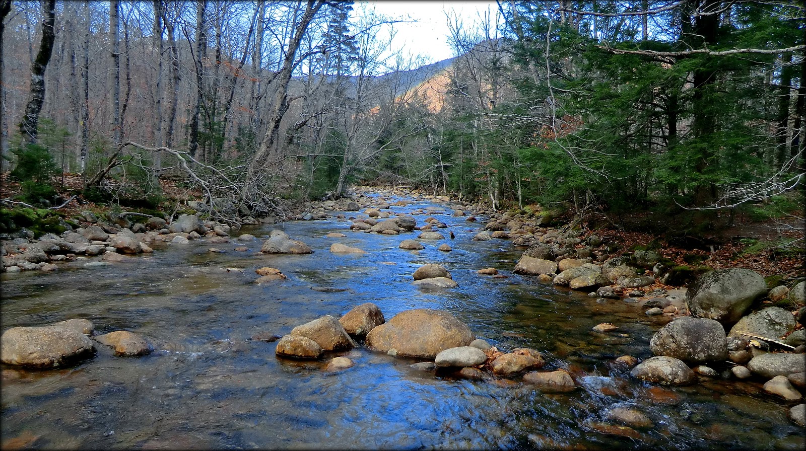
So, after admiring the scene and snapping the above photos, it was time to head off to the pond.  After a short and moderate climb on the west side of Whitewall Brook, the Zeacliff Trail levels out for a short distance.  At this point you just head due south and before you know it, you're at the unnamed pond.

The next two snapshots show the pond from two different directions.  The first photo was taken from the south end looking northward.  The second photo was taken from the north end of the pond looking southward.
 Looking northward from south end of unnamed pond

Looking southward from north end of unnamed pond

It's nearly impossible to show in a photo, but this pond lays deep in a small slit in the mountainside.  I know this sounds somewhat comical, but try to imagine a hot dog bun with nothing in it other than a thin layer of mustard at the bottom.  
In this example, the pond would be the mustard at the bottom.  Anyway, the point I'm trying to make is that it's difficult to see the pond from other locations because of how it's oriented on the landscape.

If you've ever bushwhacked to the top of Whitewall Mountain, then you know that you can get a bit of a view of this unnamed pond by standing at just the right spot.  On this adventure, I thought perhaps I could grab a "sneak peek" by scampering about 20  minutes off the Ethan Pond trail to a small ledge on Whitewall Mountain.  No such luck!  I could see a small portion of Whitewall Brook below me.  However (using my example above),  I could basically only see the slit at the top of the "bun".

The next photo shows what I could see from my little ledge.  The red arrows at the top of the photo point to the two small spots where I could catch of faint glimmer of the unnamed pond laying deep in its narrow slit on the mountainside.
Arrows point to faint glimmers of the unnamed pond as seen from a ledge on Whitewall Mountain

Okay, so that does it for my little half-day trek to an unnamed pond in the Zealand area.  And so now it's off to Part 2 which takes place a short distance down the Crawford Notch in the Dry River area.

PART 2 (Dry River Area):

The other half of my adventure in the Dry River area was a pure bushwhack.  However, there was one small bit of unexpected on-trail involvement using a new trail in the area called Maggie's Run, but more about that later.

To get you oriented, perhaps the map below will help.  This map is a bit "busy" with information.  But for now, just look at the upper right side where I've placed a large "X" to show the general location of the ledge which was my destination. 
(Click on map to enlarge it.)
 Map showing features relative to "Part 2" of my adventures

This trek was launched from the Pleasant Valley Wayside area on Rt. 302.   From this location, my targeted ledge can clearly be seen, as shown by the arrow in the photo below.  (Located on the bump at the far left of this photo are some higher ledges.  I've visited those ledges on previous occasions, but they were not on my radar for this day.)
 "My ledge" as viewed from Pleasant Valley Wayside area

As was the case with the unnamed pond in my "PART 1" trek, I also have visited this unnamed ledge on other occasions, but it has been several years ago.   On my other treks to the ledge, I've taken the Dry River Trail for a portion of the way.  However, this time I decided to "cut to the chase", and immediately head off into the woods from Pleasant Valley.

It takes less than an hour to reach the ledge, and the entire trek from start to finish takes you through open hardwoods, such as shown in the next photo.
 Open hardwoods for entire bushwhack from beginning to end

It was at the beginning of my trek that I intersected a trail that was freshly blazed.  It suddenly occurred to me that this must be a segment of the new Maggie's Run Trail.  I followed it for a short distance before it started heading off the course that I was following. (I'll be talking more about Maggie's Run toward the end of this report.)

The views from the ledge were a bit hazy, and it didn't help too much that the dullness of "stick season" is here. Regardless, shown below are a few snapshots taken from the ledge.  Hopefully, they will provide some general idea as to what can be seen from there.
 Looking down at my car parked at Pleasant Valley Wayside area

Looking southward down Crawford Notch (portion of Frankenstein Cliff is in shadows on far right)

Basically same view as above, but it shows a snippet of the cliff from which the photo was taken

 Looking northward up the Crawford Notch towards Mt. Willey and Mt. Webster

Okay, I mentioned several times above that I'd say some more about the new Maggie's Run Trail that was recently opened by Crawford Notch State Park staff.  I first learned of this trail from a Steve Smith blog report (click HERE).

Although it was now late in the day, I took time to investigate a portion of this new trail.  If you park at the Pleasant Valley Wayside Area and walk about a tenth of a mile southward on Route 302, you will come to two signs on opposite sides of the road (see photo below).  The sign in the top photo is on the west side of the highway, and the sign shown in the bottom photo is on the east side of the road.
 Signs along Route 302 for new Maggie's Run Trail

As mentioned earlier in the report, it was purely accidental that I walked a small segment of the Maggie's Run Trail on the east side of Route 302.  However, after my bushwhack to the unnamed ledge, I walked the length of Maggie's Run that is on the west side of the road.  This segment of the trail hugs the Saco River.  It's a peaceful and scenic walk.  We'll see how it pans out, but I'm thinking Maggie's Run might provide some nice mild-mannered XC-ski and/or snowshoe opportunities this winter.

If you want to get a general idea as to the location of Maggie's Run, then you might want to refer back to the map that was shown earlier in "PART 2" of this report.  Since I only followed a small segment of the trail on the east side of the highway, I have no good idea as to what course it might follow (which is why there are question marks on the map).  Regarding the portion that runs along the river, my hand-drawn depiction of the trail is far from accurate.  However, it provides a general idea about the course that this trail takes.

I should also add that you don't need to walk the tenth of a mile down Route 302 to access the west side of Maggie's Run.  You can link directly to it via a short connector trail that begins near the Pleasant Valley Wayside Area.

The next two snapshots were taken during my amble along Maggie's Run.  The first photo shows a segment of the trail itself, and the second photo shows a scene along the Saco River.
A portion of the new Maggie's Run trail along the Saco River on the west side of Rt. 302
 Saco River as viewed from Maggie's Run Trail

To sum it up, the Route 302 corridor offers almost endless opportunities for on-trail and off-trail adventures.  You can fill your day with multiple short treks, or do a longer hike that fills the entire day.  The choice is yours!  And, it almost boggles the mind to think that the Route 302 corridor traverses just one small segment of the White Mountain National Forest.  There's a lot more forest out there to fill your days for a lifetime of exploration! 

24 October 2012

A Generous Serving of "Eye-Candy" at Blueberry Mountain (Evans Notch)


It's always so amazing to me how time flies!  Before I knew it, my morning was gone and noon was fast-approaching.  Despite the compressed time frame, I opted to throw some things together and head over to Evans Notch for a short romp to Blueberry Mountain.

Although I've been to Blueberry Mountain many times, I've never hiked it from Brickett Place via the Bickford Brook/Blueberry Ridge trail combination.  Previous treks have been done as loop-hikes involving the Stone House/White Cairn trails.

In the title of this report, the term "eye-candy" was used.  As most everyone knows, this expression is used to describe visual elements that are aesthetically appealing or attention-compelling.  On this hike, there certainly was a very generous serving of eye-candy for such a measly mileage (about 3.5 miles round-trip).

The eye-pleasing treats began with the first few steps as the trail sliced its way through beautiful woodlands dressed in their finest autumn colors.
Trail slicing through beautiful woodlands dressed in their finest autumn colors

After hiking just a few tenths of a mile, you enter the Caribou-Speckled Mountain Wilderness area.
 Sign announcing entry into the Caribou-Speckled Mountain Wilderness area

A very short distance after entering the Caribou-Speckled Wilderness you pick up the Blueberry Ridge Trail which descends immediately to cross Bickford Brook.  A few hundred yards downstream from this crossing is a picturesque cascade.  The next snapshot shows the brook as it races towards its plunge over a rocky precipice to form a cascade.
Bickford Brook racing towards its plunge over a rocky precipice to form a cascade

The cascade can be viewed by following a faint pathway on the north side of Bickford Brook, or you can cross the brook and bushwhack down to the south bank.  I did both.  You get slightly different perspectives from each side of the brook.

Shown below is only a portion of the cascade.  There's more to it than I could capture, regardless of which side of the brook I was on.
 Unnamed cascade on Bickford Brook near Blueberry Ridge Trail

After crossing Bickford Brook, there is a steep climb, much of which is over bare slabs of rock which would likely be quite slippery in wet and/or icy conditions.  In less than half an hour I arrived at the first open ledges where there are views looking westward toward the Baldface-Royce Mountain Range.  Shown below are three snapshots of some of those views.
West/Southwest view toward Baldfaces

 West view toward Basin Pond (left) and West Royce (right)

West/Northwest view toward West Royce and East Royce

Everything I'd seen up to this point was all very nice.  However, the really good "eye-candy" was found atop Blueberry Mountain on the Lookout Loop Trail.  One of the delights is shown in the next photo which is looking southeasterly toward Shell Pond.
 Southeasterly view toward Shell Pond as seen from Blueberry Mountain

The wide vista shown in the above photo was nice.  However, there was an even more generous scoop of "eye-candy" at the spot from which that photo was taken.
One of the viewing spots along the Lookout Loop Trail atop Blueberry Mountain

Blueberry Mountain, as you might guess, gets its name from the abundance of blueberry bushes that are located there.  As could plainly be seen in the preceding photos, the leaves on these bushes take on a brilliant red color in the autumn.  
The next photo is just one more example of the "eye-candy" that is created by these bushes.
 Another colorful scene along the Lookout Loop Trail atop Blueberry Mountain

While rambling around the top of Blueberry Mountain, there were many other sights that caught my attention other than the blueberry bushes.  One such spectacle is seen in the next photo where a Tamarack tree demonstrates how to stand out in a crowd.  You come dressed in a gold-colored wardrobe when all your buddies are dressed in green!
A golden-colored Tamarack tree standing out among its buddies who are all dressed in green

Also, I came upon a small stand of cotton grass, as seen in the next photo.  I (and perhaps many readers as well) have seen stands that are much larger and almost resemble snow upon the landscape when viewed from a distance.
 A small stand of cotton grass on Blueberry Mountain

After getting my fill of "eye-candy", I descended the mountain and arrived back at the trailhead with about an hour of daylight to spare.  Therefore, before heading for home, I drove a short distance down Route 113 to snap a few photos at Basin Pond.  The next photo is looking northward across the pond toward the south end of West Royce Mountain.
 Northward view across Basin Pond

From the Basin Pond area, I also took an eastward-looking snapshot of the colorful foliage on and near Sugarloaf Mountain.
 Colorful foliage on and near Sugarloaf Mountain as seen from Basin Pond area

After leaving Basin Pond and heading for home, there was a roadside vista that caught my attention.  I pulled over to a wide spot on the shoulder of Rt. 113 and snapped the next photo which shows some of the many lumps and bumps associated with West Royce Mountain.
Roadside vista of the many lumps and bumps associated with West Royce Mountain

For anyone who might be unfamiliar with this area, shown below is a map.  My route is highlighted in yellow. 
(Click on map to enlarge it.)
 Map which shows my route highlighted in yellow

If you go to this location and have more time than I did, there is a nice loop that can be done by continuing northward along the Blueberry Ridge Trail.  You can re-intersect the Bickford Brook Trail, do a short side-trip to Speckled Mountain, and then descend back to the trailhead via the Bickford Brook Trail.

To sum it up, I wish things would've worked out such that I'd gotten an earlier start.  Nonetheless, it was still a magnificent way to spend an afternoon by doing a short hike to Blueberry Mountain via a route that was new to me.  
And, as a bonus, I received a generous serving of "eye-candy"!

18 October 2012

Squam Lake: 5-Finger Point and Eagle Cliff


Autumn always seems so brief to me.  And so,  I like to try to experience as much of it as possible while it lasts.  The brilliant colors of "peak season" have faded, or are gone, here in northern New Hampshire.  Therefore, I decided to drive southward to Squam Lake (NH Lakes Region) with the hope of finding some dazzling Autumn colors there.   Only two short hikes were undertaken, but there were many handsome rewards.

Circled in white on the map below are the two areas where I hiked.  One hike included the Five Finger Point area, and the other hike was to Eagle Cliff. (Click on map to enlarge it.)
 Circled in white are the two areas where I hiked

PART 1: Five Finger Point

Starting from the small parking area on Pinehurst Road in Holderness, NH, it's a short and pleasant hike to Five Finger Point peninsula. About midway around the peninsula loop, there is a large sign which is shown in the next snapshot.
Sign located about midway around the peninsula loop

There are segments of the trail on the peninsula loop that are quite colorful, especially at this time of year.
Colorful segment of Five Finger Point Trail

Of course, the views from the shoreline are the superstars of the show.  One of the star attractions is a vista of West and East Rattlesnake mountains (next photo).
West and East Rattlesnake Mountain, as viewed from Five Finger Point

The next four photos provide just a sampling other shoreline views along Five Finger Point that are so beautiful during the Autumn Season.
Photo 1


Photo 2

Photo 3

Photo 4

The next two photos are my attempt at being "artsy"!  These images merely show a small slice of some things along the shoreline that was visually appealing to me.  But you know what they say, i.e. beauty is in the eye of the beholder!
Artsy Photo 1


Artsy Photo 2

PART : Eagle Cliff

Following my hike to Five Finger Point, I hopped in my car and drove part way around Squam Lake to the trailhead for the Eagle Cliff Trail.  Although you can follow this trail all the way to Red Hill, my modest goal for this particular day was only to go to Eagle Cliff.  I had never been there, and so I was uncertain exactly what to expect.

First of all, this trek took far less time than I had anticipated.  After only about 20 minutes of hiking, I arrived at the main viewing area.  My second surprise was the vastness of the view.   Not only were there the anticipated views of Squam Lake, but there was a marvelous vista of a huge array of peaks in the Sandwich Range.

Perhaps the next series of snapshots will provide some idea of the views from Eagle Cliff.
Squam Lake view from Eagle Cliff

View of Squam Mountain Range on the west side of the lake

Another Squam Lake view from Eagle Cliff

A boater enjoying an Autumn day on Squam Lake

Watching a boat come ashore at a cove directly below Eagle Cliff

A huge array of peaks in the Sandwich Range visible on the horizon

The next photo is a zoomed photo which features Mt. Chocorua (right) and Mt. Paugus (left).  Does any reader have an idea as to which NH village might be the proud owner of the church steeple seen in this photo (a red arrow points to it)?
(FOOTNOTE: As indicated in reader's comments below, the steeple has been identified as belonging to a church located in Center Sandwich, NH.)
Zoomed photo showing Mt. Chocorua on the right and Mt. Paugus on the left
 
To sum it up, hiking in the Lakes Region of New Hampshire is always a pleasure, but I find it particularly nice when the colorful leaves of Autumn contrast so magnificently with the blue waters of the surrounding lake.  I don't know how many, if any, more opportunities there will be for colorful Autumn hikes this season.  Regardless, I'm already eager for next Autumn to come around.  The only things standing in the way are the upcoming Winter, Spring and Summer! :-)