Pages

About Me

My photo
Bethlehem, New Hampshire, United States
E-mail contact: randonneur8@yahoo.com | Facebook: facebook.com/1HappyHikerNH

Text Above Search Box

SEARCH MY BLOG USING TEXT BOX SEEN BELOW:

26 February 2012

Mt. Hayes on a Windy Day


Wind was a definite factor for me when considering which hike to do on 26-February.  Everyone has their own likes and dislikes.  Wind is a definite "dislike" for me, especially when hiking.  A breeze is fine, but strong and gusty winds spoil the hiking experience for me.
To lessen the discomfort of the blustery conditions on this day, I wanted a trail that was forested, plus a destination that was relatively low in elevation.  In the Gorham/Shelburne area of NH, there are a number of hikes that met my criteria.  I eventually settled on a 6.6 mile (round-trip) hike to Mt. Hayes (elevation 2,555 ft).   Although it had only been about a year since I'd visited Mt. Hayes via the Mahoosuc Trail, it had been over 5 years since I'd climbed this mountain via the Centennial Trail.
Upon arriving at the junction of North Road and Hogan Road, I was delighted to see that a large area had been plowed for parking.  It was also great to see that the trail had not been recently travelled and there was only about 5 inches of powdery snow from the day before.  I find it so enjoyable to hike through the forest when the snow is pristine and undisturbed.
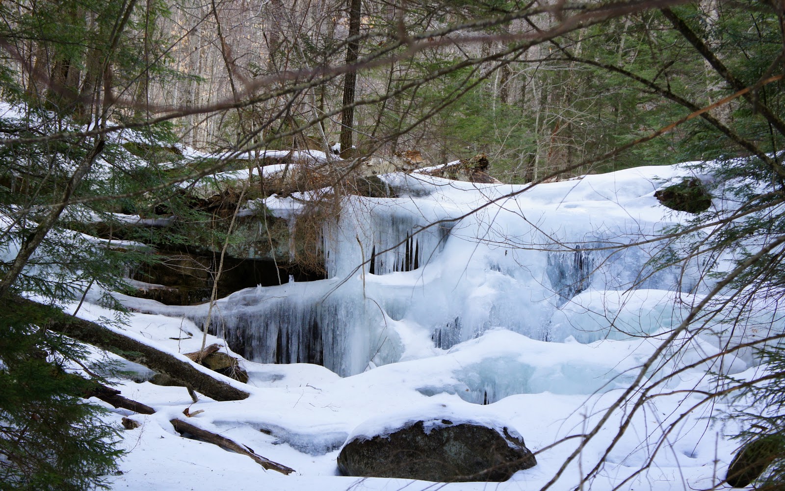
The next two photos show the type of conditions that I encountered as I hiked the Centennial Trail.


En route to Mt. Hayes, there are a number of ledges with restricted views.  I was uncomfortable with venturing out onto any of these ledges since I had no idea what icy conditions might lie beneath the layer of freshly fallen snow.  From the rear of one of the ledges, I snapped a rather bland photo looking southward toward Shelburne-Moriah Mountain (see below).

As I indicated earlier, the snow depth was only around 5 inches, and so breaking through the powdery snow was no problem and required little effort.   However, as I came within a few tenths of a mile from the summit, the snow depth increased to a foot or more.  This made things a bit more difficult.  And, the difficulty was compounded by a herd of moose who had apparently decided to hike the trail earlier in the day.  Since these "hikers" had failed to wear snowshoes, they created deep holes in the snow (known as postholing) which made a very uneven surface.   To truly appreciate what it's like to follow in the bumpy footsteps of a moose, you need to experience it.  A photo is of little help and simply doesn't capture the sensation.
After awhile, the moose tracks headed off in another direction at a point where the trail makes a sharp left and ascends rather steeply.  Most likely, the moose know a way to avoid this steep section since their annoying postholes rejoined the trail at a point where it leveled off.   Perhaps those who design the layout of trails should consider using the route followed by the moose in winter?!
Upon reaching the easterly summit of Mt. Hayes, my much dreaded wind was there waiting for me!  In the next photo you can sort of see the blowing snow in the middle of the snapshot where the snow and trees meet.  (You might need to click on the photo to enlarge it.)

From the easterly summit of Mt. Hayes, I trudged onward for another 0.3 mile where the trail ends at a junction with the Mahoosuc Trail.  By this time, the wind was beyond my comfort level.  Nonetheless, I went the extra distance and trekked for another 0.2 mile to reach the true summit of Mt. Hayes.   By the time I got there, windblown snow was swirling all around me and I didn't even want to pull out my camera.  I was no longer having fun!
There was definitely no desire to continue onward for another 0.3 mile to reach the ledges on the southwest end of the summit.  There are nice views from those ledges, but I'd just been there in March 2011 when I hiked to Mt. Hayes via the Mahoosuc Trail.  My Blog report for that 2011 trip has photos taken from those ledges (Click HERE).
After the decision was made to end my journey, I turned around and headed back for the Centennial Trail.  Mother Nature is amazing!  The wind had already filled in my tracks.  You would never know that I'd traveled this section of the Mahoosuc Trail less than 20 minutes ago.
The Centennial Trail is more sheltered from the wind.  Therefore,  once I reached that trail my footsteps were once again visible.  And so, with the benefit of my trailbreaking endeavors during my ascent, the descent was quick and easy.  I only made one brief stop to attempt to capture the setting sun shining through the forest.  Although the next snapshot is not the greatest, it perhaps will provide a general idea of the scene I was attempting to capture.

To sum it up, any day spent hiking in the woods is a good day, at least from my perspective.  Although no stunning views were experienced on this hike, I have no regrets.  Overall, it was an enjoyable day!

21 February 2012

Trekking to Mt Carr in Recent Times and 125 Years Ago

You couldn't see far from Mt. Carr!  That was certainly a true statement on 19-February when my friend Marty and I trekked up the western slope of this mountain via the Carr Mountain Trail near Warren, NH. The weather forecast called for clear skies by early afternoon.  But as often happens in the mountains, weather predictions can be less than accurate.

Since we experienced very little in the way of views from the top of this 3,453 ft foot mountain, there isn't much to share in terms of photos.  Even in ideal weather conditions, Mt. Carr only offers "stand-up" views.  These are best experienced from some concrete steps that are part of the remains of an old fire tower that once stood on the summit.  And although you cannot sit and enjoy them, Steve Smith (the consummate "mountain wanderer") says that you can see the summits of 31 of the White Mountain's 4,000 footers from Mt. Carr.  

The panorama photo (shown below) was taken from a ledge near the fire tower.  On this day, it didn't much matter where you stood.  This photo is certainly not presented for its "artistic quality", but rather just to demonstrate the viewing conditions that we experienced.

The clearest view (relatively speaking) was of Mt. Moosilauke, as seen in the next photo.

During our ascent to Mt. Carr, we took a short detour to hike the 0.2 mile spur trail to Waternomee Falls.  As would be expected in February, the falls were frozen, but a pretty sight nonetheless (photo below).

Regarding conditions along the Mt Carr Trail, things were overall in good shape.  There were a few blowdowns, but all were easy to negotiate in one manner or another.  The  trail had a light layer of firm snow from trailhead to summit.  Microspikes were worn for the entire hike.

That concludes the report about the trek Marty and I undertook to Mt. Carr.  However, Steve Smith filed a much more complete report on his Blog (click HERE) for a trek to Mt. Carr that was done on a day in May 2011 when viewing conditions were much more favorable.

Also, I found it fascinating to read a Trip Report of a trek to Mt. Carr that was done 125 years ago in 1877.   This report was filed in June 1988 edition of Appalachia (Volume 5, page 151-155).  It's publically available on the Internet via GoogleBooks.  I've excerpted the portion of the report which I found to be most interesting.  (If you want to read the entire report, click HERE.)

To sum it up,  probably most readers would agree that hiking isn't solely about the views.  There are other significant components such as the camaraderie of hiking with a friend.  Plus (as was true with this trek), there can sometimes be interesting historical tidbits to be learned about your hiking destination. 

And lastly, there can be unexpected views just travelling to and/or from the trailhead.  As we were travelling along Limekiln Road, we happened to hit it just right for a sunset view of the Hogsback and Sugarloaf Mountain (photos below).

15 February 2012

From Missile to Grave: A Trek to Mud Pond (Tunnel Brook)


My wife was unimpressed with the venue that I selected for the hike which I undertook on Valnetine's Day.  Why could I not have included a destination in my itinerary with a romantic-sounding name such as Lovequist Loop, or Hart Ledge?  Where was the romance in my decision to go to yet another spot in the White Mountains that is named Mud Pond?
There was only a roll of the eyes when I proffered that the trail leading to this particular Mud Pond is called the Tunnel Brook Trail.  You know, "tunnel", as in "tunnel of love"!  Ah well! I suppose I'll never be accused of being a hopeless romantic, perhaps just hopeless! :)
In the title of this report are the words "Missile to Grave".   There is a reason for this!!   I started my day with a visit to a missile, and finished the day with a visit to an old graveyard.  The trek to Mud Pond is merely what I did in between!
As to why I began my day with a visit to an old Redstone missile, it just so happens that Warren, NH was on my route of travel to the trailhead for Mud Pond.  I can safely say that Warren is the only New England village to have such an adornment on its town square.   As to why the missile is here, please read the inscription included with the next photo. (And if you're really interested in learning more, then click HERE for more information.)

My day ended with a visit to an old graveyard in the tiny village of Glencliff, NH.  (Shown below is a snapshot of the graveyard which was taken as the sun was setting.)

The majority of the headstones are unreadable since the inscriptions have succumbed to centuries of weathering.  And I do mean centuries!  On one of the headstones that was readable, the year 1813 is inscribed as the date of death. (Clicking on the image will enlarge it.)

As to why I ended my day with a visit to a graveyard, that is a bit complicated.  I wanted to hike to Mud Pond by starting from the southern trailhead for the Tunnel Brook Trail.  However, this trailhead isn't safely accessible due to the intense logging operations that are now in progress on Long Pond Road.   So, to reach the Tunnel Brook Trail, I parked on a widened area on the shoulder of High Street, and from there I launched a short bushwhack through the Benton State Forest.   The area where I parked is close to the old graveyard.  Since I had some remaining daylight at the end of my trek, I decided to visit this spot.
Okay, now I'll finally describe the middle part of my day, which was the trek to Mud Pond.  The short bushwhack (about 0.2 mile) at the start of my hike had an unexpected surprise.  Just before crossing frozen Slide Brook to reach the Tunnel Brook Trail, I happened upon the ruins of what I presume to be an old sawmill (see photo grouping below).
[NOTE: Subsequent to posting this Blog,  some well-founded speculation about this structure was received from a knowledgeable person in Gorham, NH.  There is a strong possibility that this was an early 1900s electric-power plant.  Please click HERE for a discussion about these ruins.]

Upon reaching the Tunnel Brook Trail, there was no evidence of human foot-traffic.  This was no surprise, not only due to the logging operations, but also because this route isn't heavily travelled in the winter months anyway.  The trail was in great shape with no major blowdowns.  The snow depth was minimal and I was able to wear Microspikes for the entire trek.
For those who are unfamiliar with the location of Mud Pond, it is situated in a deep valley (the "tunnel") between Mt. Moosilauke and Mt. Clough.  This area is sometimes referred to as Tunnel Brook Notch.
My previous treks to Mud Pond have all been launched from the northern trailhead, and they have all been done during summer months.  And so, the southern approach route was new to me, as was the trek to this spot during the winter.   As you might expect, the scene at Mud Pond during the winter is quite different from the summertime view.  This stark contrast is shown in the next photo which compares a snapshot taken during this trek versus one taken during one of my summer hikes to Mud Pond.

There is a chain of about 7 other smaller ponds just a short distance to the north of Mud Pond.  These ponds are the result of beaver activity, and the collection is sometimes referred to as simply the Tunnel Brook Ponds.  From many locations along these ponds, there is a view Mt. Moosilauke's South Peak (snow-capped peak seen in the next two photos).


Since there was so little snow in the area around the ponds, and since I had some extra time, I decided to go part way up one of the many slides on the east side of Mt. Clough.  This provided me with a birds-eye view of a couple of the ponds, as well as another look at snow-capped South Peak (see photo below).

To sum it up, my "missile to grave" hike was another one of my rather curious adventures.  Although it was fun for me, perhaps for others, not so much.  :))

/////////////////////////////////////

POSTSCRIPT NOTATION (Added 17-Mar-2012):  It just came to my attention that in February 2012, the High Street Cemetery in Benton (photos above) was added to the New Hampshire State Register of Historic Places.  This cemetery is the last remaining resource that conveys the history of the town’s early High Street area settlement, which was bypassed by most industry and transportation.  Stories of the pioneers who settled this remote, rugged area are told by the cemetery’s 46 grave markers, the oldest of which dates to 1812 and the newest to 1877.

09 February 2012

A Short Loop: Shelburne's Mt Cabot, and Wiggins Rock

This is another one of those hikes that will likely be of little interest to most folks.  However, I decided to post it anyway.  My thought is that it's worth it, even if only a handful of folks find it helpful, or if it inspires someone to get out into the woods for just a short hike.

The Berlin, Gorham, Shelburne area offers opportunities to launch major hikes to 4K peaks, as well as a variety of shorter hikes.  While in the Shelburne area On 08-February, there was only enough time for a short hike.   I opted to do a loop hike to the little mountain named Mt. Cabot, which is only 1,512 ft elevation (versus it's 4,170 ft  "big brother" of the same name which lies to the west in the Pilot Range).

This loop involves two trails, i.e. the Red Trail and the Blue Trail.  I did the loop in a clockwise fashion by ascending Mt. Cabot via the Red Trail and descending via the Blue Trail.  The elevation gain is just under 800 ft regardless of whether the loop is done clockwise or counterclockwise.  The total distance for this loop is only about 2.5 miles.  I added another 0.4 mile by doing a short side-trip to Wiggins Rock.

Besides only having a limited amount of time to hike on this day, my other motivation for doing this particular short loop was to check out Mt. Cabot's  improved views which are a result of the fine work done the Shelburne Trails Club (STC).

I began the hike from the Philbrook Farm Inn.  The personnel at the Inn cheerfully accommodated my request to park at the far end of their lot.  How many trailheads look like this (photo below)?!

Conditions were such that I wore snowshoes from start to finish. The photo below shows a typical scene along my route.

Also along my route, was the trail sign shown in the next photo.  I guess that someone had a "bone to pick" with this sign (Ha! Ha! . . . very bad joke!)  Regardless, I'm certain there must be a story to be told about how the bone ended up atop the trail sign.

Upon arriving at the top of Mt. Cabot, I made the slight descent to the ledge just a hundred feet or so off the west side of the trail.  I must say the STC did a marvelous job of opening up the views of the Presidential Range from that ledge (see photo below).  (Please be advised that for now, there is no signage pointing to this short spur trail leading to the ledge.  However, I'm certain that the STC will have a sign in place sometime later this year.)

As mentioned at the top of this report, I extended my trek to make a short side trip to Wiggins Rock where there is a limited view toward the Presidentials (see photo below).

To sum it up,  there's little else to say about this little hike, other than it was an enjoyable romp in the woods.   Another way to look at it is that a short hike is better than no hike!

05 February 2012

A Beautiful Day of Trekking in Easton, NH (Cooley Hill and Mud Pond)

Regardless of whether you did a trek to the high peaks, or simply hiked at the lower elevations, 05-February was a gorgeous day for hiking!

On this particular day, I opted to hike in the Easton, NH area by visiting Cooley Hill via the Jericho Road Trail, and I also did a short ramble to Mud Pond.  You might ask how many ponds in New Hampshire are named Mud Pond?!  In addition to the one in Easton, I can think of at least four other identically-named ponds in the White Mountain region alone, i.e. one each in the areas of Jefferson, Lincoln, Thornton, and Benton.

Easton's Mud Pond is located very near the trailhead for the Jericho Road Trail.  This was my first visit to this spot.  It is only about 400 ft off the east side on NH 116, and I've driven past it countless times over the years.  It's not visible from the road, and as they say, "out of sight, out of mind"!  In Steve Smith's book "Ponds & Lakes of the White Mountains", mention is made of a path leading down to Mud Pond from NH 116.  I didn't take time to look for the path.  Instead, I just parked on the shoulder of the road, then plunged into the open woods and headed straight for the west end of the pond to get a view of South Kinsman poking above the pond's east end.

The photo below shows the view from the west end of Mud Pond (Easton).

For anyone unfamiliar with the location of Mud Pond and/or the Jericho Road Trailhead, perhaps the map below might help. (Click on map to enlarge it.)

Not that it matters, but my trek to Cooley Hill was done earlier in the day before doing my short romp to Mud Pond.  Okay, regarding Cooley Hill, this was only the second time I've hiked to this location.  On my first hike there several years ago, I met a Forest Service crew who had just completed opening up a view on the east side of the trail about 0.1 mile from the old Cooley Hill fire tower, which is where the trail ends. 

The next photo shows the view opened by the Forest Service crew.  The vista includes mountains in the Kinsman and Franconia range.

Besides this view, there are at least two other "unofficial" viewpoints.  One is located at about 1.7 miles from the trailhead (at about 2,000 ft elevation).  If you do a short 400 ft bushwhack eastward from the trail, you'll find an old logging cut that provides a view of the Kinsmans (see photo below).

The other "unofficial" viewpoint is about a tenth of a mile northward beyond the ruins of the old fire tower.  There is some faint semblance of a trail, but it's mainly a mild-mannered bushwhack.  This view is also the result of old logging cuts.  The next photo (highly zoomed) was taken from this spot and it shows a northward vista.  I'm uncertain, but I think the feature on the far left of the photo (on distant horizon) is the Willoughby Gap in Vermont.

Okay, so what about the fire tower that I've mentioned above!  About all I know is that it was a 40 ft tower built in the 1930s and removed in the 1950s.  The photo below shows the ruins of this old tower.

And, for anyone interested, here are a few details about the hike to Cooley Hill.  The trailhead for the Jericho Road Trail is located on NH 116 (1.9 miles north of its junction with NH 112).  The trailhead sign (photo below) shows a distance of 3.3 miles.  The White Mountain Guide says 3.2 miles, and it describes the trail as ". . . originally constructed as a horse trail and mostly follows logging roads of varying ages".

This little-used trail is never overly steep.  It gains 1,250 ft elevation which is spread out over the trail's distance of just over 3 miles.  On the day of my hike, the trail was in excellent condition with only a light layer of snow atop an underlayment of ice.  Microspikes were worn for the entire hike.  Overall, it was a very enjoyable walk in the woods with many trailside scenes such as shown in the next photo.

As I mentioned at the outset of this report, it was a simply beautiful day on 05-February.  There were picturesque vistas along the highway driving to and from the trailhead.  On my way home, I pulled to the shoulder of NH 116 to take a snapshot of Cannon Mountain and surrounding area (see photo below).

And then, I made a slight detour en route to my home in Bethlehem to stop by a farm in the Sugar Hill area.  At this location, I (along with a solitary horse) enjoyed a fabulous view of the sun setting over the Franconia Mountains (see photo below).

To sum it up,  this was one of those days in the mountains that you wish would come around more often.  But then again, if days such as these were more common, perhaps they would become less special!