Pages

About Me

My photo
Bethlehem, New Hampshire, United States
E-mail contact: randonneur8@yahoo.com | Facebook: facebook.com/1HappyHikerNH

Text Above Search Box

SEARCH MY BLOG USING TEXT BOX SEEN BELOW:

30 August 2011

Hiking in New Hampshire in the Aftermath of Hurricane Irene

Under the Trail Adopter programs of the White Mountain National Forest (WMNF),  and the Appalachian Mountain Club (AMC), I have volunteered to maintain five hiking trails.   It might potentially be of interest to some to learn what I've recently experienced while doing maintenance on three of these five trails in the aftermath of Hurricane Irene.  The three trails are as follows:

1) Osgood Trail (0.8 mile segment from Great Gulf Trail to Osgood Tent Site)
2) Osgood Cutoff Trail (entire 0.6 mile trail)
3) Ammonoosuc-Around-the-Lake Trail (entire 1.2 miles)

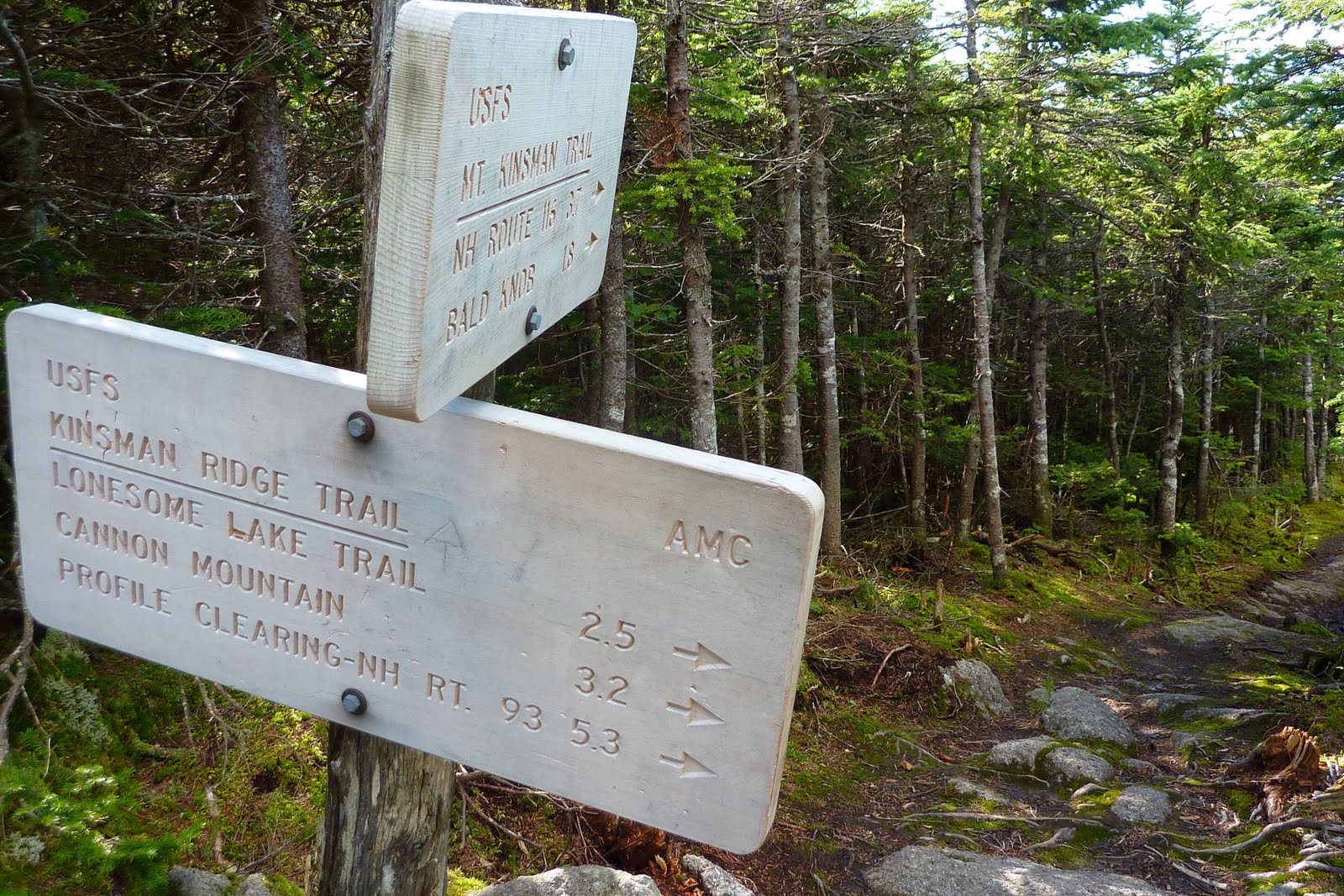
OSGOOD + OSGOOD CUTOFF TRAILS:  For maintenance of these trails, I normally hike a nearly 6 mile loop that includes a 1.8 mile segment of the Great Gulf Trail + an 0.8 mile segment of the Osgood Trail + the 0.6 mile Osgood Cutoff Trail + another 0.9 mile segment of the Great Gulf + a repeat of the 1.8 mile segment of the Great Gulf Trail hiked at the beginning of the loop (see map below). NOTE: Clicking on the map, or any photo in my Blog, will slightly enlarge it. 

On 30-August, I hiked the aforementioned route.  Other than a few minor blowdowns, there was amazingly barely a twig that was out of place!  Most importantly, there was no evidence of trail erosion.  All 40+ of my water bars held up great!  The only minor erosion was on the west side of the suspension bridge that crosses the Peabody River.  Here, there is evidence to suggest that the river "jumped" its banks.   Actually, I even saw a dead fish ON THE TRAIL just a few feet from the suspension bridge!  Over my many years of hiking, this was the first time I'd ever encountered a fish in the middle of a hiking trail!  (In the next photo, the fish can be seen at the bottom center of the snapshot.)

Since there were so few issues to address on this maintenance mission,  I did a short "add-on" to my normal route.  I easily crossed Parapet Brook,  and then hiked a short (maybe 0.1 mile) segment of the Madison Gulf Trail (northbound).  There were no issues along this short segment.

Next, I had just begun to hike a short portion of the westbound Great Gulf Trail (beyond the junction with the northbound Madison Gulf Trail).  I soon met a hiker who indicated that he had just returned from a hike on the Great Gulf Trail up to the junction with the Wamsutta Trail.  He said he had encountered negligible problems, and had turned around only because he couldn't safely cross the West Branch Peabody to access the Six Husbands Trail!

Although the water level in the area's rivers was still a bit high (especially for August), the rivers were flowing well within their banks.  Shown below is a snapshot of the Peabody River taken from the Great Gulf Trail suspension bridge.
-----------------------------------------------

AMMONOOSUC-AROUND-THE-LAKE TRAIL:  For this hiking trail, there are two wooden bridges over a brook.  Neither bridge was washed away as a result of the hurricane.  The only spot along this trail where there was some evidence of storm-related erosion was near one of the bridge abutments.  It appeared that the brook had "jumped" its banks and washed away some surrounding soil.

There was one major blowdown.  However (for whatever reason) this is pretty much the norm for this short 1.2 mile trail.  Each time I do maintenance on this trail, there is usually at least one fallen tree to be removed!  The photo below is a composite which shows the blowdown blocking the trail, and then the trail as it appeared after the blowdown was removed.

-----------------------------------------------
I have one other photo to show.  It was taken along the 0.9 mile segment of the Great Gulf Trail that is located between the west end of the Osgood Cutoff and the Osgood Trail junction.  This is not one of my adopted trails.  However, this trail is used as part of the loop that I use to access my trails.

I  want to extend my appreciation for the excellent trail-hardening work that has recently been done on this trail (see photo below).  Your hard work has paid off!  Even with the amount of rain produced by Hurricane Irene, the places along this trail that normally would have been very muddy were only slightly muddy.  Job well done!
   
Later this week, I’m hoping to assess one of my other adopted trails by hiking up the Cherry Mountain Trail (from Rt. 115) in order to access the Martha’s Mile Trail.  After that, I'll just have one more of my adopted trails to check out, i.e. the Mt. Tremont Trail.  Accessing this trail might be tricky due to the highway washout issues along Rt. 302!

To sum it up, thus far I've been pleasantly surprised with the minimal damage caused by Hurricane Irene.  However, I fully realize that my experience is limited to just a very few miles out of the hundreds of miles of trail in the area impacted by the hurricane.  I'm hoping that my experience will be representative of the general conditions on other trails.  Within the next few weeks, other folks will be reporting their experiences.   This will produce a much clearer picture of the overall damage to the hiking trails that was caused by the hurricane.
--------------------------------------------
ADDENDUM (added 02-Sep-2011):

Other reports indicate that there has been significant damage to some of the trails, as well as to some of the roads used for accessing trailheads.  Shown below is a link which provides useful information relative to trails and roads.
http://www.fs.fed.us/r9/forests/white_mountain/conditions/

23 August 2011

A "Reel" Good Approach Route to the Kinsmans!

Wow!  What a terrific approach to South and North Kinsman mountains!  Over a year ago I'd been told by the veteran hiker Steve Smith that a scenic and interesting way to visit the Kinsmans is to do an 11.5 mile trek which begins at the Reel Brook Trail and exits via the Mt. Kinsman Trail.   On 23-Aug-2011, I decided to embark upon this adventure.  I'm so glad I did it!  As indicated in the title of this report, it is a "reel" good approach route.  It has to rank high on my list of favorite hikes I've done over the years.

I'm uncertain as to the best way to present the details and photos from this trek.  So, I'll just use a conventional chronological recounting which starts with my trek up the Reel Brook Trail.  The hike along this trail was pleasant, but quite uneventful.  Despite being a lightly-used pathway, it's generally well-maintained.  A few sporadic blowdowns were easily negotiated in one manner or another.  And, the multiple water crossings were very doable.

In less than 2 hours, I arrived at the junction with the Kinsman Ridge Trail.   The trail sign at this junction appears to be quite old and weathered. I wonder if the numbers stamped on the edge of this sign indicate that this sign has been at this location since around 1985? If so, that sign has certainly seen a lot of weather over the past quarter century! (Note: Clicking on any photo in this report will slightly enlarge it.)

From this trail junction I headed northbound on the Kinsman Ridge Trail (KRT).  Within 15 minutes I came to the point where the power lines cross over the KRT.  I'll simply say that this spot offers an "obstructed" view toward Bog Pond.

The next stop on my northbound trek along the KRT was the newly reconstructed Eliza Brook Shelter.  The hardworking crew did a fabulous job on this project!

After leaving the shelter, it wasn't long before I came to the stretch of trail described in the White Mountain Guide as ". . . a very scenic section of Eliza Brook with several attractive cascades and pools."   Phew!  Maybe I'm just easily impressed, but in my opinion, the word "attractive" is an understatement!  The cascades along this stretch of trail are awesome, and numerous!  After awhile, I simply stopped taking photos.  There is just one beautiful cascade after another.  I can't believe that these gorgeous places are unnamed!
Shown  below is the first cascade that I came upon.  It's difficult to get true perspective from this photo, but it's a rather small cascade. I thought, okay that's cute!  So, I snapped a photo and thought this would be the type of cascade that I'd encounter all along the brook.  WRONG!

Shortly after encountering that first cascade, I came upon a larger one (next photo).  What a picturesque cascade!

The next photo is a side view of the same cascade shown above.

I was then totally surprised to encounter a cavalcade of other cascades.   Shown below are just a couple of them.


Following the delightful scenes along "cascade alley", I made the steep climb up to Harrington Pond which is a watery spot that is totally different in nature.  Perhaps the word primeval is an appropriate way to describe this place.  One could almost envision a dinosaur grazing here!

If nothing else, I think it's fair to say that this pond has its own unique beauty, especially at this time of year when the reddish Pitcher Plants are abundant around the perimeter of the pond.

And just for good measure, the next photo shows one more scene from the area around Harrington Pond.

Although this was the first time I had taken this route to the Kinsmans, it wasn't the first time that I had visited Harrington Pond.  In March 2010, Steve Smith and I bushwhacked to this location from the Reel Brook Trail.  We experienced some unique wintery scenes from the shore of the  pond, as well as from a little ledge above the pond.  (Click HERE if you're interested in a report of that adventure.)
After lingering awhile at Harrington Pond, it was time to move onward to the next major scenic spot along my route.  
Next stop . . . South Kinsman!
En route to South Kinsman, there were small patches of mushrooms which I thought were photo-worthy!

Just before reaching the top of South Kinsman, I took a short detour along a little spur path where I could look back at Harrington Pond.  Gheez! The pond looks way far down there!  I guess it really is quite a climb from Harrington Pond up to South Kinsman!

Oh! And what was the reason for all the helicopter activity in the mountains on 23-August??  I heard them off and on all day long, but couldn't actually see one until I arrived at the top of South Kinsman.

The views from South Kinsman are extensive.  However,  clouds were casting shadows on the mountain vistas which resulted in some generally unimpressive photos.  The next photo shows one of the views from South Kinsman.

Following a short rest on South Kinsman, I departed for North Kinsman which was my last major target of the day.  I don't know why, but I've always enjoyed that short trek between the two Kinsmans.  Perhaps it's because of pleasant little vignettes along the trail such as shown in the next photo.

Upon arriving at North Kinsman, I headed directly down to my favorite ledge that overlooks Kinsman Pond.  The lighting conditions were not the best, and therefore the next photo is also not the best!  Nonetheless, it gives a good idea of the view from this splendid little perch.

For the majority of the time that I was sitting on this ledge, the clouds were casting dark shadows on the Franconia Range.  However, for a few brief shining moments, the mountains were illuminated and I managed to capture the image shown below.  (Lonesome Lake is in the shadows at the bottom center of the photo.)

It was getting late in the day and so I headed down North Kinsman via the KRT to intersect with the Mt. Kinsman Trail.

The 3.7 mile descent along the Mt. Kinsman Trail was generally uneventful.  However, there are some spots along this trail that I find picturesque, such as the little cascade shown in the next photo.

And, there is a particular brook crossing that I also find attractive (photo below).

As was the case for my recent hike to Mt. Garfield (click HERE for that report), my wife was agreeable to drop me off at one trailhead in the morning, and then pick me up at another trailhead at the end of the day.  Since both trailheads are less than half an hour from our home, this arrangement worked out fine for both of us.
To sum it up, this was one heck of a trek!  It's difficult to pick out a favorite feature since there were so many.  The multiple cascades along Eliza Brook were a total surprise.  Also, it was terrific to make a return visit to Harrington Pond during a different season of the year.  And, of course, visiting the Kinsmans is always an awesome experience!

21 August 2011

Meanderings around North Sugarloaf (Zealand Area, NH)

Many folks would agree that sometimes it's fun to simply meander with no particular destination in mind.  One of my favorite spots for some impromptu roaming is the vicinity of the little mountain named North Sugarloaf (2,310 ft), which is located in the Zealand Valley area of New Hampshire.

As anyone knows who has hiked to North Sugarloaf (or to nearby Middle Sugarloaf), for minimal effort, both of these little mountaintops provide some very nice views, particularly toward the Presidential Range.
The views are certainly one component of why I consider North Sugarloaf as one of my favorite spots to visit.   However, another element pertains to its close proximity to my home in Bethlehem.  In less than an hour (including driving time), I can be atop North Sugarloaf!

From various wanderings over the years, I've discovered different ways of visiting this "neighbor" of mine.  There is, of course, the conventional hiking trail.  And then, there are other ways of getting there via a combination of snowmobile trails and snippets of abandoned trail, and even bushwhacking.  And perhaps best of all, and most important, all my ramblings are on public land!
On a recent rambling, I followed a portion of a popular snowmobile trail that traverses a corridor along the north side of North Sugarloaf.  This trail eventually comes to a "T" junction near the Zealand River.  If you make a right at the "T" and follow this trail southward along the Zealand River you eventually intersect the hiking path known as the Trestle Trail.  But, if you make a left at the "T", then an older snowmobile trail eventually leads you along the south bank of the Ammonoosuc River.

It is so odd how sometimes one thing will lead to another.  I mentioned my trek along the snowmobile trail to my friend Joanne who is a hiker, a librarian, and someone who has a deep interest in White Mountain history.  With little effort, Joanne came up with several references via GoogleBooks which contained photos and detailed information about an old auto/carriage road that once ran along the south bank of the Ammonoosuc River (in the general vicinity between Twin Mountain and the current-day Zealand Road), and eventually terminated at Fabyans.  It's nearly certain that the snowmobile trail closely follows the corridor of this old road (known as the Glacial Ridge Road) that was built in the very early 1900s!  
(NOTE: At the end of this Blog report are links to several articles that Joanne uncovered.)

Using photos publically available in the articles that Joanne found, I was able to roughly match up some of those old photos with snapshots I'd taken during my meanderings.  One such "match-up" relates to a spot where a side-hill cut was required to construct the road.
For the next "match-up" photo (shown below), you'll need to use your imagination!  Although the river is immediately to the left of where I took my photo, it is not visible in my snapshot.  For one thing, the trees have grown up along the river bank over the years; whereas the view is more open in the vintage photo. Also, I'm uncertain if I was standing in the same spot where the vintage photo was taken.  When I next visit this location, I might be able to get a better "match-up" by better positioning myself.  We'll see!
It's easy to understand why a roadway would have been constructed in this location.  It is so picturesque, even today!  Although trees have grown up along the river bank which block many of the views that once were present, you can still find a few open spots that are quite scenic in my opinion.  Shown below are a couple of snapshots.

To sum it up, my recent meanderings had some surprising consequences!  It was awesome to learn about the history of the old roadway that once ran along the south bank of the Ammonoosuc River.   In addition, I gained some additional knowledge about how the old and the current snowmobile trails interconnect in the area around North Sugarloaf.  By using these snowmobile trails (in combination with conventional hiking trails) I can now hike to North Sugarloaf by doing a 4+ mile loop.   This loop is nearly twice as long as other "non-loop" routes I've used.  However, it provides a terrific option when I want more of a physical workout to reach one of my favorite destinations. 

- - - - - - - - - 
REFERENCES:

As mentioned earlier, here are some references that my friend Joanne uncovered relative to the old auto/carriage road that once ran along the south bank of the Ammonoosuc River (in the general vicinity between Twin Mountain and the current-day Zealand Road) and eventually terminated at Fabyans.

Reference 1: Click HERE
Reference 2: Click HERE
Reference 3: Click HERE

18 August 2011

Mt. Garfield - The Long Way!

No, I didn't get lost, nor were any problems encountered which caused me to take a long route to Mt. Garfield.  It was done purposely!   You need to understand that my wife and I share a car, and that this hike was done on a Wednesday (17-Aug-2011). On most Wednesdays, she needs the car which means I rarely do hikes of any significance on that particular day.  However, the weather this past Wednesday was so beautiful.  I simply had to find a way to go hiking!!

Since we live in Bethlehem, the trailheads for the Skookumchuck and the Garfield Trail are just minutes away.  So, my wife agreed to leave me off at the Skookcumchuck Trail in the morning, and then pick me up at the Garfield Trail later in the day.  This enabled her to do her business, and it enabled me to hike.  A marriage made in heaven!

Before deciding upon this plan, I considered doing this route in the opposite direction.  However, some quick calculations showed that the elevation gain was about 200 ft less to do a Skookumchuck-Garfield route, versus a Garfield-Skookumchuck route.   I'd also considered just doing a simple trek up to Mt. Garfield via the Garfield Trail and returning via the same route.  That scenario would have been 2 miles shorter (10 miles versus 12 miles), and about 1,200 ft less elevation gain.  However,  the prospect of ascending and descending via the same route seemed rather boring!  Especially since the Garfield Trail is 4.8 miles long with little to see other than the surrounding woods.

Okay, that's enough about the background to this hike.  So, here are some details about the hike itself!  It took just a bit over 2 hours to hike up the Skookumchuck to the Garfield Ridge.  After a viewless hike up the trail through the trees, it's always quite dramatic to pop out onto a treeless ridgeline with stunning vistas!
There are so many truly excellent views from the point where the Skookumchuck intersects the Garfield Ridge Trail.  I think some of the vistas are comparable to those from Mt. Lafayette (0.8 mile to the south).  One such vista is shown in the photo below that includes the Presidential Range, the Twin-Bond Range, and Mt. Carrigain.
There is also a view toward Cannon Mountain (photo below), but this is a case where the summit of Mt. Lafayette definitely has a view that is better.
After taking a snack break at the point where I popped out onto the ridgeline, it was time to begin my 2.7 mile trek northward to Mt. Garfield via the Garfield Ridge Trail.  This trail has been in existence for nearly 100 years, and it's part of the Appalachian Trail.   And so, I'd guess that thousands of hikers (possibly tens of thousands) have travelled this segment of trail over the years.  Although I've hiked other portions of the Garfield Ridge Trail, this particular segment was brand new for me!

Before starting out, I snapped a photo (shown below) of my destination. Mt. Garfield is of course the pointed mountain in the center of the frame with a huge cliff on the right side of its base.
Speaking of the huge cliff at the base of Mt. Garfield, there was a spot along the Garfield Ridge Trail where  I was able to get a closer view of it (photo below).
At another spot en route to Mt. Garfield, I was able to look back at a portion of the ridgeline that I had descended along the way (photo below).
And last, but not least, my trek over to Mt. Garfield also provided me with the opportunity to visit Garfield Pond, which is only about 150 ft off the Garfield Ridge Trail.  I took one of the many herd paths that lead down to the pond.  This was another first for me!  I'd never visited this particular pond.   One of the many snapshots I took is shown in the next photo.
After thoroughly enjoying my visit at the pond, the climb to the top of Mt. Garfield began in earnest. I was uncertain how intense or steep the ascent might be from this direction.  What a very pleasant surprise!  It was neither intense nor overly steep!

The 360 degree views from Mt. Garfield are superb.  The vistas that I find most appealing are those looking into the Pemigewasset Wilderness.  One of my favorites is the scene of Owl's Head (center of next photo) just sitting out there in the middle of the Wilderness all alone!

Another favorite is the view of Mt. Guyot and the Bonds (next photo).
Further regarding the view shown above, just for the fun of it, I took a photo (shown below) from the ruins of the fire tower atop Mt. Garfield.  I was trying to capture some semblance of how the view might have looked from inside the tower.  My attempt at replicating a view from inside the fire tower was a bit laughable.  But nonetheless, the next photo shows what I got!
The view looking southward along the Franconia Range is another vista from Mt. Garfield that I particularly like.  However, the angle of the sun was such that I was unable to get a really good photo.  After trying several adjustments with my simple "point and shoot" camera, the snapshot shown below is the best I could do.

After hanging out on the summit for about half and hour, I began my long trek down the Garfield Trail.  It took just over 2 hours to descend the nearly 5 mile trek to the trailhead.  Overall, the entire round-trip took just a bit over 7.5 hours, which includes stops along the way for photos, snacks, and a short side-trip to Garfield Pond.

To sum it up, this was a truly terrific day to be hiking!  And, this trek was especially awesome since it involved two "firsts" for me, i.e. visiting Garfield Pond, plus hiking a segment of the Garfield Ridge Trail that was new to me.

14 August 2011

Hiking Along the Canadian Border: Fourth Connecticut Lake


This was an adventure that was completely unplanned!  It all began innocently enough when we decided to take some visiting family members on a tour of northern New Hampshire (far above the notches).  On previous visits they had already been exposed to sightseeing expeditions to scenic locations in the Crawford, Franconia, and Pinkham Notch.

As we were en route to these northern locations, the question was asked as to how far we were from Canada.  We did some quick mental mileage estimates and said: "It's really not that far".  Well, one thing led to another, and we eventually ended up heading for the border!  We knew that we couldn't actually cross the border since no one had come prepared with the required documents to do so.

I had recalled reading a description of a trail that skirted along the U.S./Canadian border and eventually led to the Fourth Connecticut Lake.  Spurred on by this recollection, we continued northward with great gusto!  We completely ignored a sign saying to TURN AROUND HERE if you were not intending to cross the border.   Upon reaching the border crossing, I pulled the car off the side of the road and walked up to a point slightly to one side of the border crossing booth.  I was greeted by an agent who immediately asked if we had come to hike the trail to the Fourth Connecticut Lake (how did he know that??).

The agent pointed to the spot where I should park the car.  He further indicated that once parked, we should walk up the northbound lane of the highway, go past the agent's booth, and then immediately veer left off the road onto the trail.  Oh!  And he also said that I was standing in a hard-hat construction zone and should move to my right to ask him any further questions!!

Shown below is a map which I grabbed from an Internet website after returning home.  It shows the location of the trail, plus it has a few other things labeled, such as where to park, etc. (Clicking on the map will slightly enlarge it.) 
You will undoubtedly note that one of the labels on this map states that the Fourth Connecticut Lake is a "Medium level fen system".  I won't bore you with the technicalities of this term, but if you want to read more about it, then please click HEREOn a less technical note, the Fourth Connecticut Lake (elevation 2,670 feet) is the beginning of the Connecticut River, which is New England’s longest river.

Okay, to get to the trailhead for the Fourth Connecticut Lake hiking trail, you need to take U.S. Route 3 and drive 22 miles north of the village of Pittsburg to the U.S./Canada border. You park on the east side of Route 3 near the U.S. Customs station.  The trail is just beyond the station and heads off to your left (west) along the U.S./Canada border.

Shown below is a photo collage that shows the U.S. Customs station from a viewpoint along the hiking trail.  It also shows the spot where both the U.S. and Canadian flags are flown, which is in close proximity to where you veer left onto the trail.
To my mind, one of the more unusual aspects of this hike is that the U.S./Canadian border runs down the center of the trail corridor in several spots.  You can actually stand with one foot in the U.S. and the other foot in Canada.  The composite photo below shows an example of one of the boundary markers along the trail's treadway, as well as a boundary marker tacked to a tree.
There are some minor inconsistencies between various guidebook descriptions in terms of the total mileage for this hike.  However, a brochure published by the New Hampshire Chapter of the Nature Conservancy lists the round-trip mileage as 1.7 miles (0.6 mile from the trailhead to reach a 0.5 mile loop trail around the lake, plus the 0.6 mile return to the trailhead).  The Nature Conservancy's brochure can be accessed by clicking HERE.

The Nature Conservancy does a great job of maintaining this trail.   There are some segments that are surprisingly steep and rocky, and there are other segments that are generally flat.  Also, some segments are boggy, but the boggiest areas generally have bog bridges that are in good shape.  The trail is easy to follow, and it appears that much of the signage is relatively new.  Shown below is a collage of a few of the signs along the way.
You will also encounter a few other signs here and there which indicate where there are parcels of private land.  Interestingly, all those signs are in French.  But, even if you are unfamiliar with the French language, most likely you would surmise that you are unwelcome to go beyond those signs!  Shown below are a few examples of those signs.
As indicated earlier, the trail is very easy to follow.   This is despite the waist-high undergrowth that lines large segments of the trail corridor.  It's just my opinion, but  think the undergrowth adds a sense of wildness and a certain ambiance (or should I say a certain "je ne sais quoi")!  Shown below is a composite photo showing some of the trailside scenes that I'm referring to.

Besides the trailside scenery, there are also distant vistas of nearby mountains to enjoy.  Shown below is one such vista.
After about 30 minutes or less of hiking, the Fourth Connecticut Lake comes into view   I find it difficult to capture the true essence of places such as this in a photograph.  Perhaps the snapshot below appears to show nothing more than a glorified swamp.  However, when there in-person, there is a definite beauty to this remote spot.   And, at the risk of sounding overly poetic, the remoteness seems to saturate your inner being as you stand there along its shoreline.
There were definite signs of moose activity in the area, however we saw no 4-footed wildlife on our trek.  Although not nearly as dramatic as a moose-sighting, we did spot some other forms of "wildlife" in the form of wildflowers and insects (quite often they were paired with each other). Take a look a the composite photo below.  On the far left is a deep-pink wildflower where a yellow crab spider was partially hidden (center of photo).  Then on the upper right photo is a tiny insect (possibly a mosquito) taking a siesta on a white Turtlehead flower.  And then on the bottom right photo is a busy bee at work. (Clicking on this photo will slightly enlarge it.)
As enjoyable as this adventure was, let's face it, it is a very LONG drive up there for most folks.  This hike would be a nice side trip if you were travelling to/from Canada.   Another option to make this long drive worthwhile would be to preplan some other hikes in the general vicinity, such as Mt. Magalloway, and/or something in the Dixville Notch (Table Rock, etc).  Or, you could do as we did, i.e. simply doing some sightseeing of picturesque roadside settings like the Balsams Resort (photo below).

To sum it up, this hike along the Canadian border was a complete surprise to our family members, and to us!  It was totally unplanned.  Sometimes, surprises can be pleasant, and this was definitely one of those times.