Pages

About Me

My photo
Bethlehem, New Hampshire, United States
E-mail contact: randonneur8@yahoo.com | Facebook: facebook.com/1HappyHikerNH

Text Above Search Box

SEARCH MY BLOG USING TEXT BOX SEEN BELOW:

29 March 2011

A Mountainous Gaze from Mt. Hayes (Mahoosuc Range)


The Mahoosuc mountain range extends from Gorham, NH to Grafton Notch in Maine. Mt. Hayes is the last peak at the southern end of this range, and it's also ranks last in terms of altitude, reaching only 2,555 ft at its summit. The tallest peak in this range is Old Speck at 4,170 ft.

Although it's officially the spring season, there's still plenty of winter to go around! I've been to Mt. Hayes on a number of occasions, but have only ventured up there once during snow-season. That trip was done about 4 years ago using the Centennial Trail. This past Tuesday (29-Mar-2011), I decided to access Mt. Hayes via the Mahoosuc Trail since I'd never done a snowshoe hike using that trail. (By the way, at the end of this report, I'll give some details about parking.)

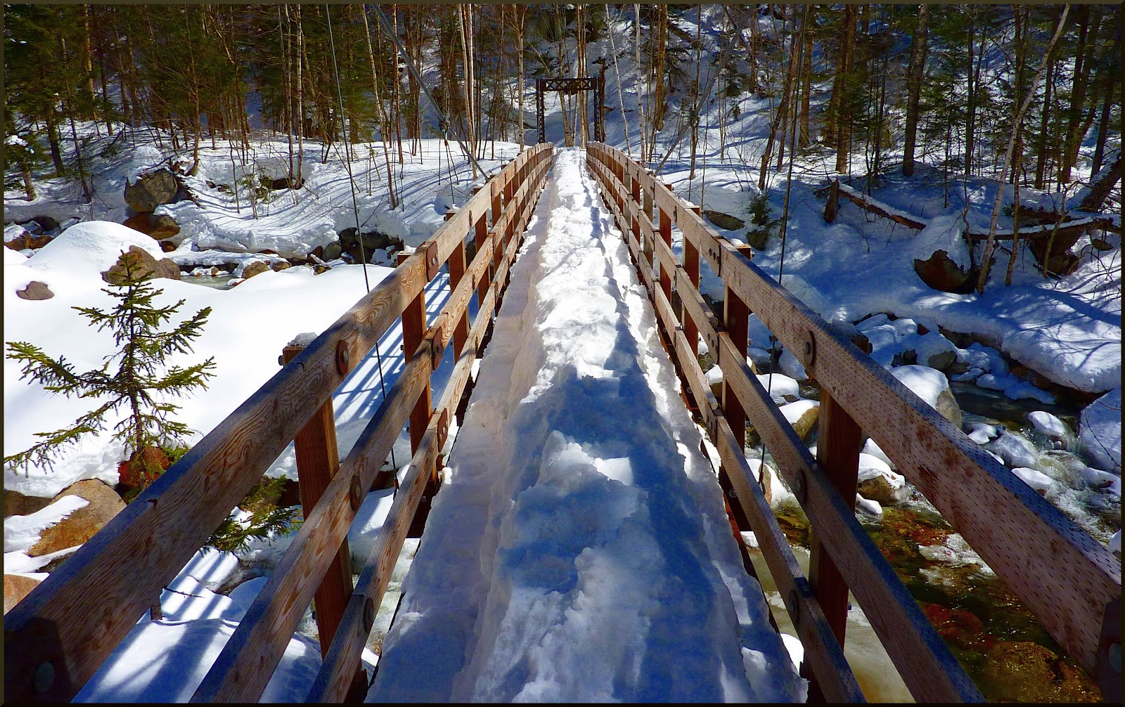
Upon reaching the trailhead on Hogan Road, it was a pleasant surprise to find that there was evidence of human foot traffic along this trail. Although the track consisted of a combination of snowshoe and bare-boot activity, the treadway was overall in pretty good shape.

But, as might be expected (if I'd thought about it), the broken-out trail ended at the spur path for Mascot Pond. From that point onward, the main Mahoosuc Trail was unbroken. There were occasional deep post holes that had been created by moose that had decided to "hike" a segment of the trail here and there.
Although I broke trail for the remainder of my journey, it's really not saying too much!  Fortunately, the snowpack was very firm which allowed me to basically walk on top of the snow.  And actually, since the snow smoothed out all the rocks and roots, I think I made better time than during warm-weather conditions!

In about 1.5 hrs from leaving my car, I arrived at the wide-open ledges located about 0.3 mile from the actual summit of Mt. Hayes. The first thing to catch my eye was something that led me to believe that maybe true springtime conditions are actually coming! It was nice to see that there was a large portion of ledge that was snow-free and dry! It made a perfect spot for lunch.
Although the views were great to experience in-person, the lighting conditions were not ideal for taking photos on this particular day. I'll bore you with just 2 snapshots taken from this ledge.

LOOKING SOUTHWARD DOWN THE PINKHAM NOTCH
VIEW FEATURING MT. MORIAH AND NORTH CARTER
After visiting the ledges, I hiked further northward along the Mahoosuc Trail. I stopped for a moment at the cairn marking the summit of Mt. Hayes, and then continued onward to the junction of the Centennial Trail.
From this junction, I decided to do some exploring off-trail. This exploration provided some decent views. There was a nice vista toward Cascade Mountain, even though it was partially obstructed by trees (SEE PHOTO BELOW).
Also, way off in the distance, there was also a view toward the Pilot Range. The highly-zoomed snapshot below shows this particular vista. (It's by far not the best photo I've ever taken!)
After my little off-trail exploration, I began the return-leg of my journey. When I arrived at the spur trail for Mascot Pond, I opted to do take the 10 minute side-trip just for the heck of it. None of the snapshots taken from there were particularly inspiring. However, I will show one photo (SEE BELOW) taken from this location. It's looking toward the entrance to the old mine shaft (circled in red) which is located at the base of Leadmine Ledge.
I didn't take the time to remove my snowshoes in order to trek up to the old mine on the loose gravel surface. However, I've been up there during warm-weather months and have taken photos such as the one shown below.
The entrance to the mine shaft has been barricaded not only for human safety, but also for the safety of the bat population that lives there. Click HERE for an interesting link that contains additional information about this.

After my brief visit to Mascot Pond, I retraced my steps back to my parked car. Along the way, I took the photo shown below. It's looking down the canal toward the powerhouse with Imp Mountain and North Carter in the background.

TRAILHEAD PARKING:
Okay, as to where I parked, here goes! As you know, the trailhead for the Mahoosuc Trail in Gorham is sort of in "no-man's land", especially during snow season when Hogan Road is closed. The current White Mountain Guide (28th Edition) only provides directions via the Hogan Road approach. Since the road is closed to automobile traffic in winter that would mean doing a 4.5 mile road-walk. I didn't do that!

The sign at the trailhead (SEE PHOTO BELOW) contains the words "US Rt. 2 VIA RAIL TO TRAIL". Those words are preceded by an arrow pointing in the direction from which I had come. The sign further indicates it is 2 miles to some point on Rt. 2. Wherever that point might be, I didn't park there either! Actually, it's unclear to me if the sign is even directing you to a parking spot??
Public parking is permissible in a lot at the base of the old B&M railroad bridge on the east side of US Rt 16. This is where I parked. The lower deck of this bridge is available for pedestrian use. It's perfectly safe to cross on-foot, especially since metal decking has been installed within recent years.

Once you walk over the bridge to the other side, you will immediately see a huge sign that points to "AMC Trail" (SEE PHOTO BELOW). And, all along the way, there are additional signs and blue blazes that guide you to the trailhead. This route does NOT take you over the dam at the powerhouse! (As the current White Mountain Guide correctly points out, it is no longer permissible to cross the dam at the east end of the canal where the powerhouse is located.)
I think it should be said that even though I parked in the public lot at the base of the old B&M bridge on Rt. 16, this location is not sanctioned as trailhead parking (at least that is my understanding). Therefore, each person would need to decide for themselves whether to use this as a launch point for a hike to Mt. Hayes on the Mahoosuc Trail.

TO SUM IT UP: It's a great half-day hike up to the ledges on Mt. Hayes. Yes, some of the views from this ledge incorporate the village of Gorham in the line of sight. However, I don't let that discourage me from visiting this spot now and then since the views from there are quite nice, at least in my opinion!
---------------------
ADDENDUM:
Since publishing my report, I've received the following E-mail communications.

1) The following was received from a Gorham resident.

“The walkway under the trestle and the conversion of the upper deck to a snowmobile bridge was done by the town of Gorham with state funds. The state owns the trestle and the parking area adjacent to the trestle, so it's perfectly legit to cross over the river via either the upper or lower deck. Brookfield hydro owns the RR right of way from the trestle to the papermill upriver, so the AMC has elected not to maintain the trail in this section. The "AMC trail" signs between the trestle and the trailhead were installed by Brookfield and are their recommended route around the hydro station which is now gated off on both sides.”

2) The following was received from an AMC spokesperson in regard to the sign at the trailhead for the Mahoosuc Trail which gives a mileage of 2.0 miles to Rt 2.

"We changed the mileage on that sign to reflect the change in distance when hikers were no longer allowed to cross the dam and when the lower deck of the trestle by VIP Auto Parts in Rt 16 in Gorham was closed off for hikers and there was no plans to repair it. This added some distance walking the roads and rail-to-trail from the RT 2 Snowmobile parking area just a little past KFC . . . the State was able to provide the funding and repair and reopen the lower deck for hikers allowing them to park and cross at RT 16 once again. Simply, this sign [has] not yet reflected that change . . . I have CC'd . . . the AMC Trails Supervisor . . . so he can add this sign to his project list for 2011."
--------------------

Leaving a comment via this Blog is always appreciated. However, if you prefer to ask a question or make a comment via a personal E-mail, then you may contact me at: randonneur8 at yahoo dot com.

27 March 2011

Exploring a Wilderness within a Wilderness (Presidential Range-Dry River)

Sometimes I get a yearning to do a totally goofy bushwack to explore a small geographic feature that shows up on Google Earth. Yesterday (27-Mar-2011) was one of those days! I'd noticed that there was a "white strip" that shows up on Google Earth along an unnamed drainage to the east of the Dry River valley (located within the Presidential Range-Dry River Wilderness).  My "target-area" is circled in red on the image below, and is identified with a red arrow on the topo map.
My game plan for reaching this "white strip" was to hike the Dry River Trail for 1.7 miles to the suspension bridge, then cross over the bridge and begin looking for a good spot to head off the trail in an easterly direction.

The Dry River Trail was well broken out by a combination of snowshoe and XC-ski traffic. It continued to be broken out (for some unknown distance) beyond the point where I left the trail. I always enjoy the hike up to the suspension bridge. The Dry River itself provides some eye-pleasing sights. On the day of my hike, the river was flowing rather slowly since it was sort of in a partially-frozen state.
And although the Dry River is very attractive, there is a sight that is even more picturesque while en route to the suspension bridge. Of course, I'm referring to the spectacular view of Mts. Washington and Monroe perched on the headwall of Oakes Gulf. The two snapshots below show this impressive scene. (The second photo is obviously zoomed.)
Most certainly, I'm not the first person to have made this discovery, but nonetheless, this was the first time for me! By going just slightly downstream from the suspension bridge, you can get a view of the bridge with Mt. Washington in the background. The snapshot below shows what I'm talking about.
Crossing the suspension bridge was slightly complicated by a huge "monorail" on its decking. Considering the two handrails on either side, should this be considered as "the third rail"? If so, should you touch it?! :)
After crossing the bridge, I very quickly selected a point to leave the trail and launch my bushwack to investigate the "white strip" that I'd seen on Google Earth. The woods were wide-open and so there were very few bushes to whack! Early on into this trek, it became apparent that the journey into the wilderness though these gorgeous open-woods was a worthwhile adventure, even if the "white strip" turned out to be nothing noteworthy. The snapshot below shows a couple of typical scenes along the way.
When I eventually arrived at the "white strip", it was less dramatic than I had hoped it might be. It consisted of an expansive snow-covered area on the SSE bank of the unnamed brook. To access this area, I crossed the brook on an ice/snow bridge.  During the warm-weather months, I have no idea if this wide-open area is a dry ledge, or possibly part of a cascade. Regardless, shown below is a snapshot taken while standing on the ledge/cascade.
There were some attractive ice formations along this unnamed brook. The photo below shows one of them.


TO SUM IT UP: This was a very entertaining adventure. I always enjoy the picturesque hike along the Dry River Trail to the suspension bridge. And, although the mysterious "white strip" turned out to be less scenic that I'd hoped for, the trek over to it through the wilderness was great fun! As often happens, the journey provides as much joy as the destination.

---------------------------------
ADDENDUM (added 04-Apr-2011):

A reader of this Blog sent me an E-mail asking for additional details about my route for the bushwhack portion of my trek. In case other readers might be interested in my response, it is summarized below.

I need to mention that the reader suggested a nickname of "White Spot Brook" for the nameless brook that I visited, and so that's how I'll refer to it!:)

Included in my response was the map shown below. The red line shows the route that I took. As can be seen, I crossed the suspension bridge and went just a short distance northward on the Dry River Trail, then soon left the trail and began bushwhacking in an ESE direction.
After I crossed the bridge, I could have bushwhacked southward along the east bank of the Dry River, and then worked my way up White Spot Brook. However, before embarking on this exploration, I had decided that I didn't want to fight my way up the steep & narrow corridor of White Spot Brook. I wanted to go directly for the "white spot" at the upper end of the brook to check it out first.

Once I arrived at the brook, I hit the "white spot" nearly dead-center. I then worked my way southward for about a tenth of a mile down the steep and narrow corridor of White Spot Brook. Since I wasn't finding anything of interest (no significant waterfalls or cascades), I turned around and headed back the same way that I came.
-------------------------------

Leaving a comment via this Blog is always appreciated. However, if you prefer to ask a question or make a comment via a personal E-mail, then you may contact me at: randonneur8 at yahoo dot com.

23 March 2011

Nothing Wrong with a "Little Deception"!

Little Mt. Deception is a 2,400(+) ft peak at the southwest end of the Dartmouth Range. This little guy can be accessed entirely on public land by travelling a few tenths of a mile up the Old Cherry Mountain Road (from the Rt. 302 end), and then launching a trek from the east side of the road in the vicinity of Campsite #3. Since there are faint traces of an old corridor (presumably the long abandoned Deception Trail), it would involve a "little deception" to peg this as a true bushwhack. However, please understand that this trek should NOT be attempted unless you are experienced in off-trail travel. It's very easy to lose the old trail which means that compass & map skills are then required for navigation.

Shown below is a portion from a 1938 quad map that shows the now abandoned Deception Trail that once lead up to Little Mt. Deception (and beyond!).
As indicated, this is a short hike. It's only about a mile from the launch point on the Old Cherry Mountain to the top of Little Mt. Deception. However, as they say in the automobile industry "your mileage may vary!" I add this disclaimer since the actual mileage depends upon where you park your car to begin your trek. During the winter months, Old Cherry Mountain Road is gated which means parking at the gate (at the Rt. 302 end) and then walking a few tenths of a mile along the road (a snowmobile trail in winter). During the summer months, it can be difficult to find a safe/convenient spot to park along the roadside.

This trek takes you through some nice woods.
And, once you arrive at the top of this little mountain, there are some great views from a small ledge just slightly off the summit. Below is a snapshot of the ledge.
The focal view from this ledge is an up-close view of the Presidential Range.
Another view that is quite prominent is THE Mt. Deception . . . a much BIGGER mountain than Little Mt. Deception!!
TO SUM IT UP: This is one of the many short hikes that are close to my home in Bethlehem. For folks who live outside the area, this hike might not be worth a special trip. But, that's only my opinion. Regardless, it's sometimes fun to simply read about off-trail locations such as this which lie within the borders of the WMNF.
----------------

Leaving a comment via this Blog is always appreciated. However, if you prefer to ask a question or make a comment via a personal E-mail, then you may contact me at: randonneur8 at yahoo dot com.

20 March 2011

Visiting a Neighbor across the Road: Mt. Crescent

Being located directly across the road (U.S. Route 2) from the northern Presidential Range, Mt. Crescent is certainly qualified to be considered as a "neighbor" to the likes of Mts. Madison, Adams and Jefferson.  But, compared to those 5,000+ ft Presidential giants across the road, the mountains in the Crescent Range are shall we say . . . smaller! The highest peak in this mountain range is Black Crescent Mountain (3,264 ft), but it can only be reached by bushwhacking. Mt. Crescent (3,251 ft), on the other hand, can be reached by hiking trails and is nearly as tall as Black Crescent.

On a sunny Sunday afternoon (20-March-2011), it was decided to pay a visit to Mt. Crescent and take a look out of its "windows" which provide views of the northern Presidential Range, as well as some sweeping vistas of peaks in the Carter-Moriah Range, and the Pilot Range.

From the outset, it promised to be a great day when I was fortunate to find an open spot at the small trailhead parking pull-off at the end of Randolph Hill Road. Since there is only room enough for about 3 cars, I considered myself lucky indeed. The next good omen was that it was readily apparent that the Mt. Crescent Trail had seen some recent snowshoe traffic. This favored the odds that trail breaking would be unnecessary. (And in fact, it did turn out that all the trails I travelled were nicely broken out.)

I donned my snowshoes at the trailhead and headed onto the Mt. Crescent Trail. In very short order, I passed the myriad of trail junctions on the lower end of the trail. Those intersecting trails include the Cook Path, Carlton Notch Trail, Boothman Spring Cutoff, Jimtown Logging Road/snowmobile trail.

Further up the trail, I came to the junction with the Castleview Loop Trail. It's unclear to me as to why I've never taken the time during my past travels to explore the first part of this trail, especially since there are two viewpoints that are less than 5 minutes from this junction. The first spot is named Castleview Rock (a huge flat-toped glacial erratic boulder), and the second spot you come to is named Castleview Ledge.

As advertised, both spots do provide a view of the rock formations along the Castellated Ridge leading up to Mt. Jefferson. And although the "castleviews" are pleasant, I suspect they might have been more dramatic in the past before trees grew up and obstructed the view.

The photo below is a collage showing a portion of Castleview Rock, as well as the view of the Castles from that location.
This next photo (below) is a collage showing the view of the Castles from Castleview Ledge. It also shows the rather respectable view of the Presidentials that is available from that location. I'd venture to say that if you only had time for say about an hour for a short hike, then this ledge could be a worthy destination to consider.
After this short digression down the Castleview Loop Trail I returned to the main trail to continue my trek to Mt. Crescent. Upon reaching the junction of the Mt. Crescent Trail and Crescent Ridge Trail I needed to decide whether to do this loop clockwise or counterclockwise.
I've done this loop both ways, but for whatever reason, I prefer the clockwise direction.  And so, I continued onward along the Mt. Crescent Trail and soon arrived at what is known as the "South Viewpoint". This wide-open ledge provides unobstructed views toward the Presidentials, and predominately wide-open views toward the Carter-Moriah Range.

The photo below is sort of a mini-collage of the views from the South Viewpoint.
From the South Viewpoint, it's almost literally a hop, skip and a jump to the "North Viewpoint". From here, there is a very dramatic view of the peaks in the Pilot Range all aligned in a row. The Weeks, Mt. Cabot, The Bulge and The Horn, they are all there! And, you can even spot the snow-covered gum-drop shaped Percy Peaks off in the distance to the north.

The photo below spotlights the views from the North Viewpoint.

TO SUM IT UP: The hike to Mt. Crescent is short in terms of distance (3.4 miles round-trip), but with a 1,500 ft elevation gain, it still provides an adequate workout. And, it also offers quite an exceptional variety of views. There are up-close and personal views of the Presidential neighbors right across the road, and sweeping vistas of the Carters-Moriah Range, plus the dramatic line-up of the peaks in the Pilot Range.

All things considered, it's very worthwhile making a neighborly visit to the Crescent Range now and then!


------------------------
ADDITIONAL PHOTOS:

Below is a collection of a few other snapshots taken on this trek to Mt. Crescent.
Map of my route:

----------------

Leaving a comment via this Blog is always appreciated. However, if you prefer to ask a question or make a comment via a personal E-mail, then you may contact me at: randonneur8 at yahoo dot com.

19 March 2011

A Late Winter Hike to Georgiana Falls . . . and Beyond!

My first winter visit to Georgiana Falls was just last year in January 2010. Since that was such an enjoyable trek, I decided to do an encore performance! The trailhead for the Georgiana Falls Path is off Hanson Farm Road just north of North Woodstock, NH. And although this is in close proximity to busy I-93, you soon leave the road noise behind.

Actually, I find that there is a level of tranquility about the visit to these falls since there are far fewer visitors than to other waterfalls such as Arethusa Falls in the Crawford Notch. It is somewhat puzzling as to why Georgiana Falls seem to lack popularity. They were glowingly described by Thomas Starr King as early as 1859, and a path to the first path to the falls was cleared around 1877.

On the day of my hike (19-Mar-2011), the path up to both the lower and upper falls had been tramped out predominately by hikers on snowshoes, but there were also some postholes resulting from those who had opted to bareboot it. Also, it should be noted that the snow had softened considerably by the time I was heading back down the trail in mid afternoon. Even with wearing my snowshoes, I occasionally sank and created a hole here and there.

There are picturesque cascades all along Harvard Brook to keep you entertained as you make your way up the trail. However, the star attractions on this hike are two waterfalls. One has a 30 ft drop, and the other one drops 80 ft. The smaller waterfall is often referred to as Lower Georgiana Falls and the larger 80 ft waterfall is referred to as Upper Georgiana Falls (also known as Harvard Falls). There are no signs to identify these falls. However, below are two snapshots which show what I'm fairly certain is Lower Georgiana Falls in the FIRST photo, and Upper Georgiana Falls in the SECOND photo.

By carefully working my way to a spot near the top of the upper falls, I was able to peer down at I-93 off in the distance. Perhaps many readers have seen this vantage point while travelling northward on I-93 in the vicinity of Exit 32. Particularly during the winter months and during the Spring run-off, it appears as a small white streak near the top of a distant ridge on the west side of the Interstate corridor.
Just as I'd done on my previous winter visit to Georgiana Falls, I opted to go beyond the upper falls by bushwhacking another half-mile or so up the brook to a boggy area that has been created by beaver activity. On many maps, this area is named Bog Eddy. There are excellent views from this location toward Mt. Pemigewasset, as well as the Kinsman Range.

Mt. Pemigewasset:

Kinsman Range:
On my previous visit to Bog Eddy, I was able to get a dramatic view that included not only Mt. Pemigewasset, but also a portion of the Franconia Range (SEE PHOTO BELOW). On this March 2011 visit, I just didn't take the time to bushwhack around to the spot where I could get this particular view.
By high peak standards, this hike was relatively short. Including the bushwhack to Bog Eddy, this journey was well under 4 miles round trip. However, in my opinion, it was just as enjoyable as many of my hikes that have covered a far greater distance. There are simply times when less is more!
----------------
Leaving a comment via this Blog is always appreciated. However, if you prefer to ask a question or make a comment via a personal E-mail, then you may contact me at: randonneur8 at yahoo dot com.
----------------
ADDENDUM TO ABOVE REPORT:

It might be of interest to learn that "trip reports" have been written about treks to Georgiana Falls (as well as to other White Mountain locations), as least since the mid 1800s. Below is report that appeared in the Appalachian Mountain Club's journal entitled "Appalachia" (Vol IV 1884-1886).
(NOTE: If you would prefer to read the original text, it has been digitized by Google Books and can be accessed by clicking HERE.) 
--------------------------------

Path To Georgianna Falls
By M. Isabella Stone

On the Pemigewasset valley stage-road, at a point about two miles north of North Woodstock post-office, and three miles south of the Flume House, the traveller crosses Harvard Brook, flowing from the northwest and running east to empty into the Pemigewasset River. Half a mile north of this point, on the eastern side of the road, is the house of Mr. Stephen Russell, where a guide can be obtained for Georgianna Falls, described in Osgood's Guide-book as eighty feet in height, located on Harvard Brook, but rarely visited on account of the difficulty of traversing the pathless forest for nearly two miles. Directly after a heavy rain, when the brook is pouring away its high tide of life in merriest music, this is a delightful walk, extending through beautiful woods rich in botanical attractions, and ending in a short, steep clamber. Both below and above the Georgianna Falls proper there are numerous picturesque cascades, varying from three to fifteen or twenty feet in height. For the first one above, which is especially beautiful, I suggest the name "Harvard Cascade."

Formerly, to reach the cliffs at the top of Georgianna Falls, from which is an attractive prospect down the Pemigewasset valley, and for the best view of the falls themselves, we were obliged to fight our way through an intricate mass of fallen timber called "the burnt district," where hundreds of large trees, killed by fire, have rolled into the bed of the stream, seventy feet below, or are hanging over its precipitous banks. This summer a good path was cut through this debris; but the injury to the waterfall and its grand setting from the unsightly mass of dead wood is irreparable.

In 1877, from the point of intersection of Harvard Brook with the stage-road, a narrow path was "brushed out," following the course of the stream to the falls, but leaving untouched countless huge logs, which afforded the pedestrian ample gymnastic exercise. From neglect this path soon became badly overgrown, obscure in places, and encumbered with fresh windfalls.

The majority of guests at North Woodstock in recent summers hare considered this excursion a hard day's work, — once in the season being quite enough for nearly all, too much for many. Several persons wandering up the brook for a seemingly long distance returned firmly convinced that the lofty waterfall was a myth, and smiled at the gross exaggeration of certain enthusiastic mountaineers. The truth was, they had failed to reach the true Georgianna Falls at all.

During 1882, 1883, and 1881 the writer five times visited these falls, and has ascended far above them, exploring the upper course of the stream which rises in Bog Pond. Nearly half a mile below the pond is a series of interesting cascades, in a gradual descent for a considerable distance, making a continuous cataract. These we named "Upper Falls," painting the name on a tree blazed for the purpose. About halfway between its source and its mouth the brook entirely loses its impetuous character, and for perhaps three eighths of a mile spreads out into a series of pools, between which it almost disappears in tracts of marshy land. From the margin of one of them we obtained a fine view of Mt. Liberty. This part of the brook's course bears the local name of "the Bog Eddy."

Opposite the house of Mr. Stephen Russell, above-mentioned, is a grove, through which leads a broad path due west, the first right-hand fork of which the traveller should follow northwest — as directed by a sign-board — into an open field; thence nearly west, guided by a white topped stake, to the edge of the woods, where there is a guide-board inscribed "Georgianna Falls, 1 mile 54 rods." By a mossy log the path crosses a tributary stream, passes through the woods westward till it strikes Harvard Brook itself, where it turns to the right, continuing up the left bank. Another sign is placed here. From this point the old path of 1877 was followed on account of its nearness to the charming brook. The present path continues to the falls, where is a large board bearing the name, and a smaller one inscribed "Bog Eddy, J mile;" it passes on for sixty-four rods through " the burnt district" and beyond to Harvard Cascade, which shall have a sign next summer if the name be approved or a better one offered. The present path, from the road as far as Harvard Cascade, made in the summer of 1884, is well brushed out, holes filled up, most of the logs chopped asunder or removed, and steps fixed for the others. In short, the work was done by Mr. William M. Sargent, now of North Woodstock, well known to many Appalachians as a skilled woodsman and a faithful worker.

Beyond Harvard Cascade to the Upper Falls, less was attempted, as few visitors would care to go so far. Other laborers were employed. A good blazed trail is made the entire distance; much of the way a narrow, rude path has been made. At the upper end of the Bog Eddy is placed a sign, and another nearby, directing to the Upper Falls, with the distance marked. At the Upper Falls we nailed a sign directing to "Bog Pond, i mile;" this distance is estimated, and is probably overrated. From this point the writer and one companion, on Aug. 7, 1884, with a light two-rod surveyor's chain, measured the entire route down to the highway, marking every quarter-mile on trees blazed for the purpose, and putting up the eight signs above-mentioned, prepared by the writer.

DISTANCES
From the road at S. Russell's to Georgianna Falls .... 1,1/4 miles 18 rods.
Georgianna Falls to Harvard Cascade .... 1/8th mile 24 rods.
Harvard Cascade to end of Bog Eddy .... 4/8 mile 16 rods.
Bog Eddy to Upper Falls .... 7/8 mile.

Total . . 2,7/8 miles 18 rods. According to the measurement of Mr. Sargent, the height of Georgiana Falls, to the first basin below, is sixty-seven feet. At the foot of the falls is a cave for shelter in case of rain. This summer, sixty, two rods below the falls, close to the path, a birch-bark camp was constructed.

15 March 2011

Enjoying Trailside Cartoon Art on the Way to Mt. Pierce!

There have been countless numbers of folks who have traipsed up the Crawford Path since it was carved out of the forest in 1819. And, there have been innumerable Trip Reports written by hikers who have climbed this mountain. So okay . . . here is yet another report!

In the morning (15-March-2011), I had some business to tend to which took until nearly noon to complete. It was a beautiful sunny day which was simply screaming out for a hike to a high place. Considering the lateness of the day, my options were somewhat limited. In the end, I opted to hike the Crawford Path to Mt. Pierce. There are no water crossings to consider, and it's overall just a no-nonsense trail which provides quick and easy transport to the Presidential Range.

There was one thing that made this trek to Mt. Pierce a bit different for me. At several points along the trail, I was entertained by the work of some talented person who had etched various cartoon-like faces in the snow banks adjacent to the trail. Some might consider this as graffiti, however I found it entertaining! Since I lack any talent for drawing, I'm easily impressed by those folks who can perform what I consider to be artful "magic" with just a few stokes of a pencil (or a trekking pole, in this particular case).

And so, below is a collage of but a few of the many cartoon faces that entertained me on my trek to Mt. Pierce.
Besides enjoying the trailside "art show", I also enjoyed taking photos of the same vistas that all of us do when we visit Mt. Pierce. I'll just bore you with a few photos as shown below.
And besides snapshots of mountain vistas, I (of course) took the obligatory photo of a Gray Jay along the way.
Oh! And this was my first time this particular season to see snow fleas (a.k.a. springtails).  Spring is indeed near!
------------------------------------

Leaving a comment via this Blog is always appreciated.  However, if you prefer to ask a question or make a comment via a personal E-mail, then you may contact me at: randonneur8 at yahoo dot com.

14 March 2011

Low-Hanging Fruit: Peeking Around the Corner at Webster Brook

Okay, I had a few hours in the afternoon (14-March-2011), and so I decided to "pick some low-lying fruit". In other words do something that didn't require much time or effort.

Probably there are few (if indeed any) who have wondered what's around the corner when Webster Brook makes that left turn and heads NNW up that steep-sided valley toward Mt. Webster. Well, I was curious to "peek around the corner" to see what I could see.  I didn't expect much, and I didn't get much!

Perhaps the map below will help to better visualize the area that I'm talking about.
About 0.2 mile after crossing Webster Brook, I left the Saco River Trail and bushwhacked northward for a few tenths of a mile. I visited 3 spots as shown on the GoogleEarth map below.
--------------------------------------------------------------------------------
Below are 3 photos which show the main view from each of the 3 places I visited.

View from Ledge 1: (Looking toward Ripley Falls/Avalanche Brook area)
View from Slab: (Looking "head-on" up the NNW segment of the Webster Brook valley)
View from Ledge 2: (Looking southward down the Crawford Notch)
SUMMARY: Probably this can best be summed up by saying the following. This was a wacky bushwhack!

Although I was curious to "peek around the corner" to look up into the Webster Brook valley, this isn't a bushwhack I would have undertaken had this valley been located many miles deep in the Pemigewassett Wilderness. As said at the beginning, this was merely a matter of picking some low-lying fruit!